Showing posts with label Colvin. Show all posts

Saturday, February 27, 2016

Colvin and Blake. 2016-02-27

I had set out to add four peaks to my February Grid but the ol' bod suggested I keep it real. Something was amiss and my willing spirit had to battle reluctant flesh all morning long. After C&B, I turned towards Elk Pass and then my spirit capitulated as well; the whole package pivoted back to the Lake Road. There would be no 8.5 hour tour of CBND today. Nevertheless it still made for a better day than sitting at home. Six hours, gate-to-gate, plus I got to meet three new people. Hello Sporty Spice, Little Miss Brave, and sati!

I left home at 5:00 AM and was treated to a beautiful sunrise over the Green Mountains. Some folks from MOAC planned a moonlit walk up the auto-road to Whiteface's summit to watch sunrise. I think they got their money's worth!

I rolled into the Ausable Club's parking area shortly after 7:00 AM. It was a crisp morning (-11 C/ 12 F) under a clear blue sky. I signed it at 7:37 AM and optimistically indicated Colvin, Blake, Nippletop and Dial.

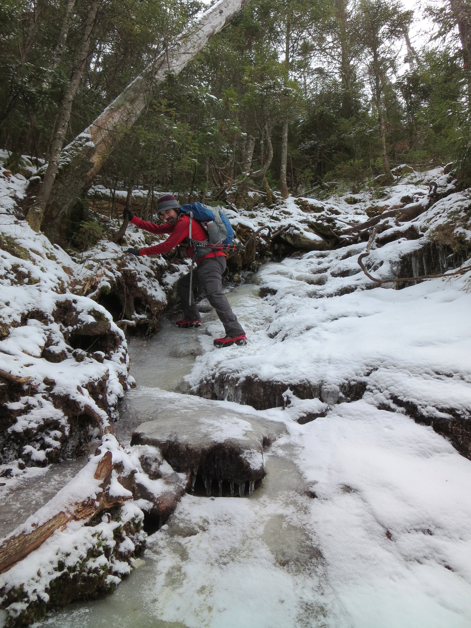
The Lake Road was paved in ice. I stopped at the Leach trail junction to put on Trail Crampons. A group of three, headed for Dial and Nippletop, did the same. Sweating had begun on cue and I stripped down a single baselayer.

The ice was very hard. My spikes filled the air with the din of a rock-crusher. No one would have a problem sneaking up behind me because I could hardly hear myself think.

The recent heavy rain had caused brooks and rivers to overflow their banks. I passed a section of road that looked like a skating rink. Later, on the trail, I'd see "blowouts" where water emerged from the icy surface and deposited a long stream of frozen earth.
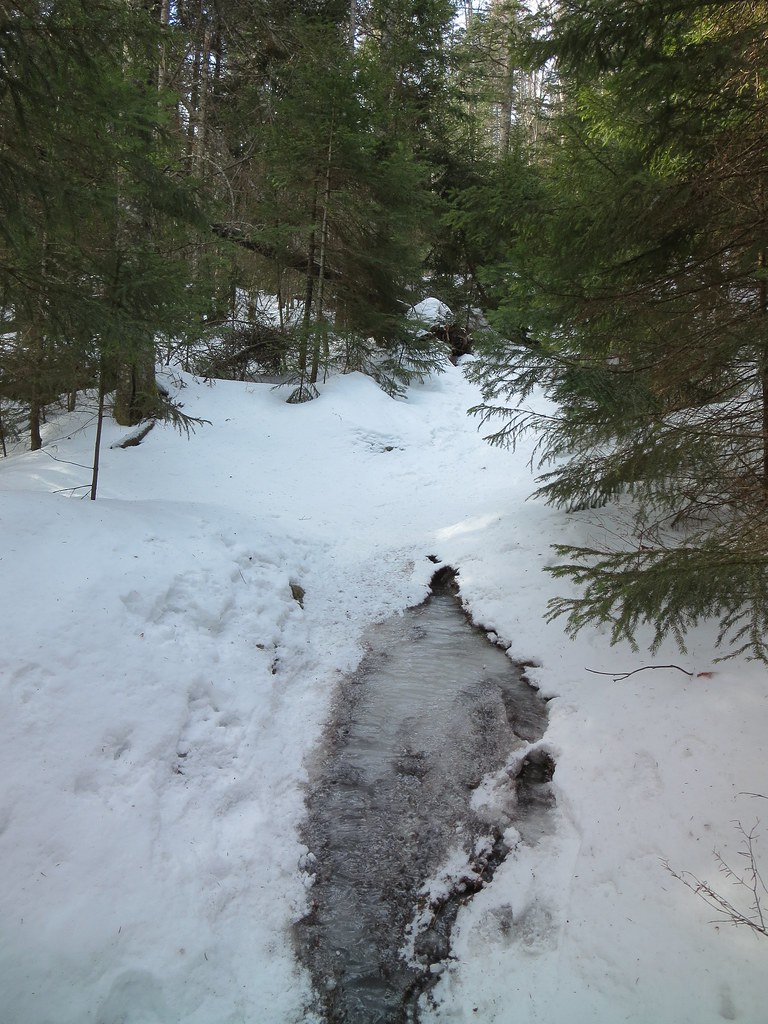

Trail "blowout".
I turned into the woods at the Gill Brook Cutoff and the snowcrete effectively silenced the rock-crushers. Two of the three campsites along Gill Brook were occupied. I could hear stirring from the cluster of tents at the second site. I passed a group of four hikers taking pictures; I'd meet then again later.

I reached the Elk Pass junction and turned right to Colvin. The first icy patch was a little tricky in Trail Crampons but, fortunately, it proved to be the worst of the lot. Before ascending too far, I found a thick clump of firs and promptly deposited four pounds of ballast in the woods (I hid my snowshoes).

I felt something was "off" today. I didn't feel strong and had to keep adjusting my pace to avoid becoming winded. I thought my pace was at least as good as last month's trip yet I felt I was working harder. (Jan/Feb: 48m/42m)

Moments after arriving on Colvin, low clouds rushed in from the south and obscured the higher summits. It turned into a blustery snow squall with a biting wind and reduced visibility. I donned my hard-shell, took a long swig of water, stuffed my camera and a Clif bar into my pockets, then proceeded a few yards down the trail to hide my pack.
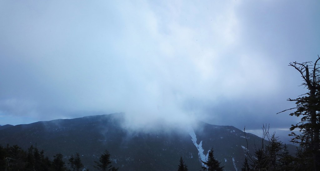
Snow squall passing through.
Unencumbered by paraphernalia, I felt light and agile. The wind-chill was noticeable and I battened down my hard-shell. For a moment I considered returning to retrieve overmitts but I figured a bit more effort would rewarm my hands (it did). I think I finally got the hang of the two ladders and can now descend facing forward like on a staircase. Practice makes perfect!

Once again, the ascent of Blake felt harder than it had in January despite the fact my time was the same (25m). I tagged the summit, wandered out into the snowy "clearing", discovered its views weren't any better, then returned to the col. The steep sections, now thoroughly paved in ice and snow, were a breeze to descend.

I returned to Colvin in about the same time I had in January (Jan/Feb: 35m/32m) but, even without a pack, it felt harder than it should have. I passed the four hikers I met earlier. When asked how were the views from Blake I sensed it was wry inquiry so I replied with a smile "Oh, you know, the usual."

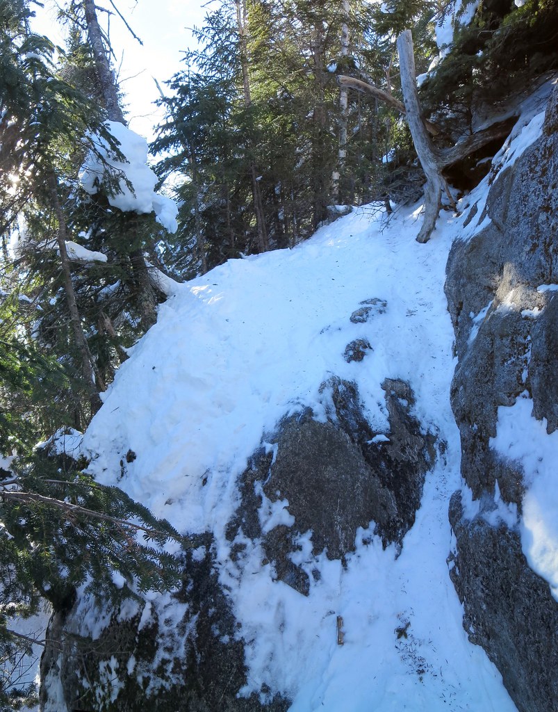
I collected my pack, paused on Colvin for one last view, then down-climbed the Colvin Step. The crack is now filled with ice and snow thereby providing better footing for spikes. The ladder is not visible.
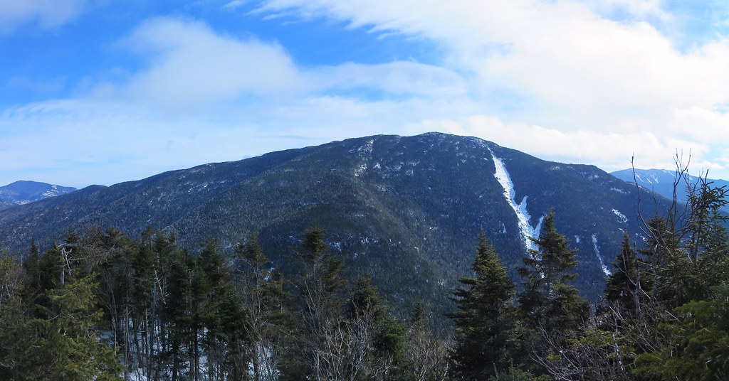
All clear on Nippletop.
About three-quarters of the way down, a hiker wearing crampons inquired if my Trail Crampons were adequate. She said I looked familiar and asked if "I was on the forum". The inquiry led to an exchange of real and forum names. Sporty Spice said she donned crampons at the first gnarly patch of ice but found they were overkill afterwards. I confirmed the first patch was the most challenging and the rest of route to Blake was achievable in Trail Crampons. We wished one another a great day and went our separate ways.

I retrieved my snowshoes and descended to the Elk Pass junction. After a bit of mental see-sawing, I tipped in favor of continuing to Nippletop. One small step at a time will get the job done. Less than five minutes into the decision, I stopped in my tracks. The muscles in my legs, normally stoic, grumbled. As sudden and unwelcome as the snow squall earlier, a gloomy mood clouded my mind. I decided this was definitely an off-day and it was best to end it on happy note. I turned around and began an easy-breezy descent to the Lake Road.

While downwind of the campsites, I caught a whiff of "humans". The cold clear air amplified the collective odor of campers. Nothing nasty but distinctively "not woodsy". I think "sleeping bag funk" would describe it best.

I remained on the Gill Brook trail to get the best view of the brook and its numerous icy cascades and pools. I greeted a pair of hikers and met Little Miss Brave and her companion Sati, friends of Crepuscular. They were heading to Nippletop and that led to a brief discussion of the day's trail conditions. They were using Trail Crampons and I said they probably wouldn't have too much difficulty ascending but the descent might require some care. I wished them well and we parted company.

I followed the "Scenic" option along Gill Brook and it led to the brook's flooded and frozen edge. There were an endless variety of natural ice sculptures. Several of the ice formations reminded me of the rippled pillars and mounds found deep in caves. The sky was blue and clear and I felt a touch of regret for cutting the trip short. Nevertheless, I knew it was for the better. I'd return on a day when body and mind worked as a team.
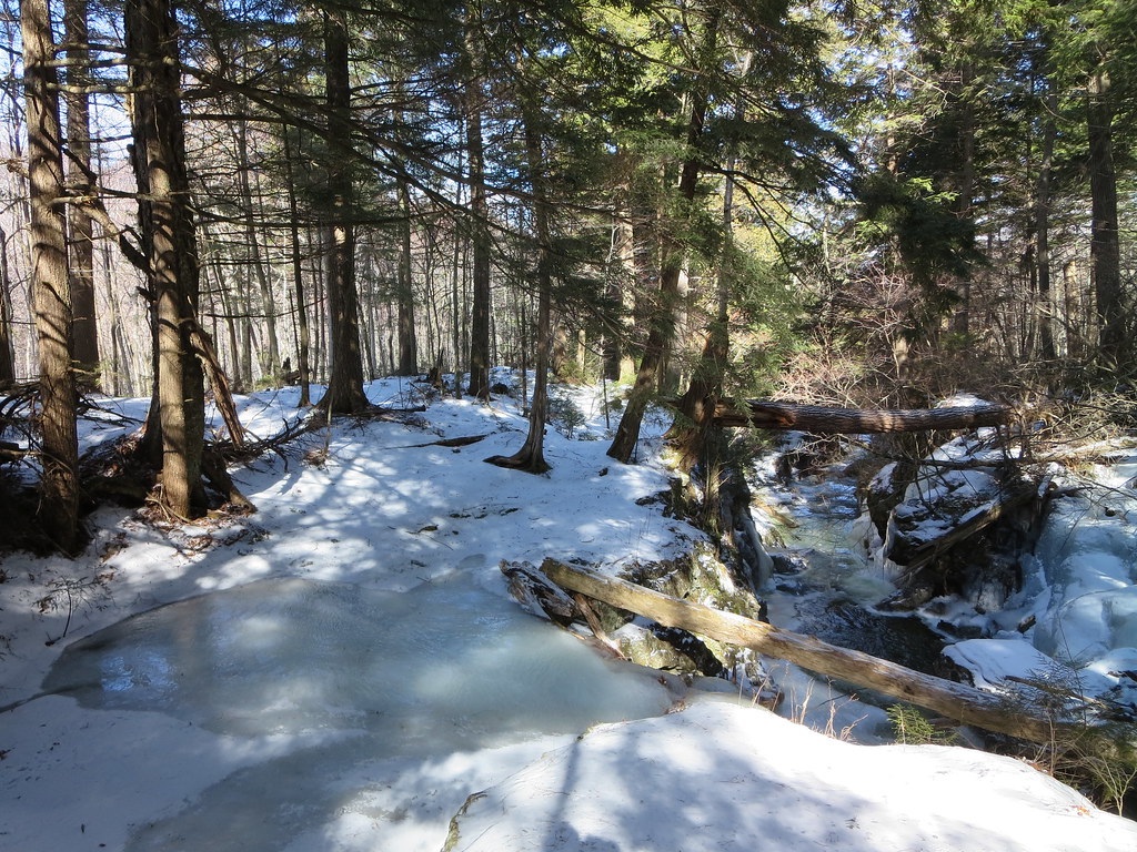
Flooding on Gill Brook trail.
The Lake Road remained as tough as boilerplate although the temperature was now a balmy -1 C/ 30 F. A half-hour's march brought me back to the AMR gate, six hours from departure. I only covered half of my intended itinerary but a wise man once said "Don't be greedy!"

Photos

See all photos.


Sunday, January 24, 2016

Colvin and Blake. 2016-01-24

Something for your "low-mo" day, sir?

Sunday's weather was predicted to be excellent and I wanted to be out in the mountains. However, it was a "low-motivation" day; nothing seemed to pique my interest. From past experience, low-mo is instantly cured the moment my feet touch the trail. The biggest hurdle to overcome is getting from home to trail-head.

January's Grid list offered many challenging destinations but I wasn't in the mood for them. I wanted a sub 8 hour hike so I chose Colvin and Blake with a side-order of Fish Hawk Cliffs and a glass of Indian Head.

I left my home at 5:00 AM. The US Customs and Border Protection officer subjected me to an unusually long list of questions. The dozen or so inquiries ranged from the usual, such as destination and purpose of visit, and then probed deeper to frequency of entry, employment status, vehicle's owner, and wife's occupation. I felt his question about why my wife had not joined me was a little over the top. Nevertheless, I responded politely and was granted entry.

Sunrise was an hour away and the night sky treated me to the full moon low in the west and five planets in the east (Mercury, Venus, Saturn, Mars, and Jupiter). However, I only identified four planets and missed Mercury.

I made good time and rolled into the St-Huberts parking area at 7:00 AM. I spent about fifteen minutes prepping for the day. I'd be trying something different to keep my hands warm. Normally I use a combination of fleece mitts, liner gloves, and chemical hand-warmers. Nevertheless, I'm still prone to developing painfully cold fingers especially after extracting my gloved hands to perform a task (like operate a camera). Today, my first line of defense would be a vapor-barrier in the form of a pair of vinyl gloves. I had tried this trick using nitrile gloves but they were too snug and my fingers became cold (not the material's fault but the fit).

While collecting my gear from the trunk, I met a fellow from Rochester, who planned to hike Sawteeth. He was the first to sign the trail-register and I was the second. By day's end, eleven other groups signed in with most heading to Sawteeth, Dial and Nippletop, or Gothics. I was the only one to register for Colvin and Blake.

I left the trail-head at 7:32 AM. The temperature was a cool -15 C (4 F) and the sky was clear. As expected, my motivation was restored the moment I began my stroll along the Lake Road. I tried to catch up with the Rochesterian but didn't see him again until the end of the day.

The road was hard-packed and, if one steered clear of the icy patches, easily negotiated in bare-boots. I considered heading directly to Indian Head but chose the "trade route" via the Gill Brook Cutoff. I arrived at the junction at 8:20 AM and set off on the trail's firmly-packed snow.

Saturday's hikers had groomed the trail which made for easy walking. I paused at the Elk Pass junction to don my snowshoes. Frankly, the trail-bed was dentproof but the snowshoe's Televators relieved calf-strain so why not put them to good use.

The trail was effectively paved from junction to summit. The snowshoe's aggressive traction helped on sections of trail that had been polished smooth by butt-sliders. The facetiously named "Colvin Step" had just enough snow to simplify its ascent. Its recently installed ladder was buried in snow and only a portion of one rung was visible.

The "Colvin Step". Ladder is barely visible.
I took a short break on Colvin's summit to soak up the views and have a snack. I had bought a box of "Clif Organic Trail Mix" bars (on sale at Costco) and found them to be tastier than the regular Clif bars. Whereas frozen Clif bars are tough and difficult to eat, these snap easily without fear of breaking teeth. A few photos and four hundred calories later, I headed to Blake.

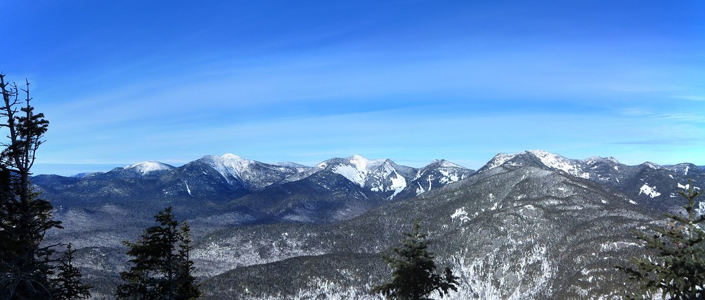
Upper Great Range.
Shortly after leaving the summit, it became evident to me that snowshoes weren't the right tool for the job. I hid them under a snow-laden tree, put on Trail Crampons, and zipped southward to Blake. Unencumbered by duck feet, I was able to walk down the ladder face-forward, boot-ski the steeps, and arrive at the col's junction in a mere 20 minutes. I took a long swig from my hydration bag, hung my pack in a tree, and scooted up Blake. The steep icy stretches I had encountered in November were now buried under snow and made for easier travel.

Blake's summit is wooded but the views of Colvin during the ascent are worthwhile. I tagged the summit and looked around for anything new and notable. As expected, there was no evidence of traffic beyond Blake. With nothing else to see, I backtracked to the col. The descent was fast and fun. Many folks love butt-sliding but my favorite is slip-sliding while wearing Trail Crampons ("boot-skiing"). I was back in a flash (12 minutes).

I collected my pack and began the slog up Colvin. My pack felt unusually heavy and it took me 35 minutes to ascend Colvin. I wanted to attribute the experience to a low-mo day but I knew the real reason. Gluttony and sloth best describe my Christmas holidays and I was reaping what I sowed.

I thought back to March 2014 when I hiked Dial, Nippletop, Colvin, and Blake in 8h 35m. That was just not gonna happen today! Exercise, and hiking, got me into that kind of shape so I vowed to start exercising again (don't we all).

Colvin's summit was warm and sunny; I stripped down to a baselayer. As for my hands, they felt like they had been in a steam bath all day. My fingertips became chilled twice but had rewarmed very quickly. The experiment with the vinyl gloves was a success and the only downside was pruney-white hands. With no significant elevation gain remaining, I looked forward to a quick descent on smooth snow. Despite falling twice (backwards and forwards), it was a 'fun ride' to the Elk Pass junction. I continued to the Fish Hawk Cliffs junction where I turned west.

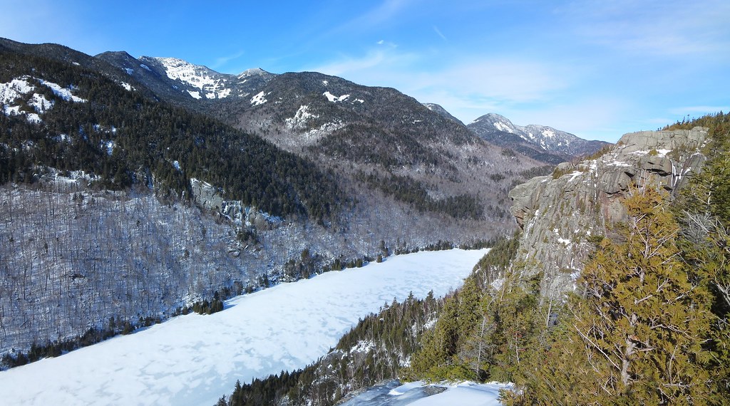
The view from Fish Hawk Cliffs was a delight but the real treat was hearing the booming noises produced by the ice on Lower Ausable Lake. Warmed by the sun, the expanding ice produced deep bass tones. The cliff walls served to amplify and enrich the sounds. I wondered if the phenomena also produced infrasound. I heard a boom approximately every 15 to 30 seconds. I tried to record the sounds (via video) but the result was unimpressive. The first 15 seconds of this video (from Sweden) is representative of what I heard:


Here's a more complex example recorded at a lake in Yosemite and this blog has more examples, taken in air and water, of ice noises.

Indian Head watches over Lower Ausable Lake.
After the novelty of lake noises wore off, I moved on to Indian Head to get a slightly different perspective of the same scenery. I recalled the ascent to Indian Head was short but seriously steep and my recollection was correct. Far below me, I could see two figures walking across the dam. Later I learned a couple had registered to hike Indian Head and Rainbow Falls so it could've been them.

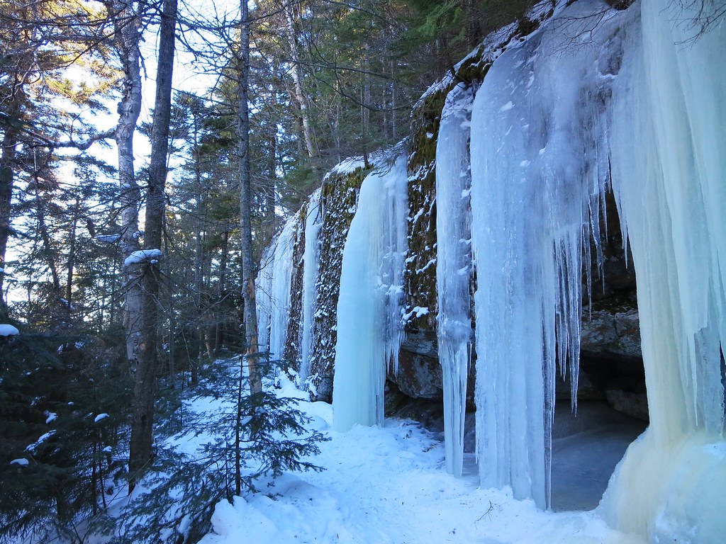
I'd had my fill of the views and began the steep but switch-backed descent to the Lake Road. The trail passes a stretch of vertical rock which, given the right conditions, develops impressive ice formations. Indeed, seeping water had coated the rock-face and formed seven "frozen waterfalls". The wall is undercut so the base of the formations became pillars of ice.

Ice pillars.
I emerged on the Lake Road and paused to stow my Trail Crampons. I set out to stride/jog the remaining 3.3 miles to the trail-register. As always, I welcomed the opportunity the Lake Road provides to slip my mind into neutral and stretch my legs with a long and steady stride. I wished I had not given up running because where I tried to jog reminded me how quickly one goes to seed! Nonetheless, I set a personal best of 45 minutes.

Along the way I passed a lone hiker, whose pack was emblazoned with many patches, and a young couple returning from Sawteeth. I signed out and entered the wrong time. A minute up the road I realized my mistake and returned to correct it. Awkward!

I returned to my car and changed into clean clothes. While stowing my gear the fellow from Rochester returned. He reported he had ascended Sawteeth via the Scenic trail and was unaware few people use it in winter. I laughed and said he probably now knows why it sees so little use. He concurred its steepness was impressive and it was far more rugged than the "highway" that is the Weld trail. I wished him a safe trip home and we parted company.

The hike had expunged the low-mo and left me feeling re-invigorated. I couldn't ask for more.

Photos

See all photos.

Stats

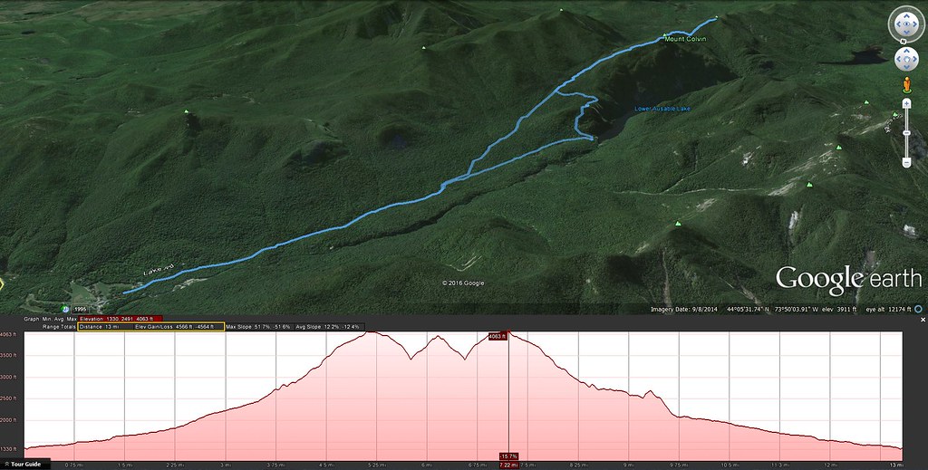
Distance: 13 miles
Ascent: 4565 feet
Total time: 6h 35m
Moving time: 6h 03m
Scenery appreciation time: 32m

07:32 AMR Trail-head
08:20 Gill Brook Cutoff
08:33 Gill Brook
08:53 Fish Hawk junction
09:16 Elk Pass junction
10:04 Colvin arrival
10:18 Colvin departure
10:38 col
11:03 Blake arrival
11:05 Blake departure
11:17 col
11:52 Colvin arrival
11:53 Colvin departure
12:15 Elk pass junction
12:28 Fish Hawk junction
12:39 Fish Hawk Cliff arrival
12:54 Fish Hawk Cliff departure
01:04 Indian Head arrival
01:06 Indian Head departure
01:22 Lake Road
01:33 Gill Brook Cutoff
02:07 AMR Trail-head


Thursday, November 26, 2015

Wednesday, May 21, 2014

Colvin Blake and Sawteeth 2014-05-21

It was a beautiful spring morning in the High Peaks; cool, windless, cloudless, and, as a bonus, no pesky insects. The clouds would roll in but not the bugs so the DEET stayed in its bottle all day.

A fine spring day.
Generally speaking, the trails were far drier than I had expected. The paths leading to Colvin and Blake, lying on the north side of their respective peaks, featured a few very short stretches of ice but nothing that demanded microspikes (and I didn't bring any). All stream crossings were easily rock-hopped. I ended the day with just a few muddy streaks on my shoes. I'd call that "dry" for the High Peaks.

A few short icy sections on the way to Blake.
I've often walked by the "side attractions" but this time I paused to check them out. I took the short detour to the "The Flume" and inspected the three campsites along Gill Brook.

The Flume.

Witch-Hobble.
The "ice wall" on Colvin is mostly melted and the "bypass" now appears to be the main route up this obstacle. The "Colvin Step" seemed extra tall and had me using my arms to haul myself up. Upon my return from Blake, I met a trail crew and discovered they had piled several logs at the base of the Step and made it a little less "sporting". They also removed all the fallen trees that I had encountered along the trail.

 
The "Ice Wall". December/May

There's nothing new to report about the trail between Colvin and Blake. The ladders are intact and the steep sections are heavily eroded. Whatever dead-fall I had encountered has been eliminated by the trail crew.

Upon returning to the col from Blake's summit, I decided to change my route and head down the Elevator Shaft to the Warden's Camp. I dropped about a hundred feet and then a little voice said to turn back. My shoes weren't very "grippy" and the steep descent wasn't enjoyable. Besides, there's more "elly gain" if you go back over Colvin.

To get to the Lake Road, I headed over Fish Hawk Cliffs and Indianhead. A few hikers were resting on the rocks and admiring the impressive view of Lower Ausable Lake flanked by Colvin and Sawteeth.

View from Indianhead.
By the time I began my ascent of Sawteeth via the Weld trail, I had nearly finished my 1.5 liters of water. I stopped twice to guzzle about a liter of untreated water (I left my Steripen at home). I selected the smallest trickles emerging from the earth in the hope it would minimize sources of contamination. Time will tell if I chose correctly.

Before reaching the Sawteeth-Pyramid col, I met another trail crew. They had cleared the trail of fallen obstacles and were returning home. The Weld trail is in fine shape from the dam to the col. I found a few more icy spots along the route to Sawteeth but nothing that made me regret leaving my microspikes at home. Frost heave has loosed several large rocks and it behooves one to avoid stepping on them and causing them to roll away.

My feet, unaccustomed to hiking in lightweight shoes, were achy during the descent. In addition, the shoes seemed to lose traction at the most inopportune moments so I decided this would be their last hike.

Shortly before reaching the dam, I saw three-quarters of a garter snake protruding from a hole in a stump. I watched as it emerged from stump, did some "snake yoga" and then slid back into the stump. 

3/4 of a garter snake.
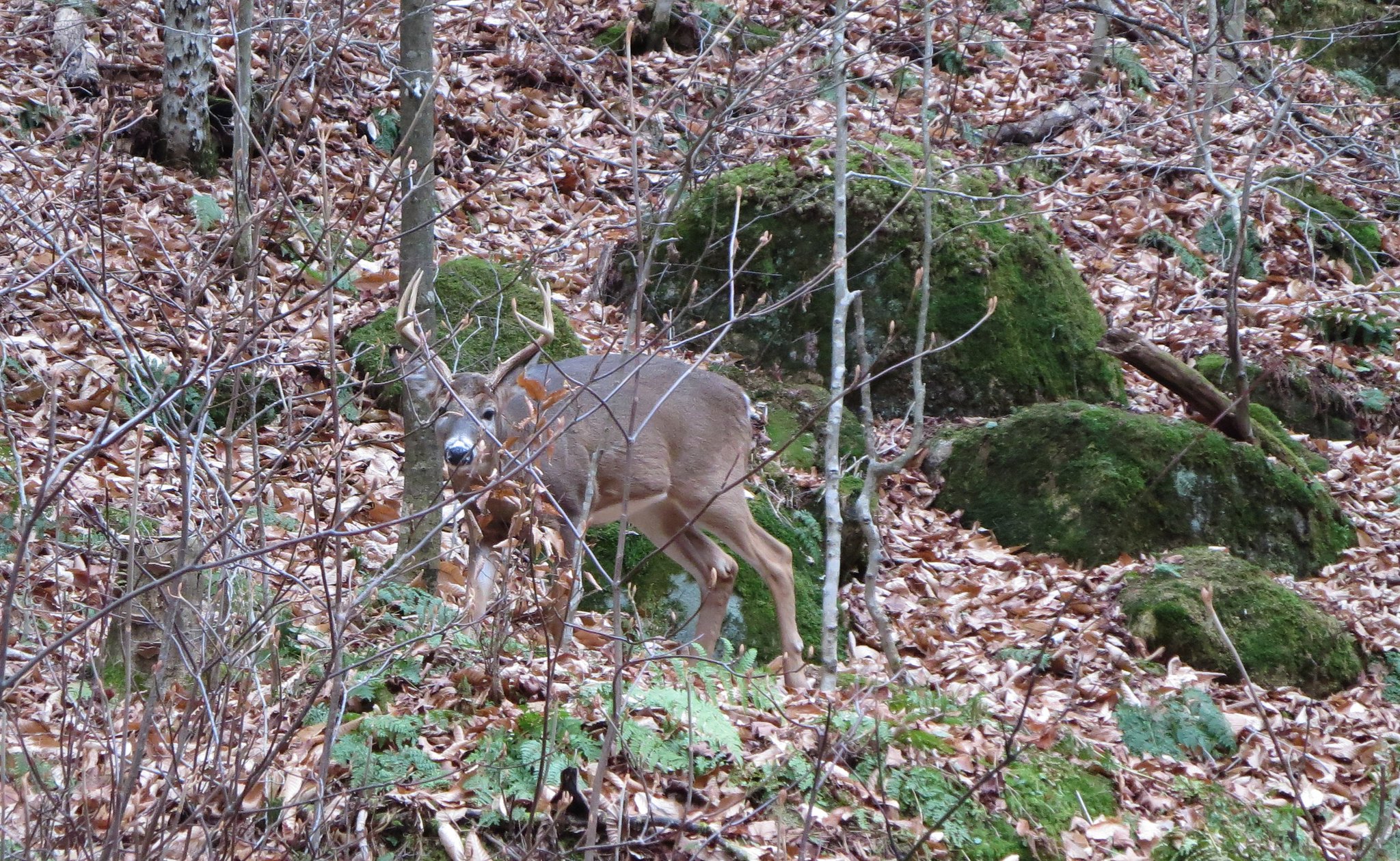
Upon reaching the dam, I stowed my poles, removed my gaiters, and headed to the Lake Road. I was looking forward to the road-walk; it's a gentle, downhill walk that's a refreshing change from rock-hopping on steep trails. Along the way I saw an interesting sculpture hewn by beavers, several curious deer, fresh spring flowers and just a handful of other hikers enjoying the fine day.

Beaver sculpture.

Hike distance and ascent: 18 miles and approximately 6300 feet.

Photos


See all photos.

Video

Snake yoga.

Friday, March 7, 2014

Dial, Nippletop, Colvin and Blake. 2014-03-07

Friday, March 7, 2014

The first day of three days in the Adirondacks.

Just a perfect day for hiking. The best part was the exciting 15 minute glissade down from Nippletop to Elk Pass pond. Joy and bliss! Nearing Colvin's summit I recognized an elderly lady from last week's hike. She explained she couldn't reach the summit due to the final icy slope (the "Colvin Step"). Too bad I wasn't there sooner because I would've given her a boost. She missed great views from Colvin. Blake was it usual low-key self. The ladders were exposed and usable; the snow was very soft on Colvin's south side.


8h 35m for the loop. Great day!

Great Range on a bluebird day.


Photos

See all photos.

See day 2 of 3.

Sunday, December 8, 2013

Dial, Nippletop, Colvin, Blake, and Sawteeth 2013-12-08

On Sunday I had the opportunity to accompany Neil on another of his "training hikes" in preparation for Project 46 a one-man fund-raising event for the ADK High Peaks Foundation. For the uninitiated, a "training hike" is a euphemism for some combination of peaks that, upon completion, ensures one sleeps like a log! If you wake up stiff and sore the following morning, the "training" aspect was a success. If you arise with a spring in your step, you're either getting stronger or the previous day's hike was too easy. Either way, your next "training hike" ought to be more challenging!

Sunday's itinerary was comprised of "CBND", namely Colvin, Blake, (back over Colvin again), Nippletop and Dial, and a fifth peak suggested by Glen (a.k.a. "Mastergrasshopper"), namely Sawteeth. The hike involved 22 miles and 8600 feet of elevation gain and took us 13.5 hours to complete. In terms of distance and ascent it was the second most challenging hike I've ever attempted (GRT was first) and the first time I've hiked all four peaks of CBND (I hiked Dial, Nippletop and Colvin a year earlier).

In bed at 8:00 PM, up at 2:45 AM, force-feed myself a hearty breakfast, out the door at 3:30 AM, pick up Neil at 4:00 AM, signing in at the AMR gate at 7:05 AM. A few folks had signed in before us and I thought I recognized a certain other Neil (another member of the ADK High Peaks forum whose moniker is "mrsmileyns").

The Lake Road was frozen solid and slippery. Being lazy, and stubborn, we bare-booted our way to the Leach trail. We followed a lone hiker's footprints up the trail. Probably around 2400', we conceded it was time for traction aids: Trail Crampons for me, Microspikes for Neil (foreshadowing). The lone hiker's footprints suggested he had done the same within a few steps of our position.

We caught up with the lone hiker on Noonmark's shoulder. The weather appeared to comply with the day's prediction and the Great Range stood out against a backdrop of clouds and blue sky. Sadly, the weather had simply done a head-fake and proceeded to become mostly overcast for the balance of the day.

The Great Range viewed from Noonmark's shoulder.
The descent into the col, with spikes, was a bit rough because of a severe lack of snow coverage. The summit of viewless Bear Den came and went. Dial offered a good view of the hazy snow showers descending on the highest peaks. The wind was brisk, we had a few more peaks to go, so we didn't dawdle on the Dial.

The trail between Dial and Nippletop was a mostly viewless but pleasant walk in the woods. It lulled us into a comfortable pace and engaging conversation. Now that our collective guard was down, it seemed like a good time to spring the first of the day's surprises. While descending a steep slope, Neil mistook an icy patch for snow and his microspiked foot slipped out from under him. Hitting the deck was bad enough but the rocks at the bottom of the slope posed a nastier hazard. Fortunately, he slid feet first. Neil's bemused look summarized the entire "WTF just happened here?" incident. After confirming he was uninjured, we continued but with greater respect for the conditions.

At the Nippletop trail junction we met "Blackbear" and company. They were doing the two peaks counter-clockwise and, temperature being what it was, conversation was kept politely brief. We bid them well and headed off to Nippletop.

We met the lone hiker, for the last time, returning from the summit. Nippletop offered a grand view of the remainder of our day's objectives: Colvin, Blake and Sawteeth. Sheesh, in terms of elevation loss and gain, Sawteeth seemed far away!

Our next three objectives: Colvin, Blake, and Sawteeth.
The descent into Elk Pass offered several opportunities to wipe out in spectacular fashion but, now chastened, we proceeded cautiously. We crossed the frozen pond in Elk Pass and hustled to the Colvin junction. Prior to ascending Colvin, Neil stashed a bottle of water and I liberated my pack of what I deemed to be non-essential gear for this leg of the trip. Unlike Nippletop and Dial, there were no fresh tracks to Colvin.

Somewhere between the junction and the summit, I wish someone had yelled "Duck!" After negotiating an icy section, I stepped up onto a ledge and proceeded to rise out of a crouch and extend my frame to its full height of 5' 11". Somewhere around 5' 0" progress was abruptly interrupted by an unseen overhanging tree. Head met tree with expected results, namely the tree won. The hollow sound of a pumpkin striking the pavement was immediately followed by intense pain. I'm quite certain I grabbed my head and yelled "Ow!" Yeah, I remember that.

I removed my hat and saw a tiny drop of blood. Swelling was certain so I stuck my head in the snow. I called out to Neil "I need a minute here." I pulled back from the snow and saw it was now bloodied. I did this two more times until the pain was numbed and there was far less blood. I found a small piece of ice, wrapped it in a bandanna, placed it on the wound, and used my hat to hold it in place. No double-vision or dizziness, no birds or stars orbiting my head, I remembered my name, where I was and what I was doing so I was good to go. Stupid tree.

My bleeding head makes an impression or three.
The "Colvin Step", or whatever you want to call it, required a bit of finesse to surmount. There was just enough ice to complicate matters but not enough to require weapons like crampons and ice axes. From Colvin's summit the view of Lower Ausable Lake, under the watchful gaze of Indian Head, is a crowd-pleaser. Meanwhile, Sawteeth loomed tall above the lake and filled me with, oh, let's just say 'doubt'.

Feeling a little 'off kilter' are we?
We paused for Skittles, stashed our packs, and headed south to Blake with just a song in our hearts. Colvin's long ridge had good snow coverage but none was present where the trail begins its abrupt descent into the col. The frozen pebbly ground probably did a good job of filing down the points of our spikes. Any thoughts of shedding the spikes flew out the window when we arrived at the first of the two ladders. A smooth slope of ice served as the "Welcome Mat" for both ladders. A slip 'n fall above the ladders would have been disastrous so we approached them with extra caution.

The trail to Blake featured three long icy sections but, being on Blake's northern face, the balance of the trail was solid snow. After a few quick pics with Blake's trail sign, we began the return trip to Colvin. The ladders and their icy mats seemed less threatening on the ascent. A look back at Blake reminded me of how Lower Wolfjaw looks when approached from Upper Wolfjaw: initially intimidating but ultimately more bluster than substance.

Playing hop-scotch on an icy slope.
Reunited with our packs, we proceeded to descend the Colvin Step. Watching Neil negotiate the drop, I noticed several "holds" in the rock that, with some audacity, I imagined would permit a quick and seemingly effortless descent. Wow! It was Alexander's solution to the Gordian Knot! Unfortunately, when it came my turn to descend, and upon closer inspection, the audacity required bordered on lunacy. I chose to descend in a careful and boring manner. The balance of the descent was uneventful and we emerged at the intersection of the Gill Brook Cutoff and the Lake Road.

I was pleased to finally completed CBND, some 6300' of ascent, and would have happily begun the easy walk back to the AMR gate. However, one more challenge lay unticked on our list of peaks, namely ascending the 2200 vertical feet of Sawteeth. It was now past 4:00 PM and daylight was fading. The ten minute walk to the dam gave me plenty of time to breed doubt. My heels hurt from boots whose fit works best with snowshoes. The extra time needed for Sawteeth would guarantee a very late return home. I hadn't exercised all week and didn't prepare myself mentally for this hike. It would be dark. My head had a boo-boo. Boo-hoo.

Off to Sawteeth.
Two things changed my mind. The first was Neil's suggestion to stop for a few minutes and eat. Whereas this was Neil's fifth CBND it was my first and I was feeling the aftereffects of the effort. I needed a few minutes to eat, drink, and focus. The second was, deep down inside, I really wanted to crack the 8500' ceiling in winter-like conditions. I wanted this and now was the time to focus and do it.

With headlamps on, we began the ascent with Neil setting a good pace. When we weren't talking, I focused on my breathing to ensure I maintained a smooth rhythm to clear my mind and pass the time. The Weld trail was in good condition and didn't present any major icy obstacles. My mood and confidence improved significantly when we topped out in the col. With another hit of Skittles, a swig of water, and packs hung on the trail sign, we left for peak number five.

Unlike the section from the dam to the col, the remaining trail to the summit included several treacherous icy slopes for our "hiking pleasure". Being late in the day, we moved with greater caution and threaded our way up the icy ramps and ledges. Upon reaching the summit, our faces were plastered with wide grins. The silhouette of Gothics, backlit by the faint glow of Lake Placid's lights, made the ascent worth every step. My camera couldn't do justice to the view; you had to be there.


Atop Sawteeth with backlit Gothics.
We spent a few minutes experimenting with photography by the light of headlamps and then began our descent to the col. With the worst of the trail behind us it was now all "downhill". After about fifteen minutes along the rock-hard Lake Road, we removed our spikes and felt the instant relief of cushioned and quiet footsteps. We reached the AMR gate at 8:35 PM and signed out.

Walking past the golf course, we spied seven sets of spooky reflective eyes. Deer, blinded by our headlamps, stood mere yards from us, transfixed by the beams. It was eerie and mesmerizing, for all species involved!

Back at the car we switched into clean clothes and sped off to Stewart's for hot chili. Somewhere during the drive back to Montreal, Neil quipped "Now imagine hiking the Sewards tomorrow!" Yep, that's all I could possibly do and that's imagine hiking them the day after! 

It was a great hike that allowed me to surmount external and internal obstacles.

Photos

See all photos here.

Thursday, December 13, 2012

Dial, Nippletop, and Colvin 2012-12-13

FUN DNC. Walk this way!

Which way? Clockwise!

Ah, the age old question: Dial and Nippletop, clockwise or counter-clockwise? For a change, I decided to hike it clockwise. It was fun. So much so that I added Colvin as a bookend. The trip took me 8.5 daylight hours; headlamp snoozed in my pack.

A completely different kind of hike was planned for Thursday. The ambitious itinerary required an ice-axe, so I rented one. Unfortunately, the other party fell ill. Finding myself fully prepared for a hike on a beautiful day, I spun the Wheel of Hiking and it stopped at Nippletop and Dial.

I left the AMR trailhead at 7:50 AM, shortly after sunrise, and headed up the H.G. Leach trail. Within a few minutes I caught up with two ADK High Peaks forum-lurkers (Charlie and Don) also heading to Nippletop. I'd meet them again later in the day at the Elk Pass/Colvin junction. 

The day would prove to be a study of the Great Range from four vantage points. Noonmark's shoulder provided the first view. In early morning light, under a bluebird sky, shrouded in a fresh mantle of snow, the Range appeared vibrant and inviting. By the time I reached Colvin, about two hours before sunset, the Range appeared dark and forbidding.

The Great Range from Noonmark's shoulder.
For no better reason than a desire for challenge, I hiked up Bear Den without traction aids. There were a few moments that made me question my decision. Nevertheless, it certainly spiced up what is otherwise a milquetoast trail. Atop Bear Den, I paused to don gaiters and Trail Crampons. There are no views from Bear Den but everyone knows that. 

It was a bit chillier than I had expected (-8 C or 18 F) but I was moving at a brisk pace and generating a lot of heat and sweat. The trail conditions improved and by that I mean more snow and ice and fewer rocks and roots. The valley had been a carpet of snow-dusted leaves but the ridge offered wintrier conditions.

Dial greeted me with a commanding view of the Great Range and then some. One could identify all peaks from Skylight to Lower Wolfjaw and even Big Slide through the Wolfjaws col. Face southeast and the bulk of Nippletop rises before you.

The Great Range from Dial.

On to Nippletop.
I enjoyed the trail from Dial to Nippletop. There are no significant views but the snow-dusted trees and frozen trailbed made for easy passage. Two inches of fresh snow carpeted the route. The Elk Pass trail junction signalled I was very near to Nippletop's summit.

Pristine trail to Nippletop.
Although I enjoy hiking with others, and meeting people on the trail, I am fond of being the sole person on a snowy trail and windswept peak. Except for the company of the wind, I had the summit to myself. Lunch consisted of the same food I had been eating all morning supplemented with much appreciated hot tea.

Nippletop's wintry summit.
I tend to hike "hot", meaning I generate a lot of heat and sweat when in motion. Accordingly, I wear lightweight clothing while hiking. When I stop for a break, I'm too lazy to dig out the insulated parka, hibernating in my pack, so I simply curtail my break when I become cold. Twenty minutes of munching on space-food, and snapping photos with bare hands, was sufficient to bring about a chill. My fingertips were aching in pain and signalled the need to put on warmer gloves, swap my cap for a hat, and get moving. Naturally, I had to pause to take photos of Dix, an imposing presence under the cloud-speckled sky, and sugar-frosted Dial.

Dix.
Shortly below the trail junction I met a group of three hikers ascending from Elk Pass. I knew I was going to have more fun descending into the pass than they had climbing out of it. Although steep and very icy, most of the route consisted of ice-steps as opposed to ice-ramps. Shod in Trail Crampons and armed with trekking poles, I descended the route at a brisk pace and emerged in the pass, safe and sound, thirty-five minutes later. A third of the morning's elevation gain was shed in a little over a half-hour.

Elk Pass.
I emerged at the Elk Pass/Colvin trail junction shortly after 1:00 PM. I knew I had enough daylight, and gas in my tank, to visit Colvin so I turned left and headed up. Bleak Blake was never given serious consideration. The route had a few steep sections of ice and one of them, although easily bypassed, tempted me to use my ice-axe. I had carried it this far so why not? I chopped out four steps and made my way up. It was a cheap thrill. The axe proved to be handier at the "Colvin Step" where I used it to hook onto tree roots. Whoever hung a cord as a handrail for this section, be it known that I packed it out.

I emerged on Colvin's summit shortly before 2:00 PM. Now late in the day, and under a cloudier sky, the Great Range appeared anything but its earlier, "warm and friendly" self. Thoroughly soaked from the exertion, I didn't dwell on the summit. After a little more food and water, I was down-climbing the Colvin Step and looking forward to the hike out. By pure chance, I met Charlie and Don, taking a break from their descent of Nippletop, at the Elk Pass/Colvin trail junction.

Lower Ausable Lake.
Taking the bypass trail, I emerged at the Lake Road at 3:30 PM. I peeled off the Trail Crampons and gaiters, downed the last of the lukewarm tea, and began the comfortable walk back to the trailhead. After a day of lifting one's feet, it was a pleasure to simply stride over comparatively level terrain. The road was frozen and merely dusted with snow.

I signed out at 4:20 PM and, from the paucity of log entries, noted that I was one of the very few fortunate to have had fun on DNC. I'll be back after December 21st to add Dial and Nippletop to my Winter 46.


Photos

See all photos.

Saturday, August 18, 2012

Sawteeth, Blake, and Colvin 2012-08-18

Route:
  • Sawteeth via the Scenic Trail.
  • Warden's Camp.
  • Carry Trail.
  • Blake via the Elevator Shaft.
  • Colvin.
  • Fish Hawk Cliffs and Indianhead.


Late Friday afternoon, I dropped in at Tmax and Topo's hostel and gave its genial hosts, Terri and David, my belated personal congratulations for their marriage. The newlyweds are doing fine and Terri's "scoped" knees are healing quickly. During my brief stay, I had the opportunity to meet a wonderful science teacher. Her clever young grand-daughter described her passion for identifying mushrooms and other fungi. Her inquisitiveness inspired me to pause and photograph various mushrooms I spotted during my hiking trip the following day. I also met the indefatigable "rbalbs" and his young son; we had met briefly atop Haystack (March, 2011) when he was tackling what he had described as "The Monster(5 peaks: Skylight to Saddleback). In contrast to "The Monster", my amusement park ride would feature a paltry three summits and something called "The Elevator Shaft".

The mere knowledge of having to awaken at 4:00 AM is sufficient to cause me a poor night's sleep. The moment it seemed I had truly settled into a deep slumber I was awakened by my phone's alarm. I removed my ear plugs and, by light of my phone, exited the room as quietly as possible, so as not to disturb my bunkmates, but I doubt I was completely successful. While gorging on a mountain of cereal, two more sleepy-eyed guests wandered into the common room. I can't eat breakfast without reading something so I thumbed through an issue of Adirondack Life and discovered a wonderful article entitled "Into Thin Hair" by Don Mellor. Even if you are not a Boomer, I think you'll appreciate Mellor's views on aging.

Sunrise was still a half-hour away when I arrived at the Saint Huberts parking lot. It was a cool morning (51 F, 10 C) but a brisk walk to the gate warmed me up. En route I passed the AMR's "animatronic deer diorama". I believe they have changed the programming because the normal scene, deer peacefully foraging on the golf green, has been replaced by a doe which sprints to the forest's edge, pauses, looks back, and is quickly joined by two fawns. It tugs at your heart-strings and suggests Disney may have consulted on this gig. I imagine the entire scene is replayed for each passing hiker.

I was the first to sign in at the AMR gate at 5:50 AM. I was still groggy and moving along on auto-pilot. The first thing to penetrate my mental fog was a nagging "wardrobe malfunction" that caused my pants to ride up my butt. It made me wonder if, in the darkness of the hostel's bunk room, I had put my underwear on backwards! After considerable adjustment the overly-familiar pants kept a respectable distance. The silliest things can spoil a nice walk.

I was eager to put the Lake Road behind me and arrived at the dam less than an hour later. I was treated to one more display of animatronic deer. I must confess these seemed real because two ran to a safe distance whereas the third, separated from the others by me, stood motionless. The moment I was no longer a wedge, the lone deer sprinted to join his mates. An interactive diorama?

Deer diorama.
From the vantage point of the bridge, I had a clear view of fog rising from the lake's surface and rising to the summit of Colvin. It was a perfect day to hike the Scenic Trail with a clear sky and cool, dry air. The initial section generally heads along the shore and offers a few good views of Indianhead. At a point where I imagine the trail crew decided "OK, enough with the lake, it's time to go up!" the trail begins to ascend in earnest. Naturally, several switchbacks are needed to get around obstacles. While following the path I thought it would be quite challenging to navigate it in the dead of winter. I spoke too soon because, in the dead of summer, I missed a switchback.

Indianhead, right profile.
I passed under a large rock overhang sheltering a small, and illegal, bivy site decorated with a single piece of charred wood. I followed a very faint path to a steep pitch that required scrambling to ascend. I topped out above the overhang and discovered all traces of the path were gone. Clearly, I was off-route. I retraced my steps and found where I had mistakenly veered away from the trail. I had stepped over some timber, ostensibly placed to prevent entry, and had hiked straight ahead instead of turning right. I rearranged the branches to dissuade other hikers from making the same mistake. 

There are several lookouts along the way to serve as rewards for one's efforts. At 8:20 AM, I took a twenty-minute side-trip to Marble Point. The lookout was damaged by fire recently but, due to quick efforts, only a small area was affected. Nevertheless it will take several years before the vegetation recovers and the charred stumps will remain for many years to come.


Approaching fire-scarred Marble Point.


Blake Peak and Upper Ausable Lake.
I arrived at Outlook #5 at 9:00 AM and it provides the best vantage point for viewing points east. Eighteen minutes later, traversing Rifle Notch, I was atop Sawteeth and admiring the views of Gothics and other peaks in the Great Range. After a few photos, I doubled back to the trail junction and began the most anticipated leg of the hike, the descent to the Warden's Camp.

Upper Great Range.
I'd heard great things about this trail and it all proved to be true. The trailbed is pristine forest floor and free of rocks, mud, and roots. The uppermost portion provides several good views, through the trees, of the Upper Great Range's western flank. It was a pleasure to descend and I made good time. A stone's throw from the private/public land boundary, I stopped at a nameless brook crossing (9:55 AM) to top up my water supply. I saw no other sources of running water prior to the brook.


En route to Warden's Camp from Sawteeth.


Aerated tree.


I arrived at Shanty Brook at 10:30 AM and was greeted by several small cairns, standing like gnomes, in the brook. Constructed of a few stones each, they clearly weren't for navigation but were erected out of pure whimsy. The brook is wide at the crossing and it took me a minute or two to find the less-than-obvious entry to the trail on the opposite bank (hint: it is a several yards downstream).

I arrived at the Warden's Camp a few minutes later and waved to a fellow riding a tractor towing baggage. At the crew quarters, I struck up a conversation with its two friendly stewards. We discussed the AMR property and its pristine trails. They indicated that a loop-trip to Haystack takes about 3.5 hours from the Warden's Camp. I filed that tidbit away for a future trip. I was also informed that there was a spring, created in a carved-out hollow, along the Carry Trail next to a "packrest". I left the Camp at 10:45 AM and followed the Carry Trail, one of the most park-like stretches of trail in the High Peaks. It connects Lower and Upper Ausable Lakes via a level path that winds along a mossy forest floor and then follows the course of the East Branch Ausable River to the Lower lake. It is a gem but cannot be reached without scaling the likes of Sawteeth, Colvin, or Blake.


The park-like Carry Trail.
Fifteen minutes later, I found the "packrest", a tall wooden bench, and stopped to inspect the spring. I had envisioned trickling water flowing in a mossy hollow but found something a little different. The spring had no running water and was simply an earthen hollow, dug out of the bank, featuring a tiny pool of water. A water pipe capped with a tap stood beside it; a sierra cup dangled from the tap. The water was clear but there was at least one insect paddling the pool's surface and another rooting around on the bottom. The tap had to be an ornament but I still gave it a turn to confirm; nothing came out of it. I dipped the sierra cup into the shallow pool and poured its contents into a water bottle. I then proceeded to sterilise the water; better safe than sorry. Several casually-dressed hikers, probably AMR members, greeted me as they headed in the direction of the Warden's Camp. I finished my Clif bar and moved on to tackle the next challenge of the day: the Elevator Shaft.


Pack-rest along the Carry Trail.
The ATIS trail leading from the Carry Trail to the Colvin/Blake col is called the "Elevator Shaft". It rises about 1400 feet in one mile. The trail's name is written vertically on a tall, narrow sign to, I suppose, highlight its kinship with a shaft. Fortunately, it is nothing of the sort and is simply a steep ascent over a very good trailbed. Frankly, the steepest section is the initial climb out of the brook where the "Elevator Shaft" sign is located. Tanking up at the spring was unnecessary because there's water to be found along this trail. It took me 45 minutes to reach the col.

The ugliest trail of the entire day was between the col and the summit of Blake. There are at least two tricky pitches and one is so badly eroded that it could benefit from a re-route or a ladder. Out of expediency, and against my better judgement, I grabbed an obviously compromised tree for assistance and it pulled out in a shower of muck. I managed to arrest my fall and, anointed in moist Adirondack soil, uttered a few choice words. I decided to avoid further destructive gardening and carefully ascended the wet slab relying exclusively on friction. Traversing this pitch will definitely become more interesting over time.

I passed two male hikers, descending from Blake, and arrived on its summit at 12:30 PM. I stopped to eat some fruit and to chat with three other hikers, all aspiring 46ers. The team of two women left about fifteen minutes later and I remained with the lone male hiker. He shared some of his trail mix and it was a welcome change from my usual hiking diet. I was feeling rested and refreshed and, at 12:55 PM, we parted company. I passed the two women and carefully descended the two tricky pitches. Hiking poles are great devices but there are times when grabbing at whatever is handy provides a speed advantage. I paused to answer questions from a father and son team; they looked like Blake was getting the best of them. It pained me to inform them that the summit was not nearby and they still had to get past two nasty bits of trail. I arrived at the col at 1:13 PM, only a few minutes faster than my ascent which says something about the terrain.

At Colvin's ladder, I passed the two male hikers and pressed on to the summit. I knew the next stretch runs along Colvin's ridge and feels longer than it appears on a map. I was looking forward to stopping on Colvin and enjoying the views. Twenty-five minutes from the col, I arrived on the summit to find it was carpeted in hikers. It appeared to be a group outing of one or more families and they were seated shoulder to shoulder. It was clear I was not going to spend time here. I took a few photos, visually traced my route from Sawteeth and, reluctantly, left the busy summit at 1:40 PM.


Lower Great Range and Lower Ausable Lake.
I arrived at Fish Hawk Cliffs about an hour later and it was deserted. Avalanche Pass is impressive but Lower Ausable Lake, flanked by Sawteeth and Colvin rising two thousand feet above its waters, is breathtaking. Indianhead, which looks good from the Scenic Trail, is most impressive when viewed from Fish Hawk Cliffs. The final ascent of the day was a mere blip of 50 feet between Fish Hawk Cliffs and Indianhead. After a few last looks from Indianhead, I began the descent to the Lake Road. I stepped onto the road at 3:30 PM.


Colvin and Sawteeth.
My last major hike had been a traverse of the Upper Great Range from Marcy to Gothics. It was a trial run for a Great Range Traverse and I learned that my fitness level, notably my right knee, was not up to the challenge. I added a lot of stretching to my exercise routine plus squats and increased my running route to 10 kilometers. The extra effort, over a period of four weeks, appeared to have improved my knee strength. My right knee felt stable throughout the hike and I felt discomfort only near the end of the route, while descending Colvin. I hiked without ever using my poles but I was glad they were handy. The final 3 miles of striding along the sandy roadbed was a welcome relief for my tired knees.

The Lake Road was busy with hikers, runners, the shuttle bus, and a person in a wheelchair being pushed uphill. Some were out for a stroll, others for training, and perhaps a lucky few were heading for the Carry by boat. Fifty minutes later, I arrived at the gate and, after a little trouble locating my name (many people had signed in), I signed out and made the short walk back to my car. The parking lot was filled to capacity and overflowed onto the shoulder of the highway. I changed into dry clothes and headed for a hot shower at the Magic Pines campground to attend the ADK High Peaks Foundation's Summer Gathering. A party in the company of fellow hikers was the perfect ending to the day. 

Photos

See all photos.


Milestones

AMR Gate 5:50 AM
Lower Ausable Lake Dam 6:45 AM
Lost about 15 minutes by deviating from the trail.
Marble Point Junction 8:21 AM
Marble Point Junction 8:42 AM
Outlook #5 9:00 AM
Sawteeth 9:18 AM
Brook crossing 9:55 AM
Haystack trail junction 10:33 AM
Warden's Camp 10:37 AM
Left Warden's Camp 10:45 AM
Packrest 11:00 AM
Left packrest 11:09 AM
Elevator Shaft 11:21 AM
Colvin/Blake col 12:05 AM
Blake 12:31 AM
Left Blake 12:54 AM
Colvin/Blake col 1:13 PM
Colvin 1:39 PM
Nippletop/Colvin Trail Junction 2:17 PM
Fish Hawk Cliffs Trail Junction 2:35 PM
Fish Hawk Cliffs 2:46 PM
Indian Head 3:01 PM
Lake Road 3:30 PM
AMR Gate 4:10 PM

Total: 10h 20m

Lower Lake from gate, 700', 3.3 mi
Sawteeth from Lower Lake, 2275', 3.0 mi
Descent to Warden's Camp, 2.8 mi
Carry Trail, 0, 1.0 mi
Blake from the Carry, 2000', 1.7 mi
Colvin from Blake, 600', 1.4 mi
Descent to Lake Road via Fish Hawk Cliffs, 3.3 mi
Gate from Lower Lake, 3.3 mi

Distance: 19.8 mi
Ascent: 5575