Sunday, December 20, 2015

Giant and RPR. 2015-12-20

On Sunday, I arrived at the AMR lot with a MOAC group. The first person I recognized was Crepuscular (Chris). He, Koda, and other friends were heading to Noonmark. Koda ignored me. What a remarkable difference from our previous encounter. I had been ascending Dix, for my first winter 46er finish, and met Chris who was returning from the summit where he had left me a winter 46er memento (thanks, I still have it). Koda was, to put it mildly, not pleased to see me. If you haven't figured it out, Koda is a German Shepherd and our first meeting showed his overly-protective side. Nowadays, he's a product of Chris's dog-rearing skills and made no fuss when I shook Chris's hand.

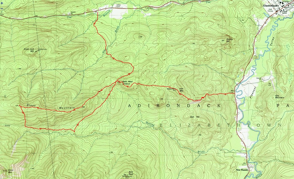
Although the MOAC group was bound for Colvin and Blake, the team leader graciously allowed me to do my own thing. When one of the group members, Vladimir, learned I was going to Giant and RPR, he asked to join me. I asked that he  get clearance from the team leader. With permission granted, we set off along the Roaring Brook trail.

My personal best for Giant and RPR is four hours in snowy, late-winter conditions. Today's effort was not competitive in nature and would break no records. The goal was to safely get up and down the icy trails and provide Vladimir ample time to enjoy his first trip to Rocky Peak Ridge (RPR).

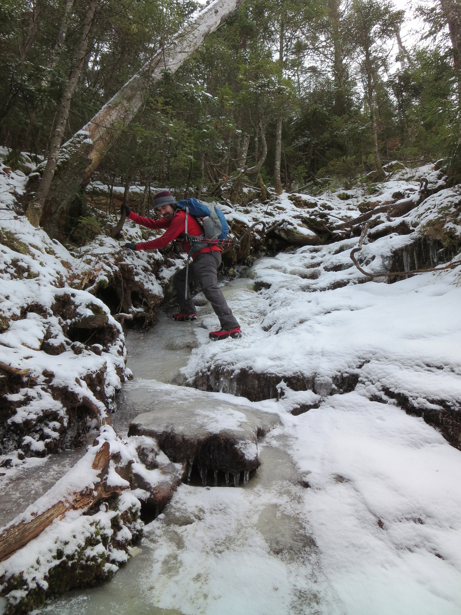
A light snowfall the previous night had whitewashed the frozen ground and ice. I soldiered along in bare-boots until the second slip, on snow-obscured ice, signaled it may be prudent to add spikes. Now the game was reversed. Without traction, I had sought rock and avoided ice. Now armed with sharp points, I avoided rock, to prevent needless dulling, and searched for ice. Vladimir wore trail-worn Kahtoola Microspikes whereas my boots flashed the freshly sharpened teeth of Hillsound Trail Crampons. The day's journey would prove it wasn't a fair fight.

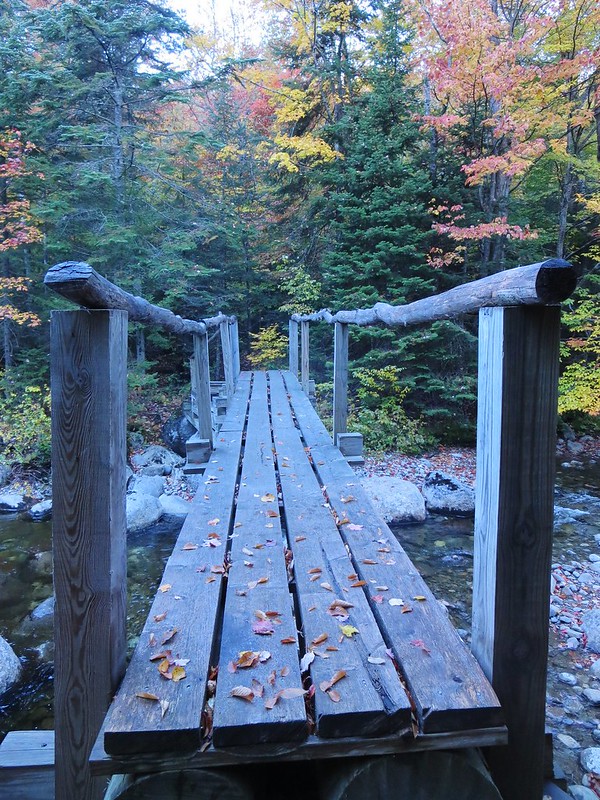
Roaring Brook flowed freely. Rather than rock-hopping the snow-covered rocks, we crossed by walking on the shallowest submerged rocks. It seemed safer to me than jumping on rocks and discovering a veneer of ice beneath their snowy blanket.

We made good progress until we reached the first of many ice flows. The ice had had ideal freeze-thaw conditions to grow over the span of weeks of mild weather. However, it was no longer yielding and Microspike-friendly. The cold morning air had made it bulletproof. Vladimir struggled to gain purchase with his spikes and lost confidence in their holding power. My Trail Crampons held securely but I was careful to plant them squarely and "flat-footed" wherever it was practical. The hardened ice slowed our ascent and I paused to allow Vladimir to creatively ascend the iciest sections. The ice softened later in the day and he was able to descend with greater confidence. Nevertheless, I imagine he will either sharpen or purchase new Microspikes after this trip.

I wished I had brought my thermometer because I was curious to know the temperature. It seemed colder than advertised because my fingers became uncomfortably cold. They have become prone to chilling to the point of causing stiffness and pain. I paused to add mitten-shells and hand-warmers. Vladimir seemed unaffected by the cold and, at least for a short while, wore no gloves or mitts. Perhaps it wasn't as cold as I thought but my hands tacitly disagreed.

About a hundred yards before the Roaring Brook trail meets the Zander Scott trail, a "false trail" joins it. I recounted an anecdote to Vladimir about how it looks like a proper trail in winter. It had caused us some confusion because one of our party used it for a butt-slide and failed to appear at the trail-junction. This morning, filled with fallen trees, no one could possibly mistake it for a trail.

At the RPR junction we met the first of a handful of hikers we would see all day. He was waiting for his partner to return from RPR. We pressed on and arrived at a steep pitch with a dangling, weather-beaten rope. My first instinct is to remove all "user-based trail-modifications". However, I temporarily left the rope in place just in case someone ahead of us had left it there for their return.

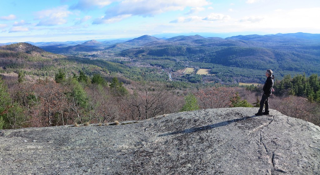
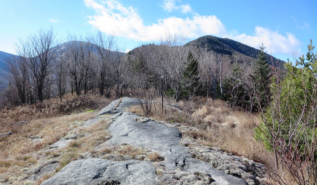
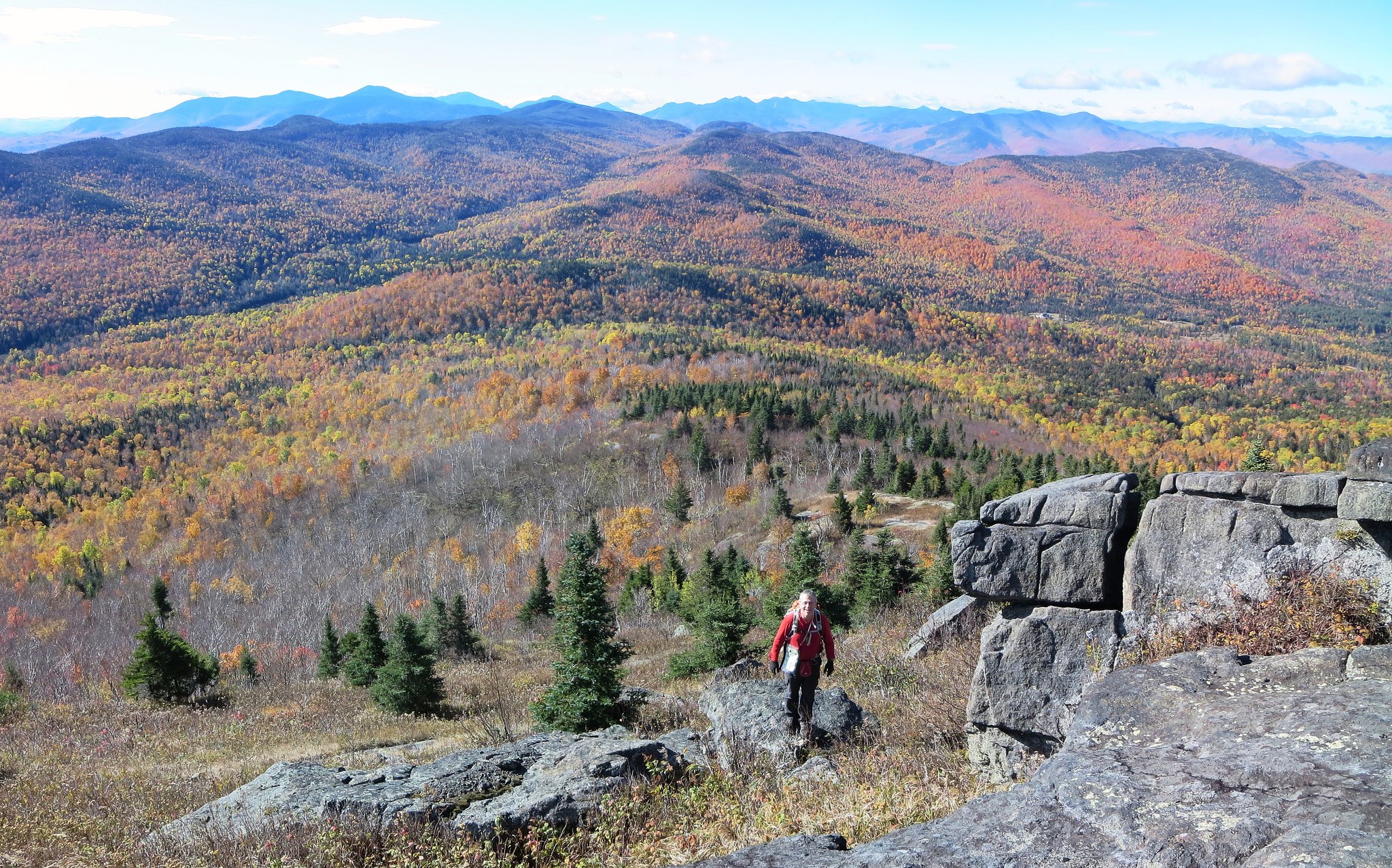
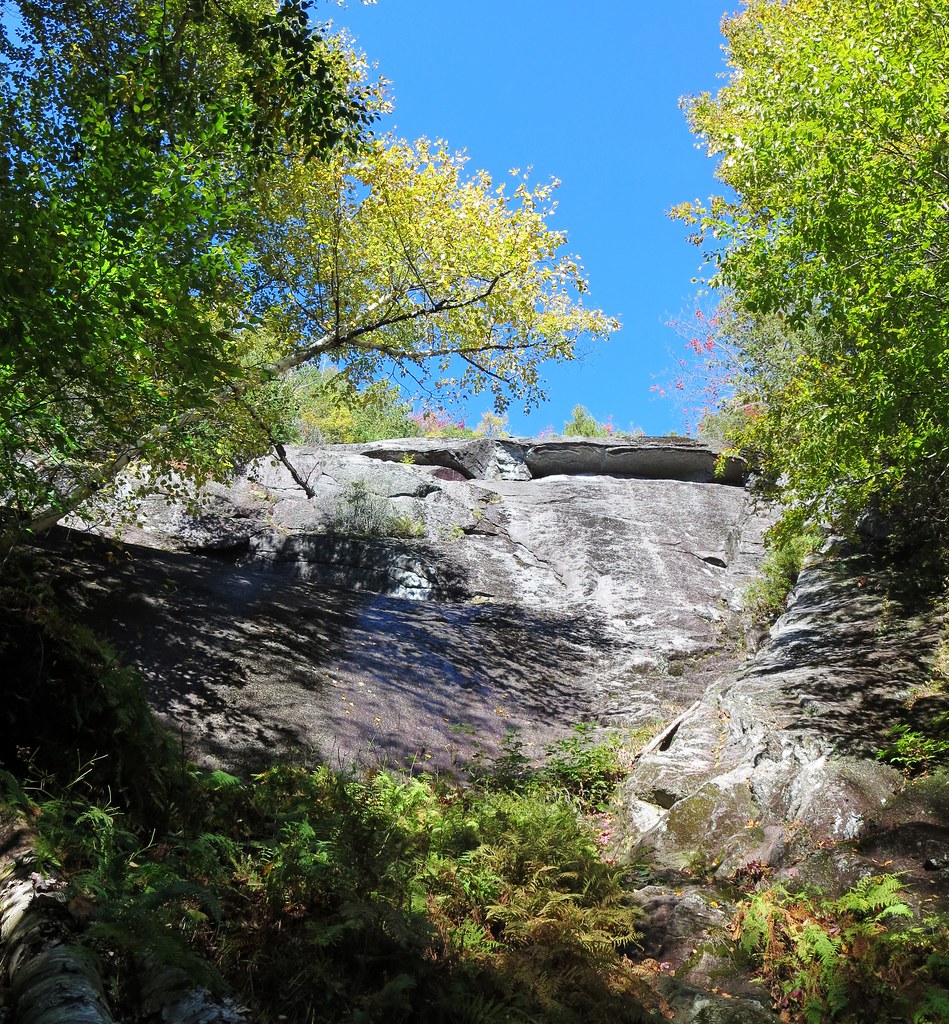
Giant's summit was shrouded in a cloud bank. It was my fourteenth visit, so it wasn't like I had never seen its views. The rolling fog added a touch of moodiness to the scene. We stayed only long enough for a snack and then my toes signaled it was time to either add a layer or get moving. We left at a brisk pace, eager to add RPR to Vladimir's growing list of ADK peaks.

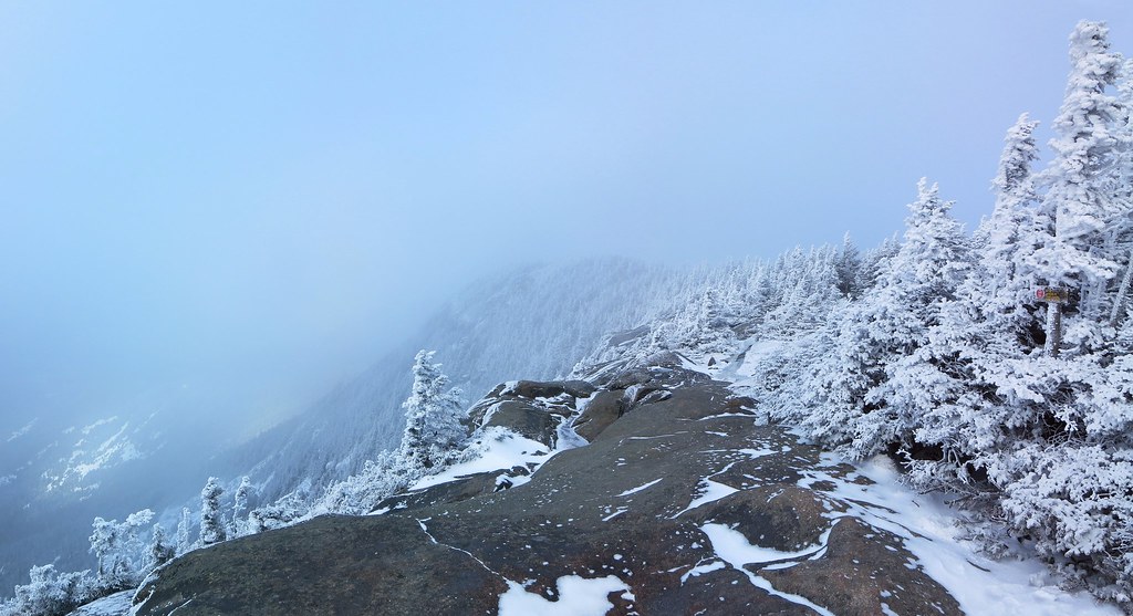
My 14th visit to Giant and it's a foggy one.

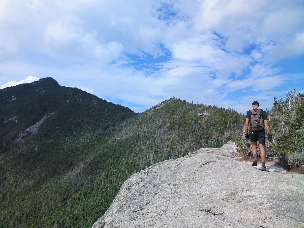
Before beginning our descent into the col, I cautioned Vladimir it would be steep and icy. He confirmed his desire to proceed, with trail-worn spikes, and so we dove in. The "usual suspects" were iced over and didn't fail to challenge us. It seems all of them have developed obvious bypass routes except for the man-high ledge (above the junction with the spur-trail). However, hiker traffic and erosion have exposed so many tree roots that they form a natural ladder; this ledge isn't as tricky to scale as it was in the past.

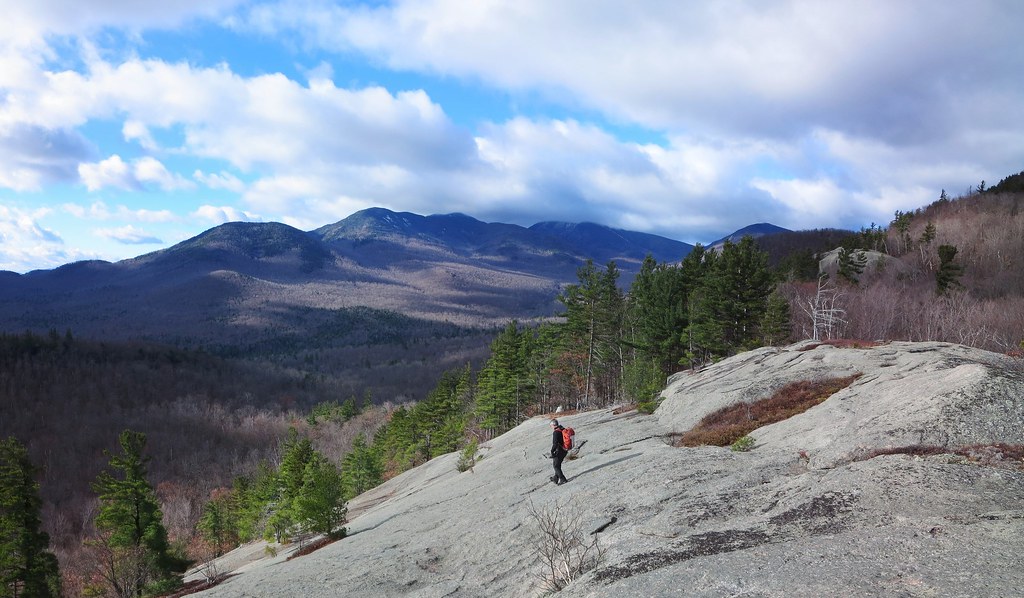
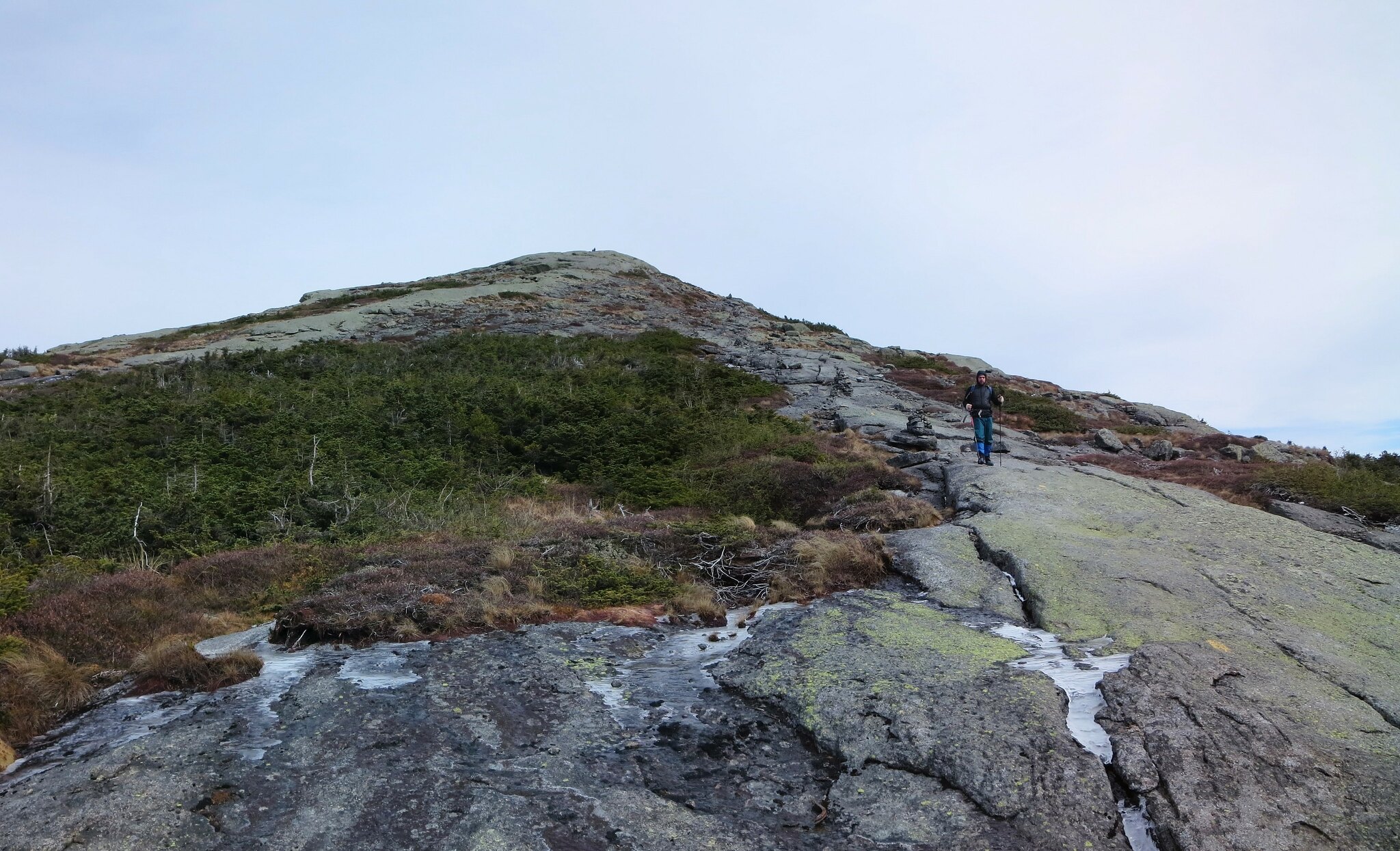
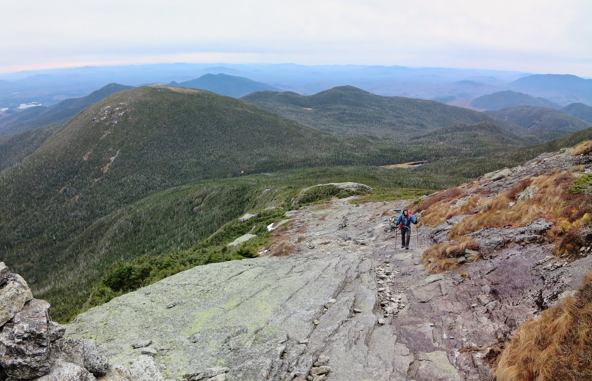
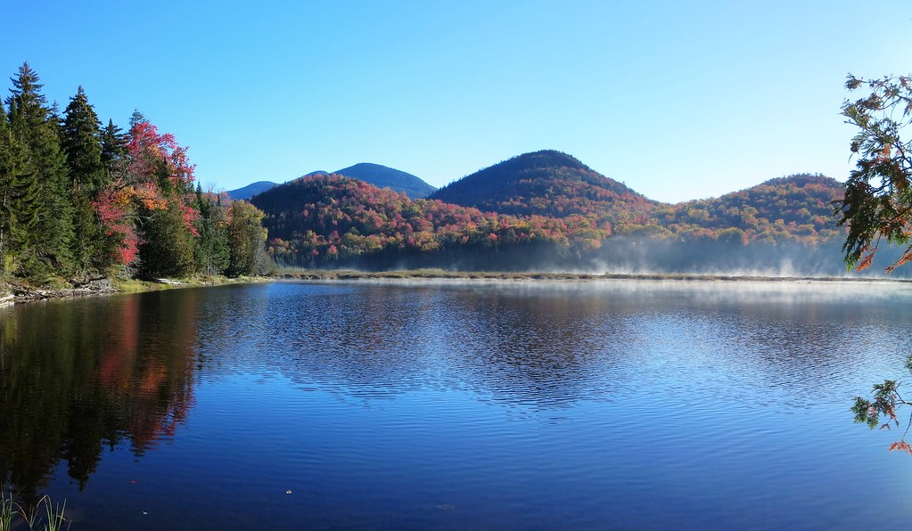
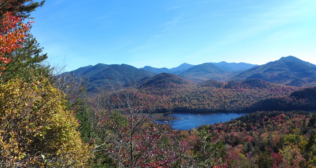
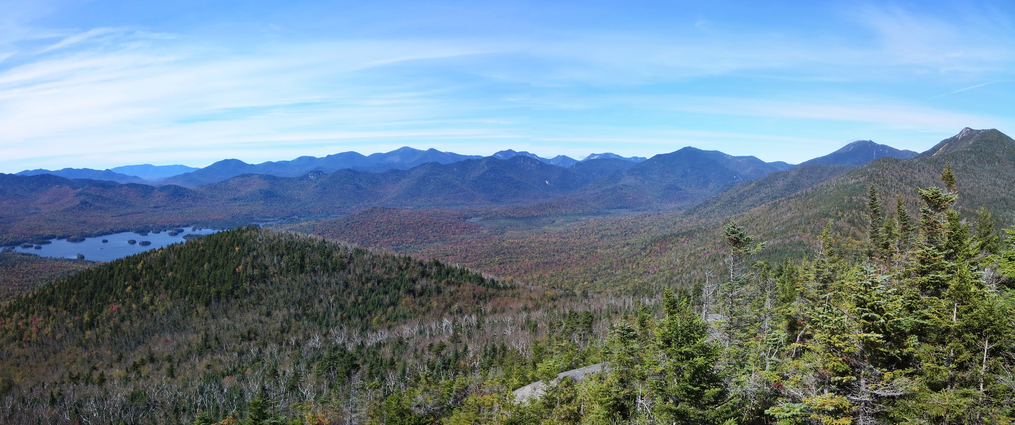
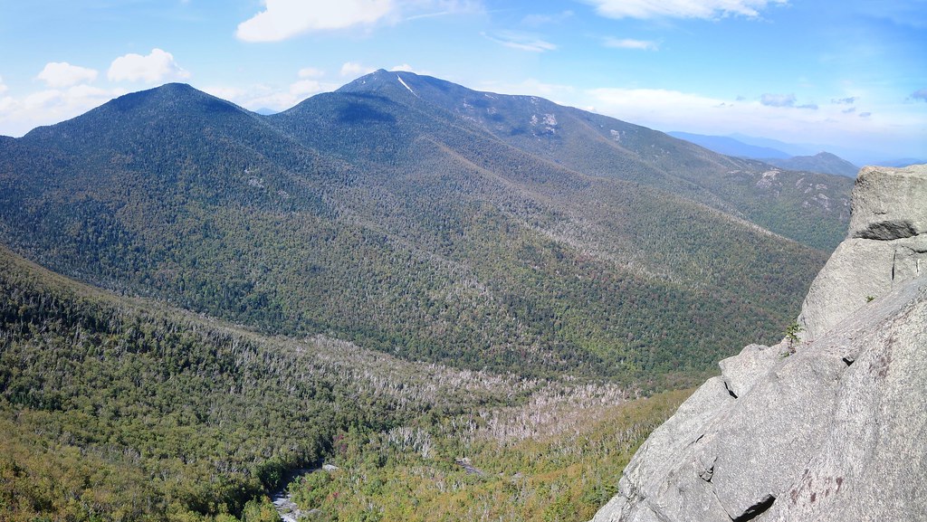
The clouds had lifted and we arrived to sweeping views atop Rocky Peak Ridge. The westerly wind was nippy so we walked to RPR's eastern side and enjoyed our lunch in relative warmth. I pointed out Lake Marie-Louise to Vladimir and described the wonderful traverse from the New Russia trail-head. As always, the view east was like a siren-call to complete the traverse. Enticing but impractical considering it was unlikely we could hitch a ride back after dark.

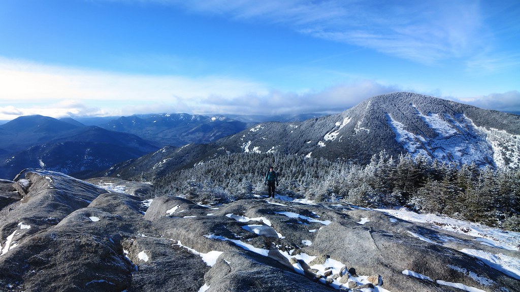
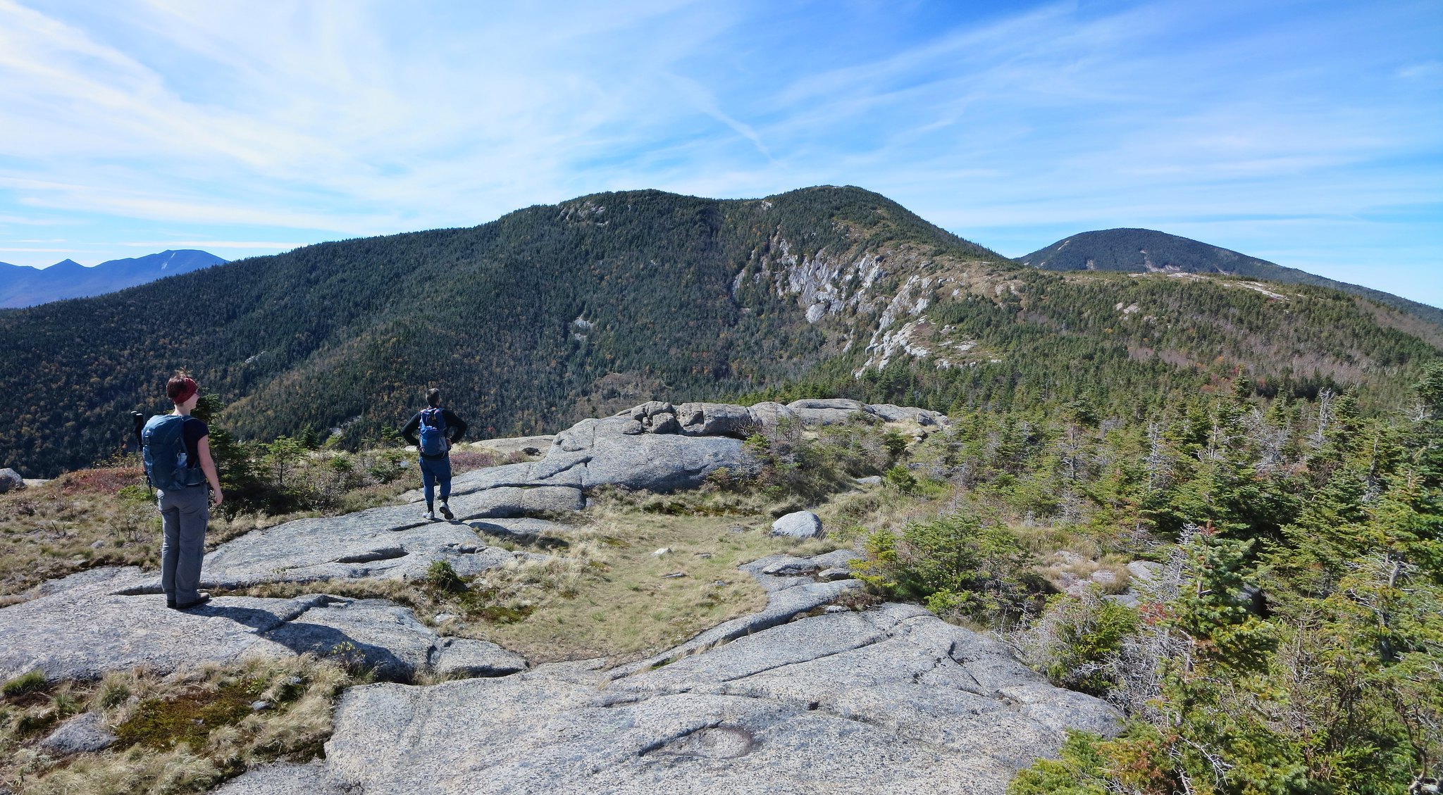
Vladimir arrives on Rocky Peak Ridge.
Shortly after leaving the summit, we met a lone hiker who commented on the steep descent into the col. "Lot's of butt-sliding!" I saw plenty of evidence of "trail-sweeping" earlier in the day. I can't imagine sliding down icy slabs was the most comfortable method of descent. We wished him well and continued along until we met two more hikers, Charles and Geneviève. I recognized Charles as a regular on Fousderando.com ("Charlie"). He's a man of the cloth and always seems to have a different attractive woman (or two) accompanying him on his hikes. There's a story I'd like to know more about.

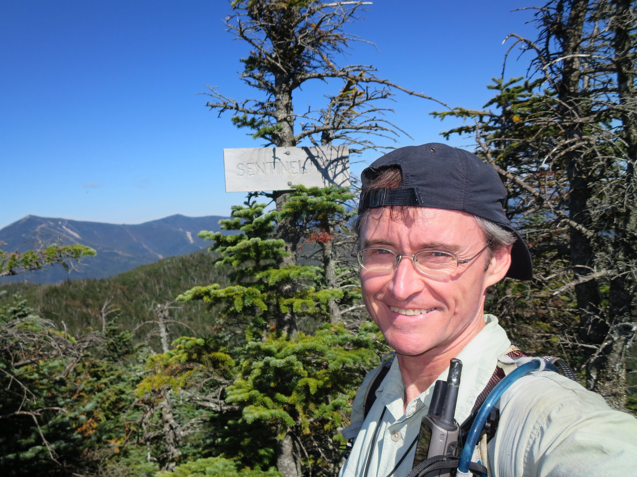
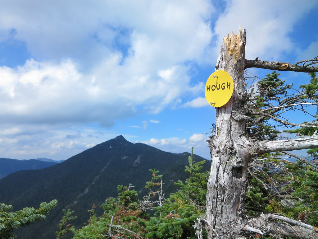
He wondered out loud why was I not hiking in the Sawtooths with Neil? He enjoys ribbing Neil about his obsession with bushwhacking the Sawtooth mountains. I explained Neil was the "Mayor of the Sawtooths" therefore he needed to be close to his constituents. Little did we know that Neil was in the Sentinels that day.

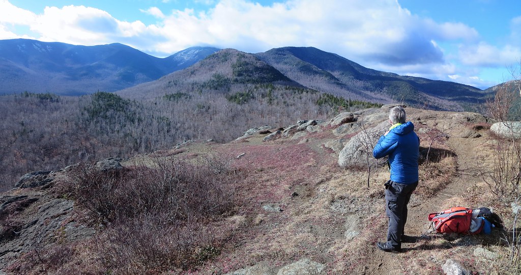
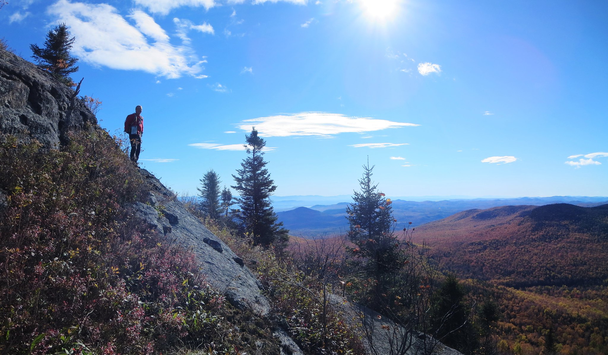
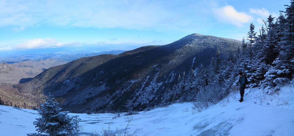
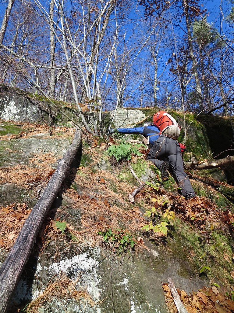
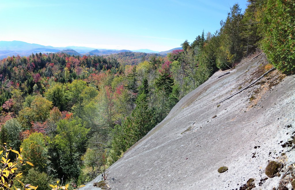
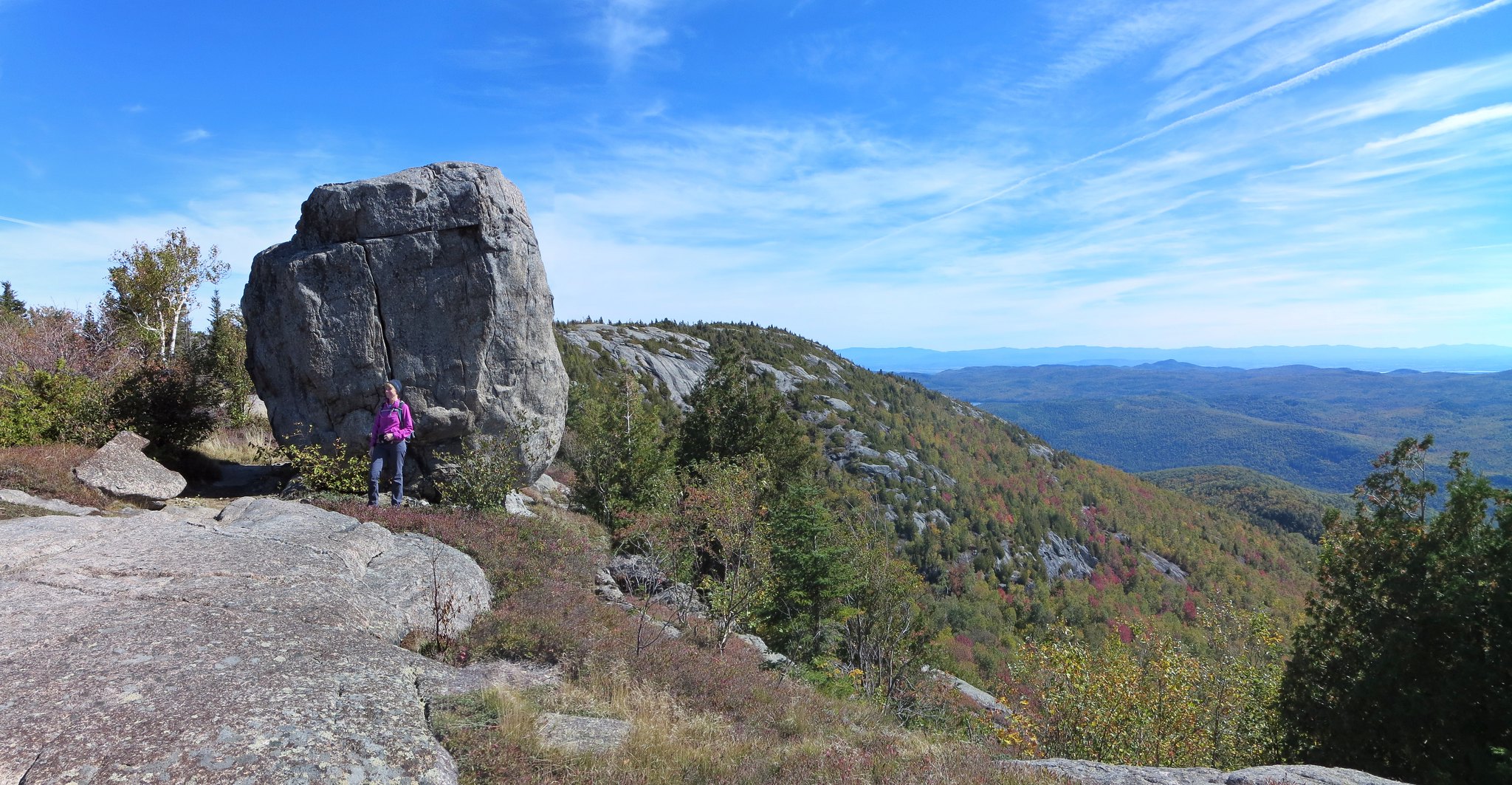
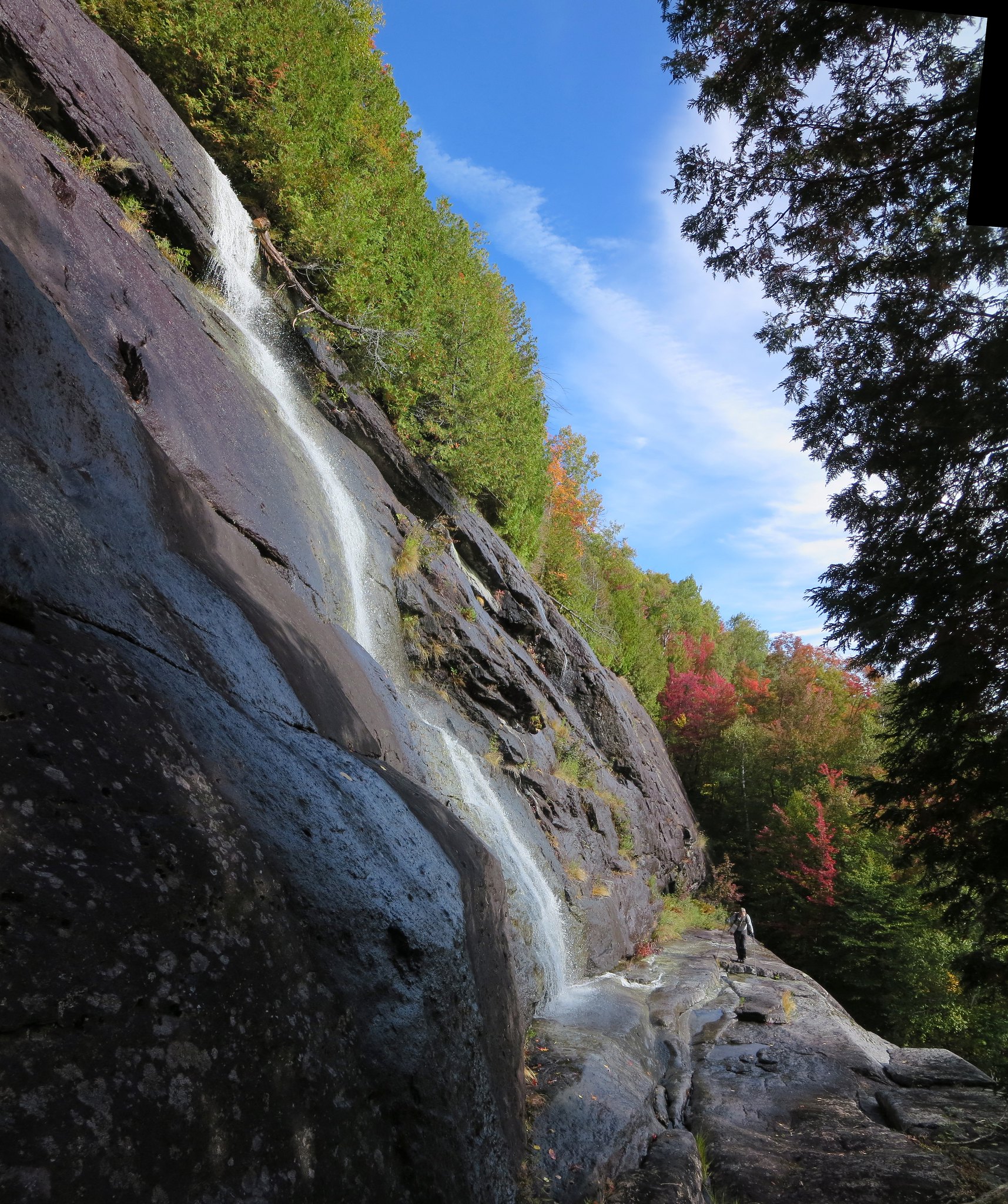
Appreciating the view from one of Giant's eastern slides.
We made a short detour along the spur-trail to savor the view from the slide. The conditions were too dicey to ascend the slide, especially with Vladimir's dull Microspikes. We returned to the main trail, made quick work of the ledge, and ascended to the main trail without incident. Before reaching the junction, I encountered yet another rope which was not present during our descent. I left it be because it was probably installed by either Charles or the lone hiker.

Back at the weather-worn rope, I concluded whoever installed it was no longer on the mountain. I untied it, used it to belay Vladimir's descent, then stowed it in my pack. I was able to easily descend the pitch without the rope.

I had failed to manage my hydration system and the bite-valve was now frozen. Nothing I did let the water flow freely so I tucked the free end of the hose into my jacket so it would eventually defrost. This would have regrettable consequences a short while later.

We continued to the "Over bump/Around bump" junction where I chose "Over" and Vladimir chose "Around". We met a few minutes later, at the base of the bump. I proceeded to dismantle two user-built cairns and then noticed the cold discomfort of a wet pant leg. Cue the punch line to my favorite joke "Hey! You're Arnold Palmer!"

I opened my jacket and discovered the bite-valve and its winter-cover had fallen off. The hose had defrosted and, whenever the pack was compressed, allowed the water to flow out onto me. Phooey! I removed my pack and asked Vladimir to wait while I ascended the trail to find the valve. Its cover was turquoise-blue so it would be easy to spot.

I climbed all the way back to the base of the bump but could not find the valve. Perhaps it fell off above the bump but I felt it wasn't worth the extra time and effort. The search was equally fruitless during the descent. I had to tie back the hose several times because it always found a way to squirt water (on my back, head, pack, etc). It finally ceased to be a nuisance when the hose frozen again. I've used a hydration bag for two winter rounds of the 46 and never experienced this glitch. There really is a first time for everything.

At the Roaring Brook junction, we chose to extend our hike by descending the Zander Scott trail to Giant's Washbowl. We would turn north, pass the base of Giant's Nubble and close the loop at the Roaring Brook trail. It seemed like a nice way to return to our car without backtracking along the entire length of the Roaring Brook trail.

High above the Washbowl, at a point where the Zander Scott trail transitions from woods to open slabs, we met a small group of photographers preparing for sunset shots. The low-lying clouds in the west offered the possibility of either dramatic colors or an unceremonious extinguishment. For their efforts, I hope it was the former. As we closed in on the Washbowl, we met a group of hikers hustling upward. They were attempting to watch the sunset but I feel they may have arrived a little too late.

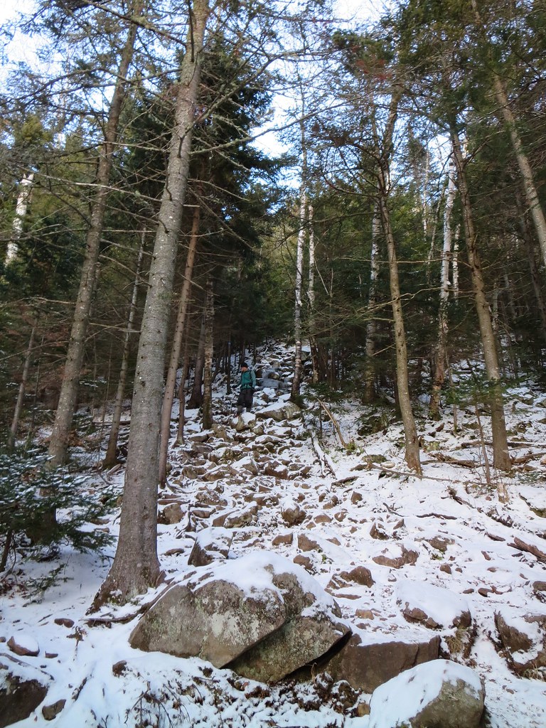
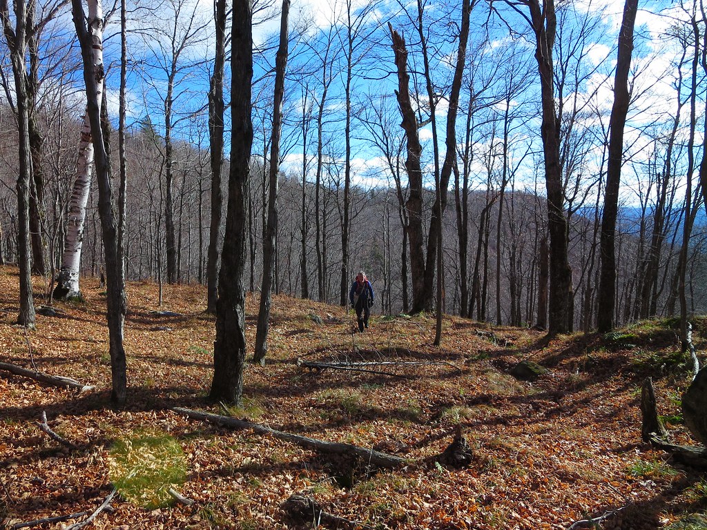
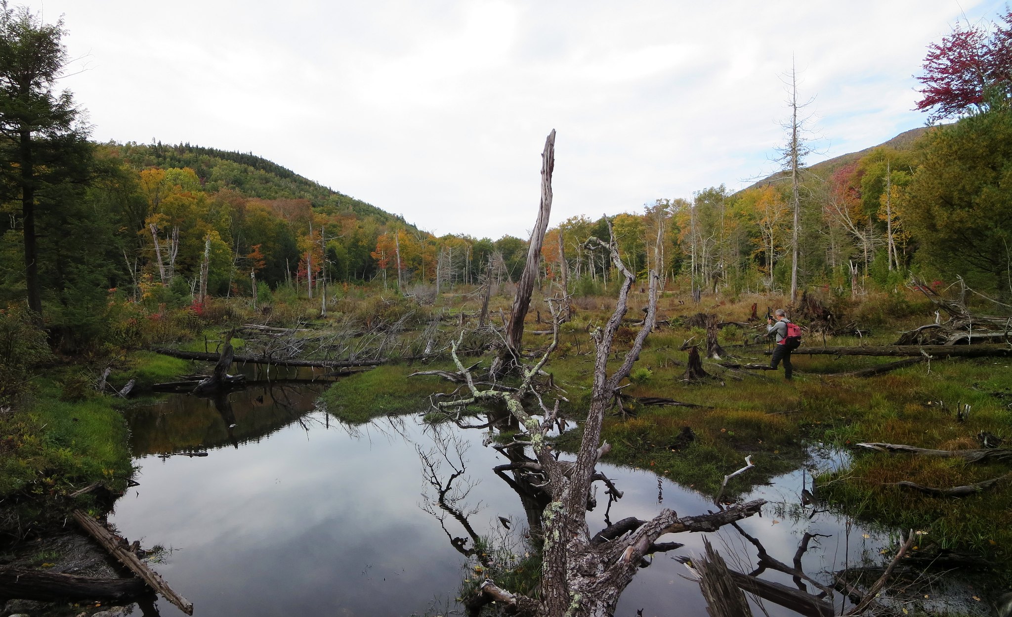
A snow-free December.
The Washbowl's surface was still and only its perimeter was frozen. I saw hikers on the eastern shore, at a designated campsite, and perhaps they were preparing their tent for the night. We continued past the Washbowl and it dawned on me that this might be my first time along this pretty stretch of trail.

The Nubble's western cliffs loomed above us as we ascended to the height-of-land. The ice was now largely absent so I removed my Trail Crampons. The descent to the Roaring Brook junction was though open woods and made challenging only by the occasional patch of slippery leaves.

We crossed Roaring Brook in the same manner as we had in the morning. The failing light made following the trail a little more challenging. Ten minutes from the trail-head, I capitulated and donned my headlamp. Vladimir soldiered on in the dark. With improved visibility, I zipped ahead and quickly signed us out at the trail-register. A three-quarter moon had risen and cast its cold light on the snowless trees.

We arrived at the car and were joined by the MOAC group a mere five minutes later. The group leader was surprised to learn we had taken as much time as their (longer) tour of Colvin, Blake, and Indianhead. There wasn't much to say about it beyond the fact we encountered many steep pitches with hard ice (notably in the morning) and dull Microspikes added to the challenge. The smiles all around indicated everyone had a great day in the mountains and that's the best measure of all.

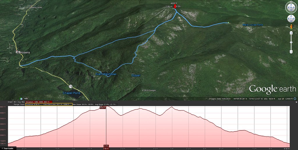
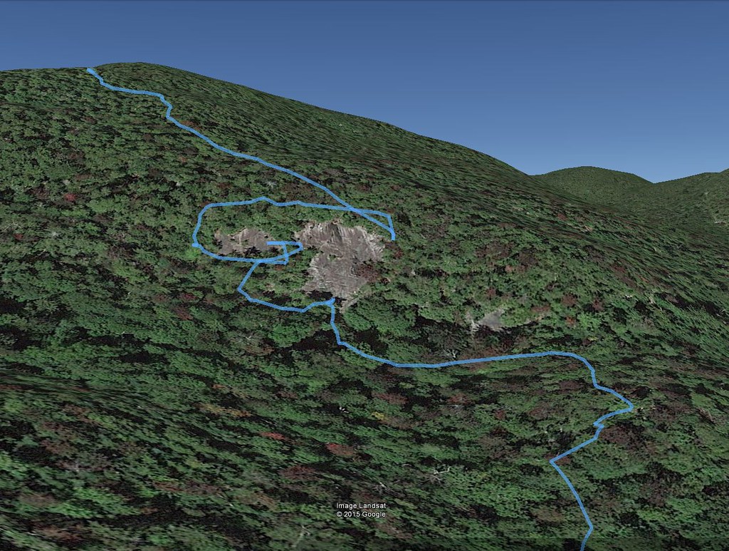
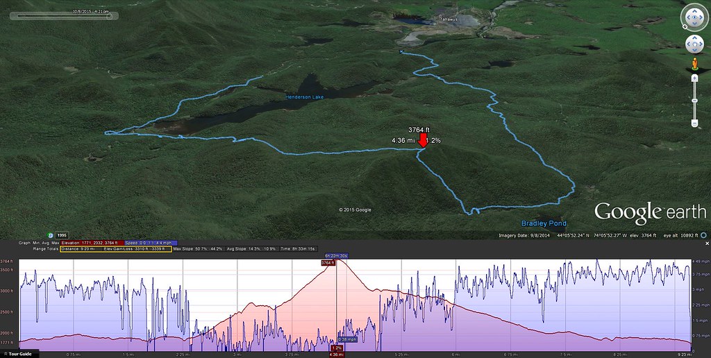
Approximately 8.6 miles and 5070 feet.

Photos

See all photos.

Thursday, November 26, 2015

Sunday, November 8, 2015

Iron, Owl Head, and Green. 2015-11-08

Standing at 3980 feet tall, Green is the 48th highest peak in the Adirondacks. It lies 1.5 miles north of the ever-popular Giant Mountain and no trails lead to its wooded summit. A very popular route to Green is from the south and involves about five miles of trail-walking, along the North Trail, followed by a steep, half-mile bushwhack ascent. Of the many ways to ascend Green, the one that appealed to me most was from the east. Departing the North Trail near Owl Head Lookout, one follows Green's ridge to its summit.

Neil suggested we up the ante and approach Green from the distant east. Our bushwhack route would start from highway 9 and proceed six miles over Iron Mountain, Owl Head Lookout, and along Green's ridge to its summit. Our return route would descend to the North Trail and follow it out to 9N. The proposed itinerary was more challenging than the "trade route". However, satellite imagery showed exposed outcrops and slides along the way so the payback would be scenic views. I was instantly sold on the idea.

Our route from 9 to Iron, Owl Head, Green, and 9N.
Aerial view.
Expecting a long hike, we left Montreal at 5:00 AM and arrived at Tom Haskins' home two hours later. Many thanks to Tom for agreeing to shuttle us from one trail-head to the other. We parked my car at the Owl Head trail-head, on route 9N, and then Tom drove us to a pull-off on the west side of route 9 about 2 miles south of Elizabethtown. Based on information gleaned from the DEC's State Land Interactive Mapper (SLIM), we selected this point because it provides legal access to Iron Mountain. A great deal of the land lying east of Iron is private and only one section borders the highway.

At 7:45 AM we bid Tom goodbye and immediately began ascending the steep embankment. After climbing about 150 feet, we were surprised to intersect an old road. We continued our ascent and crossed, re-crossed, and followed the road until it no longer coincided with our desired trajectory. The woods were surprisingly free of underbrush and, with a thick carpet of fallen leaves, made for very easy travel; there was no "bushwhacking" involved.


Hemlock Varnish Shelf (Ganoderma tsugae)
After a half-mile of park-like conditions, we breached a broad, grassy cliff and turned slightly southwest to join Iron's ridge. Mere feet below the northern side of the first knob, our progress was halted by a very broad wall of rock. We skirted it to the west and found a way to ascend it safely. In retrospect, an easier approach would be to curl around the southern end of the knob and avoid the wall entirely.

Working hard.
The open knob stands 1100 feet above route 9 and provides a commanding view of Pleasant Valley and nearby Elizabethtown. The mountains lying directly east were unfamiliar to me but I recognized the distant cloud-capped Green Mountains in Vermont. Later in the day, the clouds would lift and expose the distinctive silhouette of Camel's Hump.

First clear view of Elizabethtown.
Navigation now consisted of "connect the dots" where the "dots" were visible rock outcrops. The next section of open-rock elicited a "Wow!" I had seen satellite images but they had not prepared me for the large slope of open rock. I blurted "What an amazing slab climb!" as I envisioned ascending it from the valley. an added bonus was discovering three eye-bolts in the rock. They were arranged in a triangle and probably secured a survey station in the past. There was a shallow hole at the center of the triangle but I could not find a "survey bolt". Was it the handiwork of Verplanck Colvin's first survey or something more recent?

Neil explores the bare slope.
We re-entered the seemingly manicured woods and continued through airy pine, spruce, and birch. With a wealth of views to be found along its shoulder, Iron's summit was somewhat anti-climactic. Nevertheless, it provided us with our first unobstructed view of Owl Head and Green. Owl Head seemed close by but Green appeared to be uncomfortably far. Being only 10:00 AM, it was too soon to be concerned about running out of daylight.

Easy walking.
The next leg involved losing about 350 feet of elevation. The woods remained open but contained more underbrush and downed trees. In other words, it seemed more "normal" (to me). The lack of leafy trees worked to our advantage by allowing us to navigate visually. An unnamed peak, slightly taller than Iron, was our navigation marker. We kept it to our right and headed for a col on its south side. For anyone wishing to explore this area, I recommend heading directly for the unnamed peak. The terrain beyond the col required steep "side-sloping" across a drainage that could've been avoided by staying on high ground.

After climbing out of the drainage, the terrain returned to gentle slopes with broadly spaced trees and a deep carpet of leaves. Through the leafless trees we could see the outline of distant Bald and Rocky Peak Ridge. Its an outstanding place for anyone looking for an easy "bushwhack".

Park-like woods.
One final very short and steep ascent led to the summit of Owl Head Lookout. The last time I was there was May 25, 2015 volunteering for ADK 46er trail maintenance. A late season snow storm made for miserably cold and wet conditions. Low lying clouds dominated the landscape. On this day, the weather was excellent and we were treated to a splendid view of the peaks that form the Roaring Brook valley. Green was now closer but revealed a significant ascent awaited us.

Owl Head Lookout.
We stopped for a short break. My right boot had been gnawing at my heel and created a nagging pain. I was concerned I had developed a blister but the skin was simply inflamed. I paused to apply a blister bandage reinforced with waterproof tape. Instead of trail-shoes, it was my first hike of the year wearing a pair of leather boots. Although they were broken-in, my feet preferred the fit and flexibility of my well-worn trail-shoes.

After a quick snack, and several photos of our intended destination, we made the short descent to the North Trail. We followed it for a few yards and then cut into the woods. The conditions became decidedly more "Adirondack" and we were greeted with thick firs and downed trees. Fortunately, it was short-lived and soon we were moving along at a good clip.

We had studied our route from Owl Head Lookout but nothing prepared us for the rocky knob we named "Owl Head Two". Lying a half-mile west-southwest of Owl Head, "OH2" stands a few yards taller than OH1. Its south side is steep, exposed rock and, with limited daylight, we chose not to ascend it. However, it appears to be well worth one's time to explore. The col west of OH2 is a rugged place littered with huge boulders.

The rocky knob we called "Owl Head 2".
What grabbed our attention was the steep slope on the opposite side of the col. It was the start of a 600 foot climb to the top of the eastern end of Green's ridge. Hidden between the map's contour lines, gray walls of rock peaked through the firs and tacitly said "None shall pass!"

We contemplated skirting them by either heading north, to the col's height-of-land, or south, deeper into the drainage. We chose to get a closer look and discovered we could thread a route between the cliffs. Whereas navigation was easy, scrambling up the steep slope was not.

After clearing the steepest section, we breathed easy and settled into a steady rhythm. The sun was now lower in the sky and our route ran in the cooler shadows.  We noticed the first signs of snow accumulation. It looked like rock salt and it seasoned the moss and fallen leaves. Upon reaching the top of the climb, we re-joined the warm, sunlit, snow-free side of the mountain.

The next half-mile was a treat. Rising only 100 feet over its length, it is covered in tall grass, (prickly) underbrush, and sparse trees. Standing 900 feet above High Bank (on the North Trail), it offers unimpeded views of Roaring Brook valley and the ridge running from Bald to RPR and on to Giant. A braided game trail runs its length. It is also the last stretch of open woods along Green's ridge. The last mile to the summit is the typical Adirondack terrain one finds above 3000 feet, namely an abundance of conifers and blowdown.

Beautiful open woods along Green's ridge.
After savouring the last view we'd see for awhile, we pushed into the woods and began the slow grind to the summit. The final mile rises about 800 feet and it took us a little over 1.5 hours to traverse.  I had to stop one more time to tend to my right foot. The bandage had slipped off and the heel pain had become impossible to ignore. A fresh layer of tape and a dry sock made a world of difference.

Attempting to remain exclusively on the ridge's centerline became difficult. We dropped a few yards down the north side where we found a steep slope but open woods. I also got a peek of rocky Knob Lock mountain. Neil explained it was well worth a visit and could be incorporated into a trip to Green from route 9 (as he had done in the past).

I didn't expect much from Green's summit. It is completely wooded, quite flat, and, despite relatively open woods, no views. We had followed a game-trail/herd-path but it did not lead to a marked summit. Unlike many other peaks, I found no sign, leftover canister mountings, blaze, flagging, cairn, trodden patch of ground, or other evidence of a "herd-summit". To stand atop a peak that hasn't been marked is both satisfying and perplexing; you felt like the first person to reach it or like someone who simply hadn't found the true summit.

After scouting the area, I settled on a mossy boulder to represent the highest point even though some nearby ground seemed equally tall. I'm not sure why I bothered but it seemed important at the time. The ground was bleached white by a thin blanket of snow and the late-afternoon sun streamed in through the trees. It was the best Green could muster to welcome us to its summit and it was appreciated.

Green's approximate summit.
Our descent route seemed like a no-brainer: head south and join the North Trail. Within a few yards our progress was halted by a field of blowdown. We had no appetite for it. We backtracked east, approximately 300 yards, and tried again. It was a good strategy because it permitted us to skirt the blowdown (confirmed later using a satellite image) and find friendlier woods.

A quick check of the map showed a drainage running down Green's south face. It intersected the North Trail about a half-mile east of  Giant lean-to. We knew there were cliffs so we bet on the drainage to create a navigable path through them. The gamble paid off. We easily threaded our way through the steepest sections and dropped 1000 feet over 0.6 miles in 45 minutes (~2 mph) which is a respectable clip for bushwhacking.

Upon intersecting the North trail we paused to strip off layers, have a bite, and prepare for the final five mile trail-walk back to my car. There would be a 450 foot ascent beyond High Bank but until then it would be an easy-peasy gradual descent along a smooth trail. We wouldn't exit before sunset but we would cover the five miles in two hours.

At High Bank we met the only other hiker of the day. I believe his name was Bob and he had just returned from the base of the slides on Giant's east face. A resident of Lake Placid and an avid backcountry skier, he had lost a ski while descending the slides a few years ago. He returned to explore the area and, for fun, attempt to locate the lost ski. We spent several minutes chatting with him and he recounted many examples of what experienced local skiers had accomplished in the High Peaks.


It was now close to 4:00 PM and sunset was a mere half-hour away. Bob joined us and we chatted all the way back to the car. The final 450 foot ascent to the Owl Head junction did not go by unnoticed. After a steady climb the grade diminished and I thought the junction to Owl Head Lokout must be just a few yards away. I looked up and saw, illuminated by the day's last dim light, Owl Head about a half-mile away. Well darn! I forgot there was a brief high-point before the trail descended into a drainage and rose to meet the spur-trail to Owl Head. We passed the junction at sunset.

A half-hour past the junction, twilight was lost so we stopped at Slide Brook to don our headlamps. The remaining mile flew by in the darkness. At the trail-head we thanked Bob for his company and said our goodbyes.

Neil and I proceeded with our usual post-hike preparations for the drive home (change into clean clothes, bag and stow dirty gear, retrieve wallets and passports, inspect ground for dropped items, etc). We made one quick stop at Stewarts in Elizabethtown to replace lost calories and fill up with comparatively cheap US gasoline (US$2.45/gallon or, at 35% exchange rate, CDN$0.87/liter vs $1.10/liter in Montreal). Under a clear and starry sky, we drove home while recounting the amazing things we had seen. Visiting Green by way of Iron and Owl Head is a wonderful hike.

Stats

Distance: 12 miles.
Ascent: 4850 feet.
Time: 9h 37m.

Photos

My photos.
Neil's photos.

Saturday, October 24, 2015

Thursday, October 15, 2015

Thursday, October 8, 2015

Henderson Traverse. 2015-10-08

Neil suggested we hike to the summit of Henderson from its eponymous lake rather than, the more common approach, from Bradley Pond. It would give us the opportunity to visit the lake and to explore an intriguing cliff on Henderson's eastern slope. From the summit, we could choose between returning to the lake or descending Henderson's western slope to Bradley Pond.

We left the Upper Works trail-head at 8:00 AM under a clear and sunny sky. The woods were damp and the fall foliage was at its peak. The trail-signs appeared to be relatively new and clearly spelled out destinations such as the Henderson Lake Dam, Duck Hole, and Mount Marcy.

The trail to Duck Hole was interrupted by a mirror-smooth beaver pond. We crossed it along a precariously spongy beaver dam. The bridge across Indian Pass Brook was surprisingly slippery. Its damp boards had frozen but showed no evidence of slickness until one's first step.

Surprisingly slippery footbridge.
We followed the side-trail to Henderson lean-to and were impressed by its location. The lean-to itself is in excellent shape, of the "Lincoln Logs" variety, and is neat as a pin. From the lake's shore we watched the morning's mist rise against the backdrop of fiery autumn colors. Nearby is a brook and we crossed it above a small waterfall to begin our bushwhack to the cliff.

Mist on Henderson Lake.
The terrain was rumpled and caused us to ascend and descend a few times before finally smoothing out. We didn't know it at the time but we arrived slightly north-east of the cliff. Sighting a "hole in the canopy", we moved south-west and arrived at the base of the cliff.


Route of our exploration of the cliff.
 The portion we could see rose 40-50 feet to an overhang.  Its otherwise smooth face was scarred by a right-leaning, class 4 ramp that beckoned to be climbed. I scrambled up high enough to concede my footwear and the wet rock made for a bad combination. I carefully down-climbed to the base and followed Neil who had started ascending the steep woods bordering the cliff's left side.

Fifty-foot cliff.
We found, but did not follow, a dicey route to the top of the overhang. We continued to ascend and found a smaller cliff with a narrow grassy shelf leading to a single bush. We stepped out onto the shelf and were rewarded with a clear view of the High Peaks and Henderson Lake. Although it was possible to traverse the cliff to rejoin the woods, we agreed it was too "exposed". We retreated the way we came, entered the woods and continued to climb.

View from cliff.
The woods bordering the top of the cliff were dense and obscured all views. We probed the margins but could not find a safe vantage point. We traversed to the right side and found a reasonably safe spot to emerge onto the slab. The view was worth the effort.

Slipping is not an option.
For the next leg, we ascended to ~2600 feet and were fortunate to find relatively open woods. We followed the stripe between two contour lines and marveled at our good luck. The land rose steeply to our right and dropped precipitously to our left. It was going so well that it seemed self-evident that we would return via this route rather than traverse to Bradley Pond.

We descended to an intermittent stream and then everything changed. It's normal for the woods to be denser near a source of water but they simply refused to thin out. Wherever they did it was either short-lived or due to a blowdown field. Our progress slowed to a crawl. It became increasingly difficult to flank the blowdown fields because they seemed to have no perimeter. My gnarlometer registered a new high-water mark.

While clambering over several fallen trees, I reflected on how my perception of difficulty had changed. This was my fourteenth bushwhacking trip in 2015 and what once caused trepidation now instilled stoicism. It is what it is, so just keep moving because it can't last forever (it only feels that way). Our doggedness was rewarded by excellent views of Wallface from blowdown clearings.


Wallface and McIntyre Range.
Nearing the summit, the blowdown diminished and the relief was palpable. It was clear we would not be returning the same way. It had taken us 2 hours to cover 0.6 miles and climb 1000 feet. It was a new personal record for 'least miles per hour'.

The summit offered no views. I climbed a fallen tree to get a partial view of the High Peaks. We paused briefly for a snack and then began our descent to the Santanoni lean-to (aka Bradley Pond lean-to). Our descent route was a welcome change from our ascent route. Henderson's western slope was mercifully free of blowdown. Forty-five minutes later, we intersected the marked trail slightly north of the lean-to.

Yard-sale at Santanoni lean-to.
The last time I saw the Santanoni lean-to was in 1982. I have a vague recollection of having a view from the lean-to. According to the High Peaks guidebook, the lean-to was moved uphill. In 2015, there is no view but it seems like everyone is trying to re-establish one. The lean-to is surrounded by dozens of foot-tall stumps, tacit evidence of cutting live trees. This illegal activity was aided by a hand-held "Means of Destruction" hanging from a nail. Good luck finding it now.

The air of 'backcountry slum' was enhanced by a rumpled pile of tarps and discarded items like an adze and a sleeping bag. The fire-pit had the usual assortment of burnt and unburnt garbage. It was the polar opposite of the pristine Henderson lean-to.

Both of us had seen the Bradley Pond trail several times so we shifted into high gear and cleared the 4.4 miles in under 90 minutes. Along the way we found a hat and evidence of recent passage. We emerged at the Santanoni trail-head and caught up to two separate hikers preparing to leave.

Apparently the hat belonged to neither of them. However, its owner was known and we were instructed to deposit it on the "blue car". Both hikers graciously agreed to give us a lift to Upper Works and we accepted the first offer. I congratulated the younger hiker who had just completed his ADK 46 on Couchsachraga.

Back at Upper Works, we changed into clean clothes and made one sight-seeing stop at the McIntyre Iron Furnace before settling in for the 3 hour drive home. The balance of our trip was spent ogling the brilliant fall colors from the comfort of the car. Memories of Henderson's gnarly western side were already fading into the distant past.

9 miles and 3300 feet.

Photos

See all photos.

Sunday, October 4, 2015

RPR and Giant Traverse. 2015-10-04

Another boulder delivered by Glacier Express.

Camille and Gabriel en route to summit of Rocky Peak Ridge.

Photos

See all photos.

Thursday, October 1, 2015

Sunrise. 2015-10-01

Morning at Beaver Hollow.
Spectacular second level of West Mill Falls.

Endless mountains.

Photos

See all photos.

Saturday, September 19, 2015

Dix Range Loop 2015-09-19

On Saturday I joined three other hikers, Gabriel, Luis, and Sébastien, for a tour of the Dix Range. The trip was organized by Gabriel and, given that he had already hiked Dix, his goal was to hike four of the five peaks of the Dix Range. On the summit of Hough, Luis and Sébastien desired to continue and I joined them for their first ascent of Dix.

Our day began at 5:00 AM in front of Gabriel's home. We piled into his car and headed south. Somewhere past Westport, our host became sleepy so I volunteered to drive. We arrived at Clear Pond shortly after 7:30 PM and noticed cars parked in the lot. I knew this did not bode well for securing a spot at Elk Lake.  A sign confirmed my suspicion; the main lot was full. I chose to drive to the trail-head anyway on the chance a spot had opened up.

As advertised, the Elk Lake parking lot was indeed full. Two cars were parked on the shoulder and risked being ticketed (a sign makes that outcome abundantly clear). I offered to drop off everyone, return to Clear Pond to park the car, and then walk back to rejoin them at Elk Lake. My offer was unanimously accepted. I watched everyone quickly prepare for the hike especially Luis who inhaled his pasta-breakfast with inhuman speed! I left my pack with Gabriel and drove back to Clear Pond.

My 1.8 mile jog/walk back to Elk Lake was made all the more enjoyable by the cool, sunny morning plus being unencumbered by a pack. It took me 20 minutes to rejoin my awaiting hiking partners. We left the trail-head at 8:30 AM and headed north to Slide Brook lean-to.

Along the way I met the first of several people who recognized me. "Are you Taras?" and "Aren't you Trail Boss?" made Luis ask why strangers seemed to know me. I explained my participation in the ADKhighpeaks.com forum and, to a lesser extent, a personal hiking blog, had everything to with it. To all the folks I met on the trail, it was a pleasure to meet you and I hope you had a great hike in the Dix Range.

We passed the cairn marking the start of the unmarked trail to Macomb and headed directly to the nearby lean-to. The last time I had hiked the Dix Range from Elk Lake was in 2011. Since then, the lean-to has been relocated from a clearing, directly on the trail, to a few yards off-trail and in the woods. However, this was not the first thing I noticed. What stood out above all was the concentration of tents in the vicinity of the lean-to.

The place looked like a backcountry slum. I don't understand the attraction of walking two miles into the woods to camp two yards from the trail and two feet from your neighbors. The majority of tents were within spitting distance of the trail. Perhaps I didn't see the designated campsite markers but the majority of tents appeared to be in violation of the 150-foot rule. The owner of the tent parked directly in front of the lean-to must have thought it was the 150-inch rule.

Whereas the woods were full of tents, the lean-to was empty. We paused there for a moment and then made a beeline to Macomb's trail. My companions were young and fit so we made good time ascending the dry, smooth path. We emerged at the base of the slide at 9:45 AM.

Luis and Sébastien ascend Macomb's slide.
The slide was it's usual self, a mish-mash of sand and loose rubble down low and some clean solid rock up high. There's no shortage of cairns marking what is an extremely obvious route. We split up and took whatever path piqued our interest. I chose the cleaner rock found on climber's left whereas my companions hugged the slide's right edge. We met at the erratic perched at the top of the slide where I volunteered to take photos of a young couple.

We made short work of the remaining section of trail and arrived on Macomb's summit at 10:30 AM. It was a popular destination on Saturday. It was my eighth time on Macomb and I'd never seen it so busy. The views were good albeit a bit hazy.

I apologize for forgetting her name but a delightful woman offered homemade honey cake and I was first in line. Thank you again, it was delicious! I overheard someone say Macomb's ascent was the steepest of all 46 peaks. I explained Dix from Round Pond held that honor but they pointed to pack with a 46er patch and claimed its owner would disagree. I never got to meet the pack's owner but I invite her/him to inspect this comparative study compiled by ADK 46er Trail Master, Joe Bogardus. It lists the steepest ascents to a summit over a minimum one-mile distance (there may be steeper but shorter sections to be found). Macomb is no slouch and comes in at fifth overall.
Gabriel chose to descend first, knowing we'd catch up to him. I continued to chat with other hikers while my two companions took their fill of views and photos. We spent no more than ten minutes on the summit and then proceeded to rejoin Gabriel. Luis and I proceeded at a spirited pace, passed Gabriel, and didn't stop until we reached the col. I indicated we should wait for the other half of our team to arrive because we were at a junction (southern arm of the Lillian Brook trail).

Ascending South Dix.
I looked forward to ascending the open rock of South Dix's western face. I much prefer it to the viewless "green tunnel" between South Dix and Grace. I paused to chat with an ex-Marine while my partners continued to the summit. The fellow said his training was tough but there's something about hiking that can take the wind out of your sails.

I rejoined the gang waiting for me on South Dix and we proceeded to Grace. Luis set the pace and his feet left a trail of fire! It was a challenge to keep up with him. We paused at the junction (trail to Boquet valley) to await our companions and ensure they did not make a wrong turn.

We had Grace's summit to ourselves for a few minutes before being joined by the VP of the ADK 46ers, her husband, and their 14 month-old daughter. The little one has been to over 30 peaks but, as her mom conceded, none of them count. Nevertheless, she was well on her way to "46er-by-proxy" status (riding in a child-carrier on her father's back).

Aspiring 46er!
The hikers we had passed earlier started to arrive and the summit developed a party atmosphere. Seeking a quieter, and more scenic, spot for our lunch, we continued past the summit to the top of the Great Slide. There we found a quiet spot to snack and enjoy the spectacular view of Hough and Dix. We spent 45 minutes lounging in the sun and then packed up to return to South Dix.

Hough and Dix from the top of the Great Slide.
I set a steady pace with Luis and we cleared the green tunnel in 30 minutes. We waited at the junction for our team mates to catch up. I pointed to a ledge on Hough and explained it offered excellent views and we would be there before long. Luis and Sébastien took the lead, eager to set a faster pace.

We quickly traversed Pough and then paused at the base of Hough to allow everyone to catch up. Sébastien took the lead with Luis at his heels and maintained a brisk pace up Hough. I caught up with them at the ledge where Sébastien had taken the bypass route (left past the ledge) and Luis and Gabriel scaled the rock. Other hikers paused here as well to look back at the route they had taken from Macomb and Grace.

Wind-pruned tree.
Forty-five minutes after departing South Dix, we stood on the summit of Hough. The brisk wind was very welcome if not a little bracing. After a few photos, we moved out of the wind and discussed our next step. The two aspiring 46ers looked longingly at the Beckhorn. Gabriel declared, as per his original plan, Hough was his final peak of the day. He had been to Dix on a previous trip and felt today's hike was sufficient exercise for him. I explained the next leg to Dix would take add at least two hours to our trip; one hour to Dix plus another hour to descend the Beckhorn trail. Gabriel still needed to return to Clear Pond to retrieve his car so, time-wise, it could balance out nicely.

After considering our options, Gabriel encouraged Sébastien and Luis to continue to Dix and I agreed to join them. We wished Gabriel well and assured him we would do our best to avoid having him wait too long. I took the lead down to the col where Sébastien took over and charged up the slope.

Passing a lookout along the route to Dix.
I had explained that this route to Dix was my favorite. It follows a narrow shoulder to the Beckhorn and features at least three lookouts offering views of one's progress along the ridge. Sébastien's pace didn't leave much time for sightseeing. Luis and I fell back slightly and didn't see him until the base of the trough where he was scouting a bypass route. I pointed to the trough and said it was the usual way up. We scrambled up and, a few moments later, emerged on the windy summit of the Beckhorn.

After briefly pointing out our eventual descent route, down the Beckhorn trail, we pressed on to Dix. Fifty minutes after leaving Hough's summit, we stood astride Dix's summit bolt. I congratulated them for their accomplishment. We had the summit to ourselves and settled in for a fifteen minute break. Dark clouds had rolled in and reminded me of the chance of late-afternoon showers. A wet Beckhorn trail would slow us down so we didn't overstay our welcome.


The A-Team strikes a pose.
We returned to the Beckhorn and began the steep descent along its open rock. We paused at the ledge because it's such a cool feature! The last time I had been on the Beckhorn trail was over 30 years ago so I didn't remember much about it aside from it being steep.


Beckhorn's ledge.
I took the lead scrambling down the trail. I think the north side of Seward is a good deal rougher than the Beckhorn. Nevertheless, there's plenty to keep one's hands and feet busy during the initial descent. Eventually it moderates and becomes a seemingly endlessly loss of elevation (2750 feet).

The dull pain in my knees was occasionally punctuated by a sharper sting along the outside of the right one. I paused twice to massage the area and shake my leg to work it out. I checked my watch and knew I shouldn't expect to see the junction until one hour had passed. I had lost sight of my companions who were somewhere behind me. Undoubtedly they too were coping with grumbling legs.

Steep section of the Beckhorn trail.

Fifty-five minutes after departing the Beckhorn, the junction appeared. A few minutes later Luis arrived and then Sébastien. Everyone agreed the descent had taken a toll on their legs. However, we succeeded in covering it in an hour and could now look forward to four comparatively easy miles. Although not without a bit more elevation gain of course!

Somewhere past Dix Pond, Luis reported he had run out of water. I assured him we weren't far from Lillian Brook where we'd take a short break. I pressed ahead, arrived at the brook first and setup my water filter just in time for Luis's arrival. After we topped up our supplies, I took a few minutes to soak my feet in the cold brook and put on dry socks. Sorry Coca-Cola but this was the real "pause that refreshes"! We consumed whatever snacks we had left and then hurried south to the trail-head. We closed the loop at Slide Brook and now had only two miles of easy trail to cover.

We arrived at Elk Lake at 6:00 PM and met Gabriel resting in his car. He said he had only waited 25 minutes so we felt good that our peak-bagging excursion had not been an excessive inconvenience. After cleaning up, we stuffed the trunk with our gear, which seemed to have expanded since the morning, and then talked all the way back to Montreal. We all had a fantastic day in the mountains and look forward to our next trip.

Photos

See all photos.

Stats

08:30 AM Elk Lake
10:30 AM Macomb
10:40 AM Macomb - Depart
11:15 AM South Dix
11:46 AM Grace
12:30 AM Grace - Depart
01:00 PM South Dix
01:46 PM Hough
01:55 PM Hough - Depart
02:45 PM Dix
03:00 PM Dix - Depart
03:55 PM Beckhorn Trail Junction
04:15 PM Lillian Brook
04:30 PM Lillian Brook - Depart
06:00 PM Elk Lake

Saturday, September 12, 2015

Marcy Dam Trail Work 2015-09-12

On Saturday I volunteered for ADK 46er trail-work. I got a ride to Adirondack Loj with a MOAC group headed for Iroquois and Algonquin. We arrived at 9:20 AM which was late enough to require parking near South Meadows road. After establishing a rendezvous time of 7:00 PM with Badri, the organizer, I wished everyone a great hike and disappeared down the road.

Fifty minutes later, I emerged at Marcy Dam and began looking for tool-wielding 46ers. They had arrived well before me and were busy working on several projects. I learned Joe was a half-mile up the trail, somewhere near the Kagel lean-to. I recognized Mike milling around near the dam and introduced myself. He was waiting for Katey who would assign us our next task.

A few years ago, Marcy Brook washed away a section of the trail leading to Avalanche Pass. The trail was re-routed away from the brook. However, whenever the brook jumps its banks, at a sharp westward bend, water runs directly down the old trail and floods the new one. Katey showed us where to build a retaining wall in order to block the entrance of the old trail.


John, Mike, Bill, and Gary haul a large stone to form the base of the retaining wall.
The job required hauling stones from the nearby brook and stacking them to create a dam. The heaviest stones, weighing in at 200+ pounds, would form the base. We carried each stone in a nylon "diaper" suspended between two sturdy iron bars held by four people. The technique made us look like stretcher-bearers.


The stone heads for the unreinforced stream bank visible in the background.
Three rows, of the largest stones we could carry, formed the base of the retaining wall. The brook and the steep muddy bank made footing treacherous. The danger of twisting ankles or crushing toes was very evident. By task's end, we emerged with nothing worse than tired muscles and wet footwear. The same could not be said for the "diaper". It developed many small tears which eventually became one gaping hole that rendered it useless.


John tips the stone in place to form another row.
After completing the retaining wall, we proceeded to reinforce the earthen bank with stones to prevent the brook from undermining the wall. With the diaper out of commission, we hand-carried thirty-pounders and then lobbed 5-10 pounders across the brook. Given an ample supply of nearby rocks, we made good progress creating a stony shield. By mid-afternoon, our work was done and Joe complimented our handiwork. We estimated that we had moved close to 3 tons of rock to create our masterpiece.

Done! The stream bank is now reinforced to protect the retaining wall.
We gathered our tools and returned to store them at the DEC Interior Station at Marcy Dam. There we saw the results of another project, the construction of new "thunder-boxes". Built of recycled 2-inch thick planks, volunteer 46rs will carry these sturdy toilets to nearby lean-tos.


Autographed, limited-edition "thunder-box".
Upon departing Marcy Dam, the predicted rain arrived. It began as a light shower but we stayed dry walking under the forest canopy. Whereas we were lightly dressed, and outbound, the crowds of inbound backpackers seemed "post apocalyptic". Burdened by enormous packs and clad in full raingear, they appeared to be escaping from some devastated place. Unfortunately, they had it all backwards because the impending torrential downpour would soon make the backcountry a sodden mess.

We arrived at the parking lot shortly after 3:00 PM and said our good-byes in the intensifying rain. Joe handed out beverages and I took two bottles to tide me over the 3-4 hour wait for the arrival of the MOAC group. I joined the growing number of soggy hikers seeking refuge in the HPIC building. I chose a good people-watching vantage point, reached into my pack for a towel and dry shirt, and then settled in for the balance of the afternoon. Shortly thereafter the rain fell hard and fast.

There was an endless queue for the showers and bathrooms. The line up for the female john became so hopeless that several desperate women invaded the men's toilet. After the crowd thinned, I found an empty shower stall to change into dry pants. The last step was to buy a steaming cup of hot cocoa. Dry and warm, I could now comfortably sit and watch the droves of wet hikers seeking shelter from the downpour.

Mike reappeared and kept me company until 5:00 PM. A woman introduced herself as Celine and asked if I had finished a 46er round atop Dix and had handed out drinks to everyone. Indeed I had completed my first winter 46er round on Dix and I offered single-malt to willing celebrants. I met Celine and her father on Dix's summit and we had toasted to the occasion. She said her father was doing well and he had also finished his winter round. I extended my congratulations to him and to her young daughter who, despite the dreary weather, was ebullient.

Shortly after 6:00 PM, Gabriel appeared and indicated the balance of the group was not far behind. Over the course of the next hour, the group reassembled and was in good spirits. They had ascended the Boundary trail, skipped Iroquois and hiked over Algonquin when the rain caught up with them. The descent was slippery but everyone exited without incident. It was now after 7:00 PM, the rain had restarted and it was getting dark. Several hikers had commitments the following day so a group meal was nixed in favor of returning to Montreal ASAP. We said our goodbyes and settled in for the rainy ride home.

Photos

See all photos.