Showing posts with label Grace. Show all posts

Saturday, September 19, 2015

Dix Range Loop 2015-09-19

On Saturday I joined three other hikers, Gabriel, Luis, and Sébastien, for a tour of the Dix Range. The trip was organized by Gabriel and, given that he had already hiked Dix, his goal was to hike four of the five peaks of the Dix Range. On the summit of Hough, Luis and Sébastien desired to continue and I joined them for their first ascent of Dix.

Our day began at 5:00 AM in front of Gabriel's home. We piled into his car and headed south. Somewhere past Westport, our host became sleepy so I volunteered to drive. We arrived at Clear Pond shortly after 7:30 PM and noticed cars parked in the lot. I knew this did not bode well for securing a spot at Elk Lake.  A sign confirmed my suspicion; the main lot was full. I chose to drive to the trail-head anyway on the chance a spot had opened up.

As advertised, the Elk Lake parking lot was indeed full. Two cars were parked on the shoulder and risked being ticketed (a sign makes that outcome abundantly clear). I offered to drop off everyone, return to Clear Pond to park the car, and then walk back to rejoin them at Elk Lake. My offer was unanimously accepted. I watched everyone quickly prepare for the hike especially Luis who inhaled his pasta-breakfast with inhuman speed! I left my pack with Gabriel and drove back to Clear Pond.

My 1.8 mile jog/walk back to Elk Lake was made all the more enjoyable by the cool, sunny morning plus being unencumbered by a pack. It took me 20 minutes to rejoin my awaiting hiking partners. We left the trail-head at 8:30 AM and headed north to Slide Brook lean-to.

Along the way I met the first of several people who recognized me. "Are you Taras?" and "Aren't you Trail Boss?" made Luis ask why strangers seemed to know me. I explained my participation in the ADKhighpeaks.com forum and, to a lesser extent, a personal hiking blog, had everything to with it. To all the folks I met on the trail, it was a pleasure to meet you and I hope you had a great hike in the Dix Range.

We passed the cairn marking the start of the unmarked trail to Macomb and headed directly to the nearby lean-to. The last time I had hiked the Dix Range from Elk Lake was in 2011. Since then, the lean-to has been relocated from a clearing, directly on the trail, to a few yards off-trail and in the woods. However, this was not the first thing I noticed. What stood out above all was the concentration of tents in the vicinity of the lean-to.

The place looked like a backcountry slum. I don't understand the attraction of walking two miles into the woods to camp two yards from the trail and two feet from your neighbors. The majority of tents were within spitting distance of the trail. Perhaps I didn't see the designated campsite markers but the majority of tents appeared to be in violation of the 150-foot rule. The owner of the tent parked directly in front of the lean-to must have thought it was the 150-inch rule.

Whereas the woods were full of tents, the lean-to was empty. We paused there for a moment and then made a beeline to Macomb's trail. My companions were young and fit so we made good time ascending the dry, smooth path. We emerged at the base of the slide at 9:45 AM.
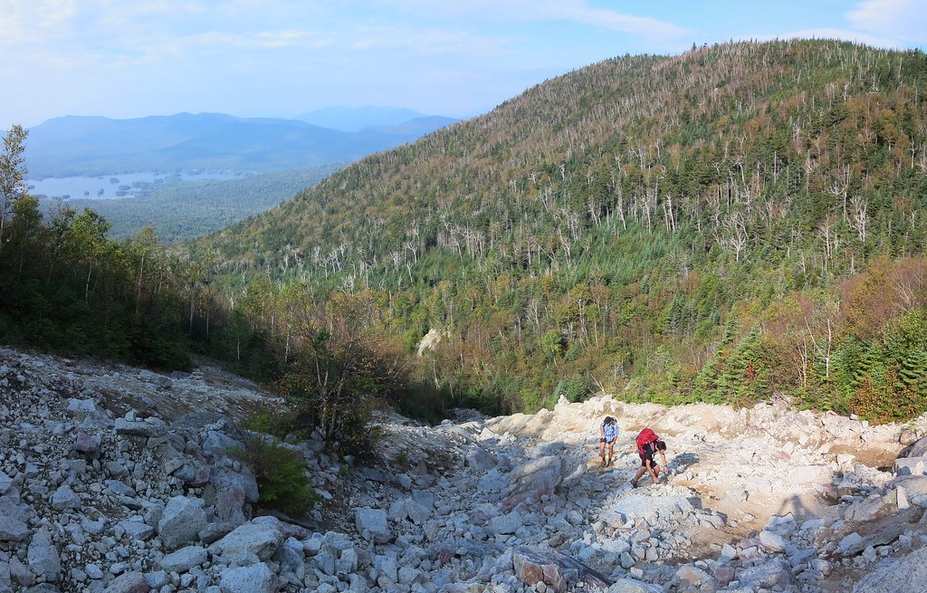
Luis and Sébastien ascend Macomb's slide.
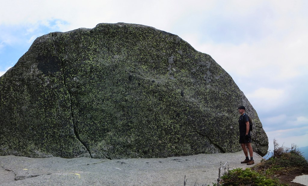
The slide was it's usual self, a mish-mash of sand and loose rubble down low and some clean solid rock up high. There's no shortage of cairns marking what is an extremely obvious route. We split up and took whatever path piqued our interest. I chose the cleaner rock found on climber's left whereas my companions hugged the slide's right edge. We met at the erratic perched at the top of the slide where I volunteered to take photos of a young couple.

We made short work of the remaining section of trail and arrived on Macomb's summit at 10:30 AM. It was a popular destination on Saturday. It was my eighth time on Macomb and I'd never seen it so busy. The views were good albeit a bit hazy.

I apologize for forgetting her name but a delightful woman offered homemade honey cake and I was first in line. Thank you again, it was delicious! I overheard someone say Macomb's ascent was the steepest of all 46 peaks. I explained Dix from Round Pond held that honor but they pointed to pack with a 46er patch and claimed its owner would disagree. I never got to meet the pack's owner but I invite her/him to inspect this comparative study compiled by ADK 46er Trail Master, Joe Bogardus. It lists the steepest ascents to a summit over a minimum one-mile distance (there may be steeper but shorter sections to be found). Macomb is no slouch and comes in at fifth overall.
Gabriel chose to descend first, knowing we'd catch up to him. I continued to chat with other hikers while my two companions took their fill of views and photos. We spent no more than ten minutes on the summit and then proceeded to rejoin Gabriel. Luis and I proceeded at a spirited pace, passed Gabriel, and didn't stop until we reached the col. I indicated we should wait for the other half of our team to arrive because we were at a junction (southern arm of the Lillian Brook trail).

Ascending South Dix.
I looked forward to ascending the open rock of South Dix's western face. I much prefer it to the viewless "green tunnel" between South Dix and Grace. I paused to chat with an ex-Marine while my partners continued to the summit. The fellow said his training was tough but there's something about hiking that can take the wind out of your sails.

I rejoined the gang waiting for me on South Dix and we proceeded to Grace. Luis set the pace and his feet left a trail of fire! It was a challenge to keep up with him. We paused at the junction (trail to Boquet valley) to await our companions and ensure they did not make a wrong turn.

We had Grace's summit to ourselves for a few minutes before being joined by the VP of the ADK 46ers, her husband, and their 14 month-old daughter. The little one has been to over 30 peaks but, as her mom conceded, none of them count. Nevertheless, she was well on her way to "46er-by-proxy" status (riding in a child-carrier on her father's back).
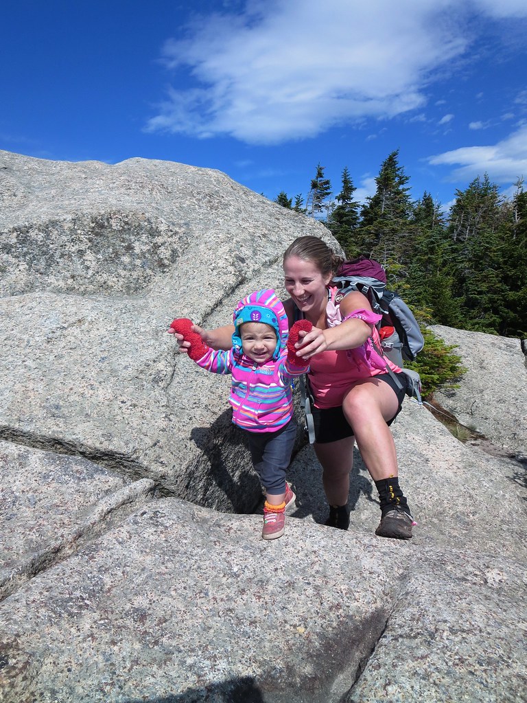
Aspiring 46er!
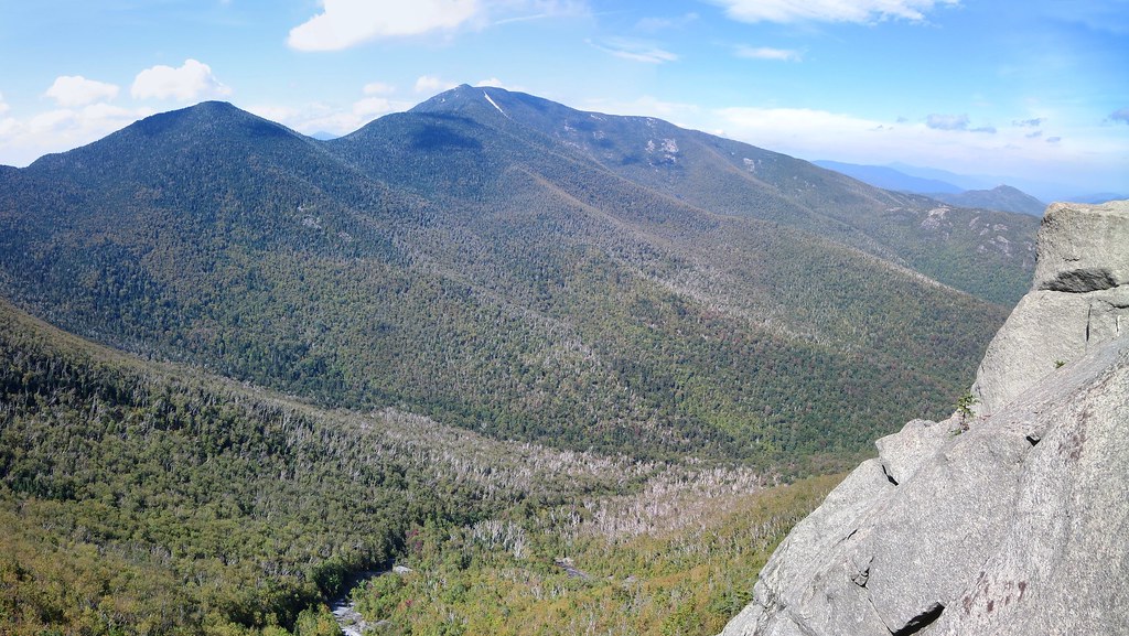
The hikers we had passed earlier started to arrive and the summit developed a party atmosphere. Seeking a quieter, and more scenic, spot for our lunch, we continued past the summit to the top of the Great Slide. There we found a quiet spot to snack and enjoy the spectacular view of Hough and Dix. We spent 45 minutes lounging in the sun and then packed up to return to South Dix.

Hough and Dix from the top of the Great Slide.
I set a steady pace with Luis and we cleared the green tunnel in 30 minutes. We waited at the junction for our team mates to catch up. I pointed to a ledge on Hough and explained it offered excellent views and we would be there before long. Luis and Sébastien took the lead, eager to set a faster pace.

We quickly traversed Pough and then paused at the base of Hough to allow everyone to catch up. Sébastien took the lead with Luis at his heels and maintained a brisk pace up Hough. I caught up with them at the ledge where Sébastien had taken the bypass route (left past the ledge) and Luis and Gabriel scaled the rock. Other hikers paused here as well to look back at the route they had taken from Macomb and Grace.
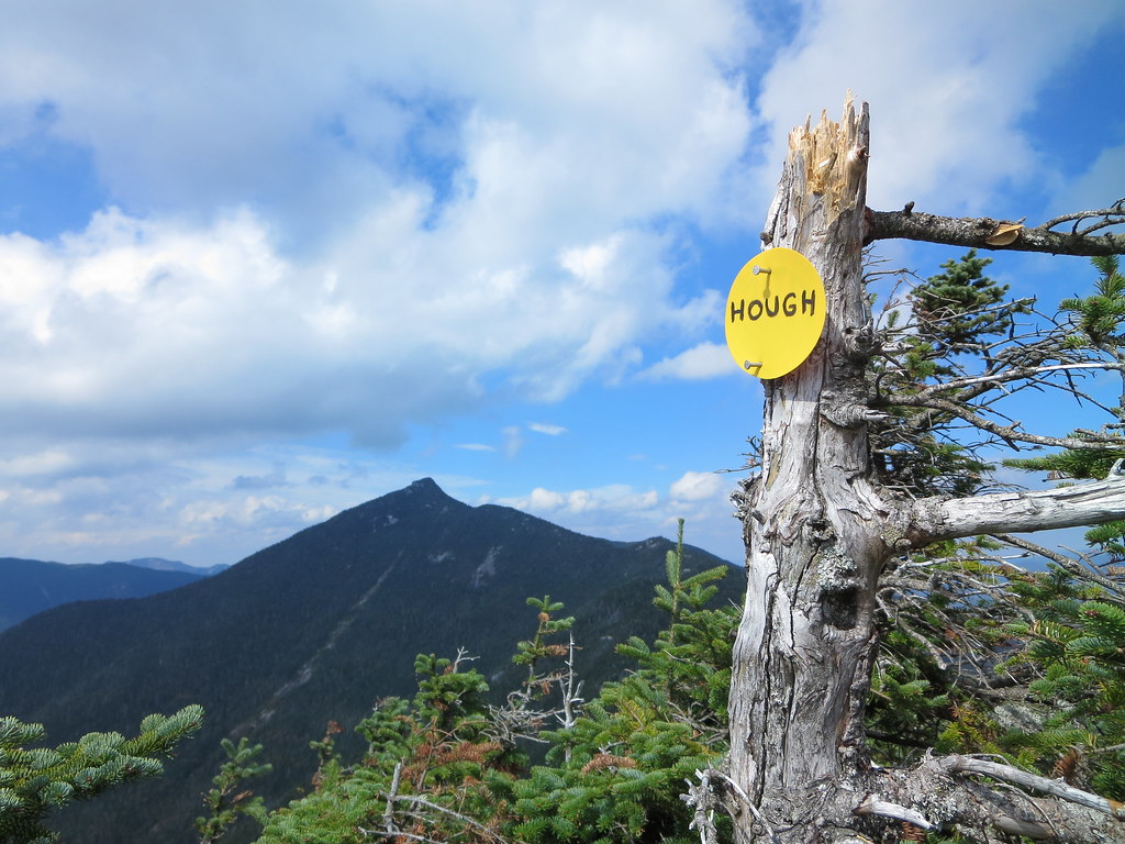
Wind-pruned tree.
Forty-five minutes after departing South Dix, we stood on the summit of Hough. The brisk wind was very welcome if not a little bracing. After a few photos, we moved out of the wind and discussed our next step. The two aspiring 46ers looked longingly at the Beckhorn. Gabriel declared, as per his original plan, Hough was his final peak of the day. He had been to Dix on a previous trip and felt today's hike was sufficient exercise for him. I explained the next leg to Dix would take add at least two hours to our trip; one hour to Dix plus another hour to descend the Beckhorn trail. Gabriel still needed to return to Clear Pond to retrieve his car so, time-wise, it could balance out nicely.

After considering our options, Gabriel encouraged Sébastien and Luis to continue to Dix and I agreed to join them. We wished Gabriel well and assured him we would do our best to avoid having him wait too long. I took the lead down to the col where Sébastien took over and charged up the slope.
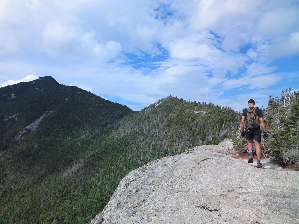
Passing a lookout along the route to Dix.
I had explained that this route to Dix was my favorite. It follows a narrow shoulder to the Beckhorn and features at least three lookouts offering views of one's progress along the ridge. Sébastien's pace didn't leave much time for sightseeing. Luis and I fell back slightly and didn't see him until the base of the trough where he was scouting a bypass route. I pointed to the trough and said it was the usual way up. We scrambled up and, a few moments later, emerged on the windy summit of the Beckhorn.

After briefly pointing out our eventual descent route, down the Beckhorn trail, we pressed on to Dix. Fifty minutes after leaving Hough's summit, we stood astride Dix's summit bolt. I congratulated them for their accomplishment. We had the summit to ourselves and settled in for a fifteen minute break. Dark clouds had rolled in and reminded me of the chance of late-afternoon showers. A wet Beckhorn trail would slow us down so we didn't overstay our welcome.


The A-Team strikes a pose.
We returned to the Beckhorn and began the steep descent along its open rock. We paused at the ledge because it's such a cool feature! The last time I had been on the Beckhorn trail was over 30 years ago so I didn't remember much about it aside from it being steep.


Beckhorn's ledge.
I took the lead scrambling down the trail. I think the north side of Seward is a good deal rougher than the Beckhorn. Nevertheless, there's plenty to keep one's hands and feet busy during the initial descent. Eventually it moderates and becomes a seemingly endlessly loss of elevation (2750 feet).

The dull pain in my knees was occasionally punctuated by a sharper sting along the outside of the right one. I paused twice to massage the area and shake my leg to work it out. I checked my watch and knew I shouldn't expect to see the junction until one hour had passed. I had lost sight of my companions who were somewhere behind me. Undoubtedly they too were coping with grumbling legs.

Steep section of the Beckhorn trail.

Fifty-five minutes after departing the Beckhorn, the junction appeared. A few minutes later Luis arrived and then Sébastien. Everyone agreed the descent had taken a toll on their legs. However, we succeeded in covering it in an hour and could now look forward to four comparatively easy miles. Although not without a bit more elevation gain of course!

Somewhere past Dix Pond, Luis reported he had run out of water. I assured him we weren't far from Lillian Brook where we'd take a short break. I pressed ahead, arrived at the brook first and setup my water filter just in time for Luis's arrival. After we topped up our supplies, I took a few minutes to soak my feet in the cold brook and put on dry socks. Sorry Coca-Cola but this was the real "pause that refreshes"! We consumed whatever snacks we had left and then hurried south to the trail-head. We closed the loop at Slide Brook and now had only two miles of easy trail to cover.

We arrived at Elk Lake at 6:00 PM and met Gabriel resting in his car. He said he had only waited 25 minutes so we felt good that our peak-bagging excursion had not been an excessive inconvenience. After cleaning up, we stuffed the trunk with our gear, which seemed to have expanded since the morning, and then talked all the way back to Montreal. We all had a fantastic day in the mountains and look forward to our next trip.

Photos

See all photos.

Stats

08:30 AM Elk Lake
10:30 AM Macomb
10:40 AM Macomb - Depart
11:15 AM South Dix
11:46 AM Grace
12:30 AM Grace - Depart
01:00 PM South Dix
01:46 PM Hough
01:55 PM Hough - Depart
02:45 PM Dix
03:00 PM Dix - Depart
03:55 PM Beckhorn Trail Junction
04:15 PM Lillian Brook
04:30 PM Lillian Brook - Depart
06:00 PM Elk Lake

Sunday, February 23, 2014

Dix Range Traverse. 2014-02-23

Sunday, February 23, 2014


On Sunday, I joined Neil and Joe (JoeCedar) for a traverse of the Dix Range. We started at Round Pond at 6:45 AM and finished at the North Fork Boquet (highway 73) 10.5 hours later.

Nearing the summit of Dix, we met RidgeRunner and on the summit Justine (VeggieLasagna) joined our team.


The weather cooperated throughout the day and only the summits were chilly owing to strong winds.


Thanks go to Rik, Inge, Blackbear, Carl, and all others who participated in breaking out the herd-paths the previous day. Navigation was a given.


East of South Dix, we met Kerry who informed us the second crossing of the North Fork Boquet presented a problem. She had to double-back and stamp out a new route along the south side of the river all the way to Lillypad Pond.


On Grace, we congratulated Joe for completing his fifth consecutive Single-Season Winter 46!


Nearing Lillypad Pond, we followed Kerry's path and, with a little extra trail-breaking, connected with the south-side herd path. Some rock-hopping along the river was required.


Neil, hiking his sixth straight day, was in good spirits and, although professing to move no faster than a sustainable "ten-day pace", hiked at a quick clip throughout the day.


Crossing Round Pond at sunrise.

Best seat in the house.

Nature's Swarosvski crystal.

On top o' the world, Ma!

Photos


See all photos.

Videos

Summit of Dix.


Friday, July 26, 2013

Dix Range Traverse 2013-07-26

North Fork Boquet River to Round Pond


Over the course of several days, Bib and I had discussed a hiking route that would include several new mountains to add to his 46er list. The Dix Range featured four peaks he had never visited so it became our objective.

The "trade route" typically begins and ends at Elk Lake and involves a counter-clockwise, or clockwise, circuit of the Dix Range. Seeking something different, I suggested approaching the Dix Range from the east, namely where highway 73 crosses the North Fork Boquet River, which lies 650' lower than the Elk Lake trail-head.

The Plan's Design

  1. Start from highway 73 at the North Fork Boquet bridge.
  2. Head to Grace (East Dix) via the herd-path.
  3. Continue over Carson (South Dix).
  4. Out-and-back to Macomb.
  5. Over Hough.
  6. Out-and-back to Dix.
  7. Bushwhack from Hough/Dix col to South Fork Bouquet.
  8. Return to North Fork Boquet bridge.

The only unknown in the plan was the bushwhack descent from the Hough/Dix col so I consulted three knowledgeable bushwhackers. Although none had followed the planned route, at least two had been in its vicinity and confirmed the woods were not difficult. In the end, flexibility was key and our plan was altered to suit our mood: we ascended Grace via the Great Slide and continued over Dix to exit at the Round Pond trail-head. Admittedly, the 1.7 mile road-walk, in the dark along highway 73, wasn't the highlight of the trip.

The Plan's Execution

  1. Start from highway 73 at the North Fork Boquet bridge.
  2. Head to Grace (East Dix) via the Great Slide.
  3. Continue over Carson (South Dix).
  4. Out-and-back to Macomb.
  5. Over Hough.
  6. Over Dix to Round Pond trail-head.
  7. Walk/run back to car after dark.

Bib and I started along the North Fork Boquet at 8:15 AM. We followed the excellent herd-path that winds its way westward initially along the North Fork and then the South Fork. We passed a few hikers heading out, notably a father and his two children, and met a large troop of boys at the undesignated camp-site located between the South Fork and a tributary ("two brooks").

Prior to the "two brooks" camp-site, the herd-path tends follow high above the course of the North and South Forks and retains a smooth trail-bed. Beyond "two brooks", the path hugs the South Fork and, as a result, becomes rocky and eroded. We crossed the "two brooks" camp-site to a cairn, passed a superb dipping-pool, and continued along, and through, the South Fork Boquet. When we arrived at the intersection of three brooks ("four corners"), I knew we very close to the Great Slide.

Eventually the herd path swung left and we began our ascent to East Dix (Grace). The path follows the eastern side of the brook (draining the slide) and we stopped for water at the point where the path crosses the brook. I drank my fill and then, knowing there'd be no other reliable sources, took on 3.5 liters of water.

On a previous occasion this was the point where Neil and I began our ascent of the slide. Today we continued along the herd-path which follows the course of the lower, slippery, and overgrown portion of the Great Slide. The path began to diverge from the slide at a point where the slide emerges from the woods and offers clean, open rock. We ventured out onto the slide and were rewarded with spectacular views.

Bib inquired if the balance of the slide's surface was of similar grade and quality. I confirmed it was except for a bit of scrambling through a band of cripplebrush and a cliff that is easily bypassed. Bib's initial reluctance to explore the slide disappeared and we abandoned the herd-path for the openness of the Great Slide.

The scenic route to Grace (East Dix).

Once past the band of cripplebrush, we reached steep rock. I suggested he continue towards the right whereas I would head left. His route would eventually follow along the edge of the cripplebrush and provided a worry-free path to the summit. I wanted to hone my scrambling skills and proceeded up a ramp leading to a chest-high wall. Surmounting the wall required a little more finesse than I had anticipated and definitely gave me my "money's worth". Eventually I arrived at the "rock chute" I had climbed on a previous trip and eagerly clambered up to the summit.

Ascending the "chute".

A priceless moment.
After a few minutes to soak up the scenery, we ambled over to tag Grace's summit. Within minutes we were joined by a couple of which one half was a summit steward. Although I didn't get her name, she and her partner were assessing the state of alpine vegetation. She reported what I had recently witnessed, namely the vegetation on Haystack, a peak without a steward, is losing the battle with misplaced footsteps. Meanwhile, summits such as Marcy and Algonquin, with stewards and rock-bordered vegetation zones, are doing well.

We passed a few more hikers along the way to South Dix (Carson) including a young couple bearing a "red flag" in the form of, what appeared to be, a red shirt attached to a pole high above his pack.  Upon reaching Carson's eastern lookout, we skirted an ocean of young boys beached on its shore. After a brief pause to photograph Bib on his 16th High Peak, we were on our way to Macomb.

For some reason I had forgotten the junction to Hough lies near Carson's summit. Our out-and-back to Macomb would require re-ascending Carson but, fortunately, it's only 200 feet. I didn't need poles and a hydration bladder to get to Macomb so I concealed them behind a rock.

The 500' ascent to Macomb taught me something about perspective. I've never ascended Macomb from the west and the route seemed more eroded than when I've descended it in the past. I guess one's perception of a trail can change depending upon whether one experiences it as an ascent or as a descent.

We passed a cheerful group descending Macomb. Bib greeted one its members with a "Have a great day!" and he replied "How could you not have a great day out here! Especially if you enjoy subjecting yourself to a beating!"

We reached Macomb's shortly after 1:00 PM and paused for a break. I hadn't eaten anything but Skittles and a Clif bar so it was time to break out the 'dog kibble'. The summit was all ours and perhaps it was due to our departure from highway 73 ensuring our schedule would not coincide with folks starting from Elk Lake.

Elk Lake from Macomb.
We returned to Carson at 1:50 PM, where I retrieved my gear, and began the short drop into the Carson/Pough col. We met the "red flag" team near Pough and passed the summit steward and friend who were descending Hough. We reached Hough's southern lookout at around 2:20 PM and paused to view the Great Slide. Fifteen minutes later, we were atop Hough and I congratulated Bib for ascending his 18th High Peak!

We stopped for another snack and to enjoy the great view of Elk Lake, Pinnacle Ridge, and beyond. Just as we were preparing to leave, the "red flag" couple joined us. We learned it was only the young woman's third hike ever! We congratulated her and, with a smile, I added that Dix was a mere hour away. She laughed and said it was scheduled for another day.

I was looking forward to the next stretch of our route. In my opinion, the herd-path from the Hough/Dix col to the Beckhorn is one of the most scenic of the "trail-less" routes. It follows a rising arc to the Beckhorn among dense woods punctuated by rocky lookouts with spectacular views to the southwest.

The grand arc to the Beckhorn.
Within the col, while Bib was off somewhere digging a cat-hole, I reconnoitered the woods to the east to gauge the difficulty of the proposed bushwhack. Naturally, the clearest stretches of woods were a result of blowdown. A few minutes of poking around convinced me progress would be slow and especially unpleasant if we lost daylight. Upon Bib's return we discussed our options. We ruled out an out-and-back to Dix, and the bushwhack descent, and opted for the "full meal deal" of hiking over Dix and exiting at Round Pond. If we couldn't get a lift, we'd just walk the "2.5" miles back to our car. The distance is actually 1.7 miles but, at the time, I thought it was 2.5.

The ascent to the Beckhorn was as good as I remembered it from a previous hike in 2011. The path follows the narrow wooded ridge and emerges at rocky ledges where one can pause to admire the incredible view. Shortly before the Beckhorn, we arrived at a "rock trough" that I have dubbed the "Route of Six" owing to nearby lichen growth in the shape of a six!

The "Route of Six".
Just a few minutes past the Route of Six, we scaled a man-high wall and popped out on the Beckhorn. Ten minutes later we were atop Dix and settled in for a long break. It was 4:30 PM and the late afternoon sun cast a soft light on the mountains. The summit was deserted, the air was warm and still and free of bugs, so we stretched out to catch a few rays. We still had 6.8 miles of trail, and 1.7 miles of road, to cover but, no worries, it was all downhill.

Well-deserved rest.
Shortly after 5:00 PM we collected our things and began the steep descent off the summit. Along the way I noticed a curious collection of bird feathers stuck on a log.

Evidence of an avian landing?
Emerging from the base of the steep and rocky trail onto the slide, one is greeted by a view of Noonmark and Giant and the slide's much appreciated smooth surface. The trail between the slide and the lean-to seemed a little on the long side but I attribute that to anticipation.

Bib emerges from the steepest descent in the High Peaks.
We arrived at the lean-to shortly before seven and discovered its occupants had just finished supper. Sadly there wee no leftovers for the hungry passerby! When asked what were there plans, the two young men indicated they would hike the Dix Range and return to the lean-to. I indicated they should get a "Expletive-deleted early start" because it was an ambitious itinerary involving doubling-back over Pough, Hough, and Dix. We bid them good luck and continued along the North Fork Boquet.

Anticipation can cloud one's perception of time and distance. It's only 1.9 miles from the lean-to to the Noonmark junction, shorter than the Loj to Marcy Dam, yet it seemed a good deal longer. Perhaps its because the scenery, lovely as it may be, doesn't change very much. Combined with a desire to return to one's car, the route begins to "drag" a little. Glen (mastergrasshopper) told me he runs this route and I now wonder if it is for the exercise or just to make it go by faster! Fifty minutes after leaving the lean-to we arrived at the Noonmark junction, crossed a tributary of the North Fork, then pressed on to Round Pond.

Once we passed the height-of-land, I stopped at a small brook to take on water while Bib continued down the trail. Shortly after passing the lean-to, I had finished the 3.5 liters I had collected, near the base of East Dix, earlier in the day. I was now thirsty and the cold clear water never tasted sweeter. I increased my pace and caught up with Bib a few minutes later.

As we approached the shores of Round Pond, the voices of campers could be heard clear across the pond. I paused on Round Pond's eastern shore for one last look. The sun had already set behind the mountains and the sky was cloud-free. The campers would enjoy a beautiful starry night.  We turned to ascend the last rise of the hike and began the sort descent to the trail-head.

Bib emerges as dusk begins.
I arrived at the highway shortly before 8:30 PM. Dusk was upon us and the chance of getting a lift in the gathering darkness was poor. I suggested we try getting a lift until the last of the available light, basically about ten minutes. After a few cars passed us, Bib handed me his car-key and said he would start walking back to the car. If I got a lift, I'd pick him up, and if I didn't I could catch up to him. Seven minutes of profitless hitch-hiking later, I was walking briskly in Bib's direction. I put my headlamp on backwards so the cars rushing by could see me strolling along the shoulder.

When I caught up to Bib I offered to run the balance of the road and return with the car. He took my pack and I ran down the road. This time I held my headlamp so the beam would pendulum along the ground and make me even more visible to passing cars. Now using a different set of muscles, running felt good if not a litle odd being in the dark on the side of a fairly busy highway! It was a Friday night, plus the weekend of the Lake Placid Ironman competition, so there was a constant stream of northbound traffic.

I was convinced the distance to the car was 2.5 miles and only later discovered it was only 1.7 miles. Had I known the true distance at the time I would have been less surprised when I caught sight of the car and wondered why it hadn't taken me longer! I knew I wasn't running fast so I already had a sneaky suspicion the distance was less then imagined. I spread my towel on the car seat, plopped my sweaty self onto the comfy car seat, and zipped up the road to collect Bib.

Bib didn't have his headlamp on and it's disturbing to learn how close you can get to a pedestrian before he finally becomes visible. There was no good place to stop so I overshot my target, slowed to a stop along the shoulder, and enabled the hazard lights. I looked back and Bib was already running towards the car along with Friday night's traffic making a broad detour around me. Moments later he hopped in and we sped off in search of a roadside pull-out. We stopped at the first one and, with that, the sketchiest portion of the hike was over. We stepped out, changed into clean clothes and sped off in search of dinner.

Sadly it was now too late for a sit-down meal (restaurants close early in Keene Valley) so it was off to Stewart's for chocolate milk. We also made use of their pay-phone to call our wives since our Canadian cellphones work exclusively with AT&T and there's no coverage in Keene Valley!

It was a great route with a wonderful hiking partner and I look forward to accompanying him in the future in his quest to become an Adirondack 46er.

Photos

See all photos.

Milestones

Start 8:15 AM
Top of Great Slide 11:40 AM
Grace 11:49 AM
Macomb 1:08 PM
Carson 1:50 PM
Hough 2:37 PM
Leave Hough/Dix col 3:35 PM
Dix 4:30 PM
Leave Dix 5:08 PM
Hunter's Pass Junction 5:26 PM
Slide 5:58 PM
Lean-to 6:41 PM
Noonmark Junction 7:30 PM
Trail-head 8:24 PM
Car 8:55 PM

Thursday, June 27, 2013

Grace and Spotted (Great Slide) 2013-06-27

Late Wednesday afternoon, Neil inquired if I had hiking plans for the following day. Thursday's weather forecast was the best of several days to come so I suggested visiting Grace by way of the Great Slide. Neil had seen this route many times before but agreed it would make for a fun day.

We parked on the eastern side of route 73, just past the bridge over the North Fork Boquet river. The morning was warm and very humid so we both switched to T-shirts and shorts. Trail-runners were the ideal footwear for the day. At 7:40 AM we began our hike along the southern bank of the river.

After passing two designated campsites, we continued along the smooth herd-path, until we reached a crossing. It looked like a viewing spot along the river bank and I had passed it and continued along the distinct herd-path. Neil called out to me and pointed to a cedar on the opposite bank marked with a faded red paint-blaze. The "viewing spot" was indeed a crossing and we rock-hopped across to pick up the herd-path on the northern bank. The path rose above and away from the river.

We crossed smaller brooks, headed left at a fork (right leads northwest), crossed the North Fork Boquet River, passed a side-trail to Lillypad Pond, veered away to pick up the South Fork Boquet River, and paused briefly at a campsite. The campsite (could not find a designated campsite marker) is located between two parallel brooks, one is the South Fork Boquet River and the other a major tributary that leads west to the Beckhorn Slide.

Idyllic pool along the South Fork Boquet River.
We followed a distinct herd-path rising out of the campsite but it ended abruptly. I had seen a cairn at the southwestern end of the campsite but assumed it led elsewhere. Figuring it had indicated the proper path we simply cut directly south, about 50 yards, and picked up the desired herd-path following the course of the South Fork Boquet.

We reached an intersection of three brooks that Neil, based on a description offered by Glen (Mastergrasshopper), called "Four Corners". We passed one more tributary and, a few minutes later, the herd-path veered away from the brook and began ascending Grace. We stopped to sterilize some water since we didn't expect to find any until we finished our traverse of Grace, Spotted and Elizabethtown #4.

Neil on herd-path to the Great Slide.
No sooner had we started up the path, we spied a deer, no more than forty feet up the trail, motionless and staring at us. As we moved forward it crossed the herd-path and stopped to look back at us.  We moved again and, violating its forty foot 'personal space', it sprinted away into the woods. No time for photos but captured as an indelible memory.

Upon reaching the first exposed bit of rock, we left the herd-path and began ascending it. Whatever was wet was dangerously slippery and forced us to remain on the 'dry and narrow'. How wet was it? Wet enough for frogs!
Emerging from the primordial ooze on the Great Slide.

Neil follows the 'dry and narrow'.
The lower portion of the slide is reverting back to woods and so we threaded our way from one exposed patch of slick rock, through woods, and on to the next. Eventually the woods receded and gave way to an open slab offering cleaner, and drier, rock as well as grand views of Hough and Dix.

Neil, Hough, and Dix.
The ascent of the slab went smoothly and was over all too soon. We found ourselves back in the trees and searched for an easy means to regain the upper portion of the slide. After a bit of exploration, we corrected our direction and resumed the ascent. Upon reaching the base of the final cliff we opted to climb it as opposed to ducking to the right and using the herd-path.

About ten yards below the summit, we found a broad chute featuring a hand-crack along the left and a V-shaped trough along the right. Neil and I chose our preferred routes and topped out on the cliff's head. I thought it was the best bit of climbing of the entire route!

Upper terminus of the Great Slide.
It took only a few seconds for the black flies, and deer flies, to find us. We quickly changed into pants, long-sleeve shirts, and "caps with curtains" to fend off the hungry hordes. Free of our packs, we proceeded southwest along a herd-path to tag the true summit of Grace. A new summit disk has been nailed to the rock and continues to offer a choice of appellations: East Dix and Grace.

Returning to the cliff, we took one last look down the Great Slide, and shouldered our packs. Accompanied by the persistent "light-saber" buzzing of deer flies, we began our descent east to double-humped Spotted Mountain. The herd-path frequently petered out and required some bushwhacking to thread a route from one stretch of open rock to another. Blueberry shrubs lined the periphery of the open stretches but their fruit wasn't ripe.

Spotted was a delight. Its two humps provided a good blend of interesting rock, woods, vegetation, and commanding views of the Dix Range. At one point we were mesmerized by nine turkey vultures soaring high above us. Their aerial gyrations were accompanied by the flute-like music of nearby thrushes and inquiring calls of white-throated sparrows. Like one radio station overpowering another, nature's symphony was soon overshadowed by the bag-pipes of deer flies. Our cap-curtains kept them at bay but did little to muffle the whine of their eager dentist-drills.

Neil atop Spotted's southwestern summit.
Elizabeth #4 lies about 750 feet below Spotted and our eyes confirmed the height disparity. We started the descent along a herd-path but eventually followed whatever course felt right, mostly by traversing from one bit of exposed rock to another. The final rock outcrop offered some fun scrambling and, after emerging from an intervening col, we stood on "E-town #4".

Neil descending to Elizabethtown #4.
The summit harbored a picturesque pond surrounded by smooth rock and luxuriant moss. It seemed like a lovely spot to bivouac under the stars. Well, maybe not this evening because we noticed the cloud-cover was descending and breaking over the summit of Dix. Heavy rain, possibly a thunderstorm, was predicted to begin in the coming hours and we wanted to be, at the very least, off the summits and in the valley before the deluge arrived.

Still-life on E-town #4.
Neil pointed to his topo map and indicated E-Town #4's northern side might offer a good descent route. The map indicated it had an open expanse of rock that could offer less resistance for our descent. It proved to be an ideal route and appeared to have been used by others. We found a few bits of weathered flagging and evidence of cleanly-sawn trees and branches. The "trail-clearing" led past the base of the rocky slope and into the woods for about 200 yards before we lost it at a steep drop-off. By the height of the flagging, Neil guessed it might have been a route cleared for skiing. The remaining stretch of forest, to the South Fork Boquet, offered open woods and an easy descent.

Easy bushwhack down to South Fork Boquet River.
We emerged on the Boquet and sat in its midst to tank-up on water, have a snack, and just lounge in the river and watch the water go by. Neil spent time photographing various water features while I sat happily munching my way to the bottom of my bag of "dog kibble". The flies seemed to sense it was time to leave us alone and I appreciated their cooperation.

A few yards up and out of the river brought us to the main herd-path. The remaining miles, a playback of the morning's travels, slipped by with little effort. We knew we were close to the highway when we heard the sounds of people enjoying the flumes and pools of the North Fork Boquet. Their laughter signaled the end of my first trip along the length of this valley and to the Great Slide. I'm already eager to return and discover its many other treasures.

Photos

See all photos.

Neil's Photos.