 |
| Image from Everytrail.com |
- Maine: 14
- New Hampshire: 48
- Vermont: 5
- New York: 48 (46 in the Adirondacks and 2 in the Catskills)
A window of opportunity opened on Tuesday, August 25, 2015. I made a one-day dash to the Catskills to tie up loose ends. I brought camping gear because I thought I would need two days but everything fell into place and I was able to fit 11+ hours of driving and two peaks into a (long) day.
I left Montreal at 5:30 AM and rolled into Phoenicia at approximately 10:45 AM. I was delayed by some sort of incident redirecting all traffic off highway 28 and around the south side of the Ashokan Reservoir along route 28A. It was fortuitous because the view from the reservoir was impressive and I probably wouldn't have seen it otherwise.
I headed northwest, from Phoenicia, along route 214 and encountered another delay due to road construction. The day's drive was filled with miscellaneous delays. I was tempted to stop at Devil's Tomb Campground, and ascend via the Devil's Path, but decided to stick to my original plan.
I parked in the only shady spot at the Becker Hollow trail-head. According to Wikipedia, this is allegedly the least popular approach to Hunter due to its steepness (2200 feet in 2.2 miles). I didn't know that at the time and chose it because it was short and seemed more challenging.
I left the trail-head at 11:10 AM and immediately passed between two tall stonework pillars. They reminded me of the "Skull Island" entrance in King Kong (also seen in Jurassic Park). The trail was broad and dry with a gentle grade. Compared to the High Peaks, the trail was smooth with little erosion. One stream crossing was unique in that it was filled with smooth, round, plate-sized stones.
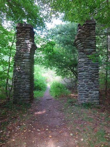 |
| Welcome to Jurassic Park. |
Last summer I purchased a Catskills guidebook and familiarized myself with the area's geology, history, and trail system. In fairness, I concentrated primarily on the two peaks of interest, Slide and Hunter. I used Garmin's Basecamp to print maps using the DEC's own trail data. Last but not least, I committed the trails and terrain to memory.
You can imagine my surprise when I reached a trail-junction that wasn't in my "mental-map". It offered two routes to Hunter's summit and my mental-map, based on DEC data, only knew the longer one. I chose to ascend the longer version (0.6 miles) and would use the shorter one for the descent (0.3 miles).
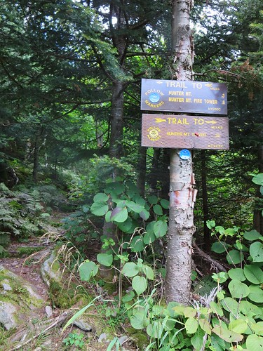 |
| Not on my "mental-map". |
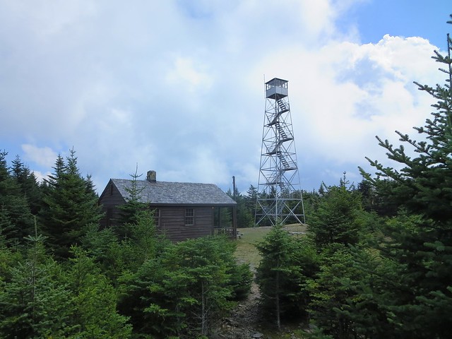 |
| Speaks of a bygone era. |
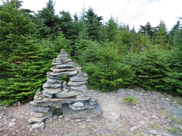 |
| A family of cairns. |
I descended to ground level and proceeded to the nearby cabin. A wall-mounted map confirmed the existence of the spur trail that was missing from my mental-map. I explored the clearing and found a curious platform and staircase with a two foot gap between them. Nearby I spotted the entrance to the spur trail (yellow disks) and began my descent. Fifty minutes later I was back at the trail-head.
I spread a large towel on the car seat and plopped my sweaty self onto it. I grabbed a sandwich out of the cooler and drove to the Slide Mountain trail-head, 28 miles away. Delays caused by road construction and an accident kept the trip interesting. At Big Indian, I turned left onto Oliveria Road and kept my eyes peeled for the trail-head. Nine miles later, I parked in the spacious shady lot. Several parked cars suggested I might meet many more hikers on this trail.
While planning my hike to Slide, I had considered a traverse of Slide, Cornell, and Wittenberg ending at the Woodland Valley Campground. However, my eleventh hour decision to go to the Catskills didn't leave time for finding partners or arranging a car shuttle. Now that I've seen the area and its trails, I'd like to return some day and hike an extended route.
The trail to Slide involved 2.7 miles and 1800 feet of ascent. Compared to Hunter via Becker Hollow, it was longer in distance but shorter in height so I estimated at least 1.5 hours of travel time. I took one look around, smiled, and began ascending the final peak of my NE111. Which, of course, is the 115th and not 111th peak!
The trail was smoother than Becker Hollow and, as expected, with a more gentle slope. Upon reaching Slide's western shoulder, the trail became broad and flat. The breadth and gentle grade made me wonder if it was ever a horse trail. I met a total of five hikers which was only two more than on Hunter. I imagine hiking on weekday had a lot to do with the sparseness.
Sixty-five minutes after leaving the trail-head, I stood on Slide's summit. A concrete block rested in the middle of the trail and it was obviously part of a fire-tower. Something in the back of mind reminded me it was Slide's true summit so I snapped a photo of myself and continued to the nearby ledge. I arrived at the ledge and, for some odd reason, doubted I was on Slide. It all seemed too easy; I was well ahead of schedule.
 |
| Ledge atop Slide. |
 |
| Burroughs plaque. |
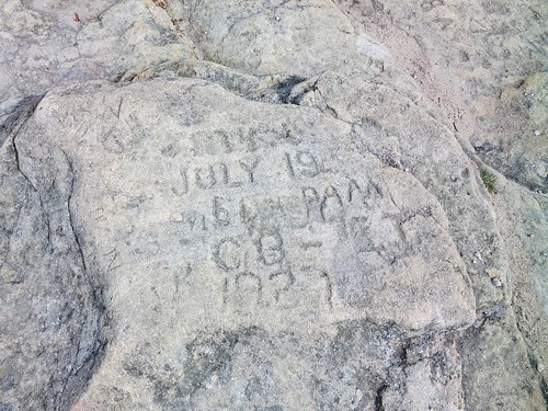 |
| Old graffiti. |
 |
| Newly minted NE111er. |
I backtracked to a lookout offering a grand view of Woodland Valley flanked by Panther, Giant Ledge and a shoulder of Wittenberg. I made quick work of the descent (45m) and was back at the car at 4:45 PM. I was delighted to have had the opportunity to visit both peaks on the same day and be able to return to Montreal at a reasonable hour.
After changing into clean clothes, I reached for another sandwich and began the long drive back home. Along the way I polished off about a quart and half of milk. I arrived at 10:20 PM and looked forward to sleeping in my own comfy bed. My wife asked "So it's done? That's it?" and I confirmed the journey was over. It was now time to move on to other things.
Photos
Hunter MountainSlide Mountain