Neil suggested we hike to the summit of Henderson from its eponymous lake rather than, the more common approach, from Bradley Pond. It would give us the opportunity to visit the lake and to explore an intriguing cliff on Henderson's eastern slope. From the summit, we could choose between returning to the lake or descending Henderson's western slope to Bradley Pond.
We left the Upper Works trail-head at 8:00 AM under a clear and sunny sky. The woods were damp and the fall foliage was at its peak. The trail-signs appeared to be relatively new and clearly spelled out destinations such as the Henderson Lake Dam, Duck Hole, and Mount Marcy.
The trail to Duck Hole was interrupted by a mirror-smooth beaver pond. We crossed it along a precariously spongy beaver dam. The bridge across Indian Pass Brook was surprisingly slippery. Its damp boards had frozen but showed no evidence of slickness until one's first step.
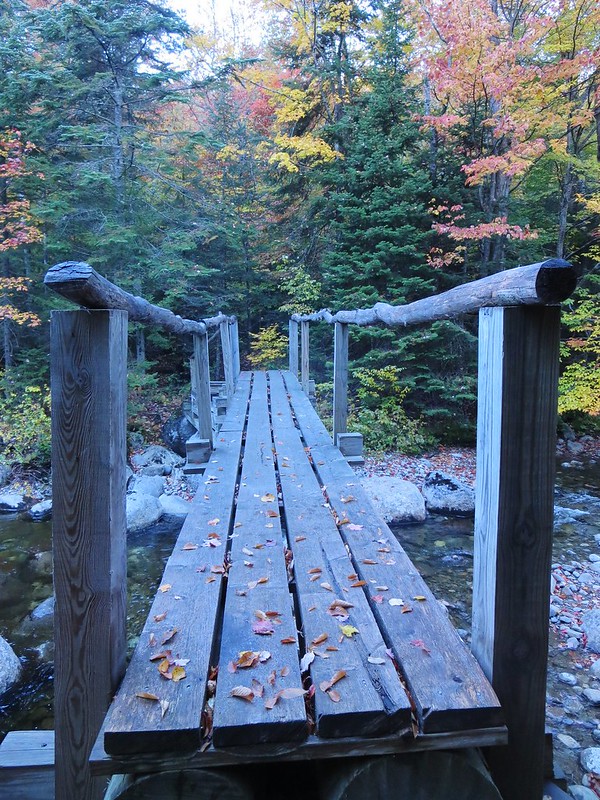 |
| Surprisingly slippery footbridge. |
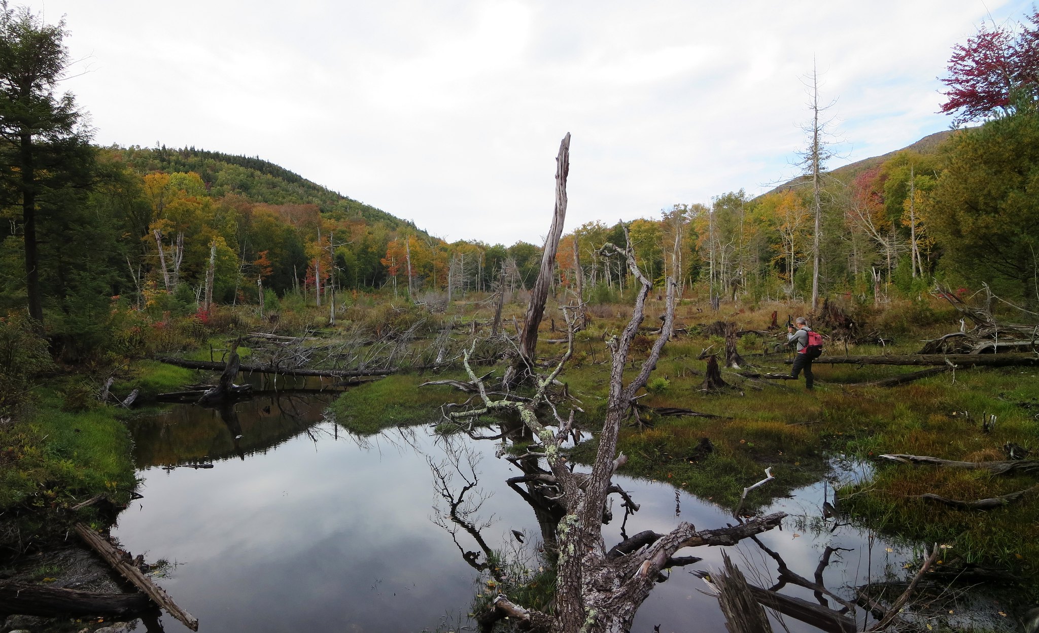
We followed the side-trail to Henderson lean-to and were impressed by its location. The lean-to itself is in excellent shape, of the "Lincoln Logs" variety, and is neat as a pin. From the lake's shore we watched the morning's mist rise against the backdrop of fiery autumn colors. Nearby is a brook and we crossed it above a small waterfall to begin our bushwhack to the cliff.
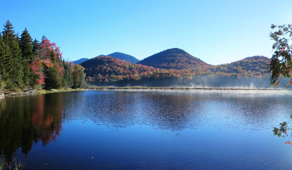 |
| Mist on Henderson Lake. |
The terrain was rumpled and caused us to ascend and descend a few times before finally smoothing out. We didn't know it at the time but we arrived slightly north-east of the cliff. Sighting a "hole in the canopy", we moved south-west and arrived at the base of the cliff.
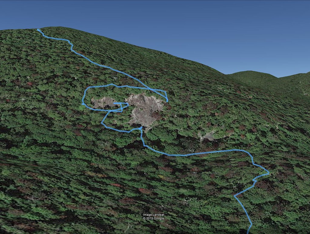 |
| Route of our exploration of the cliff. |
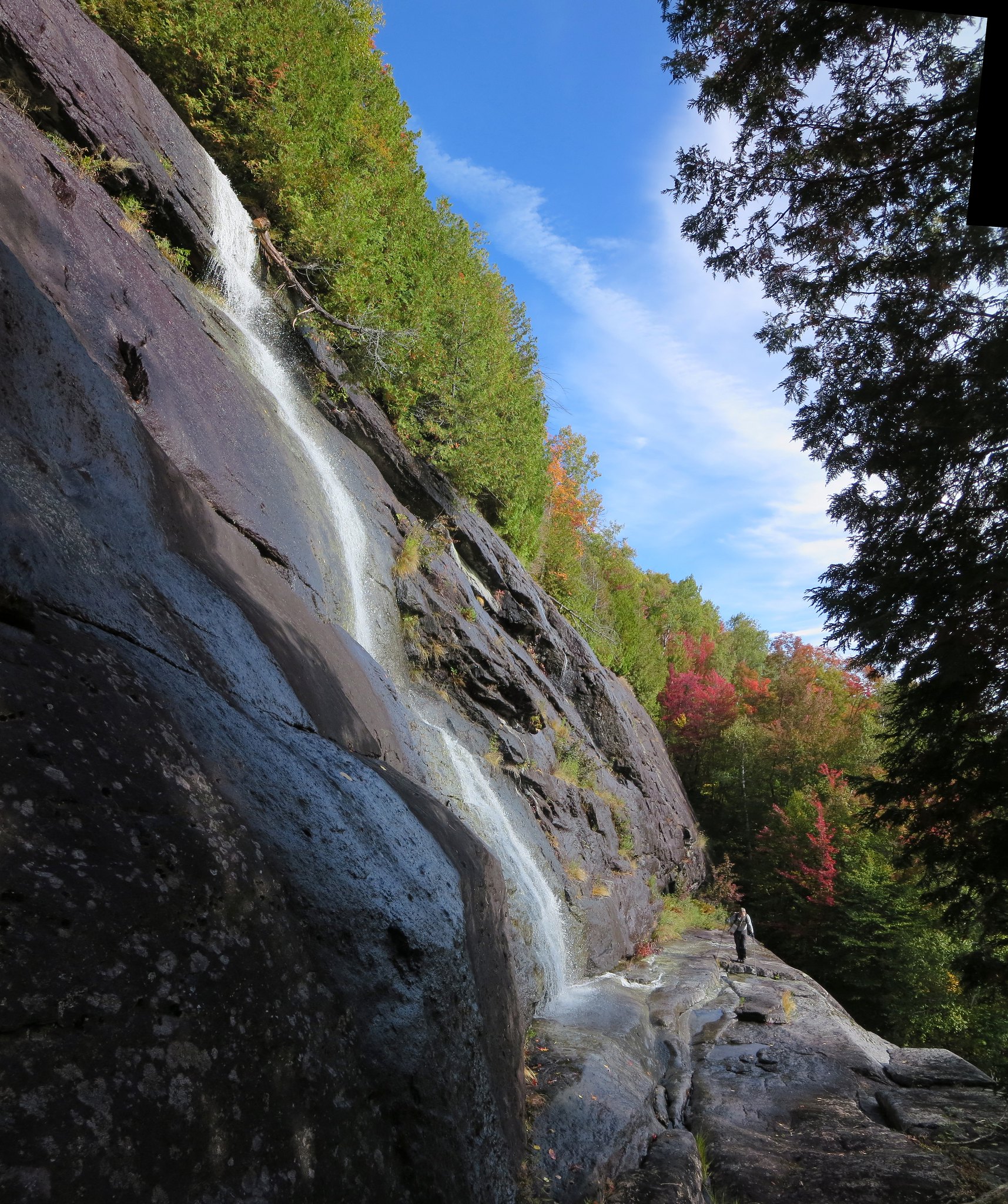
The portion we could see rose 40-50 feet to an overhang. Its otherwise smooth face was scarred by a right-leaning, class 4 ramp that beckoned to be climbed. I scrambled up high enough to concede my footwear and the wet rock made for a bad combination. I carefully down-climbed to the base and followed Neil who had started ascending the steep woods bordering the cliff's left side.
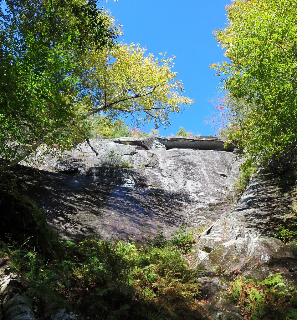 |
| Fifty-foot cliff. |
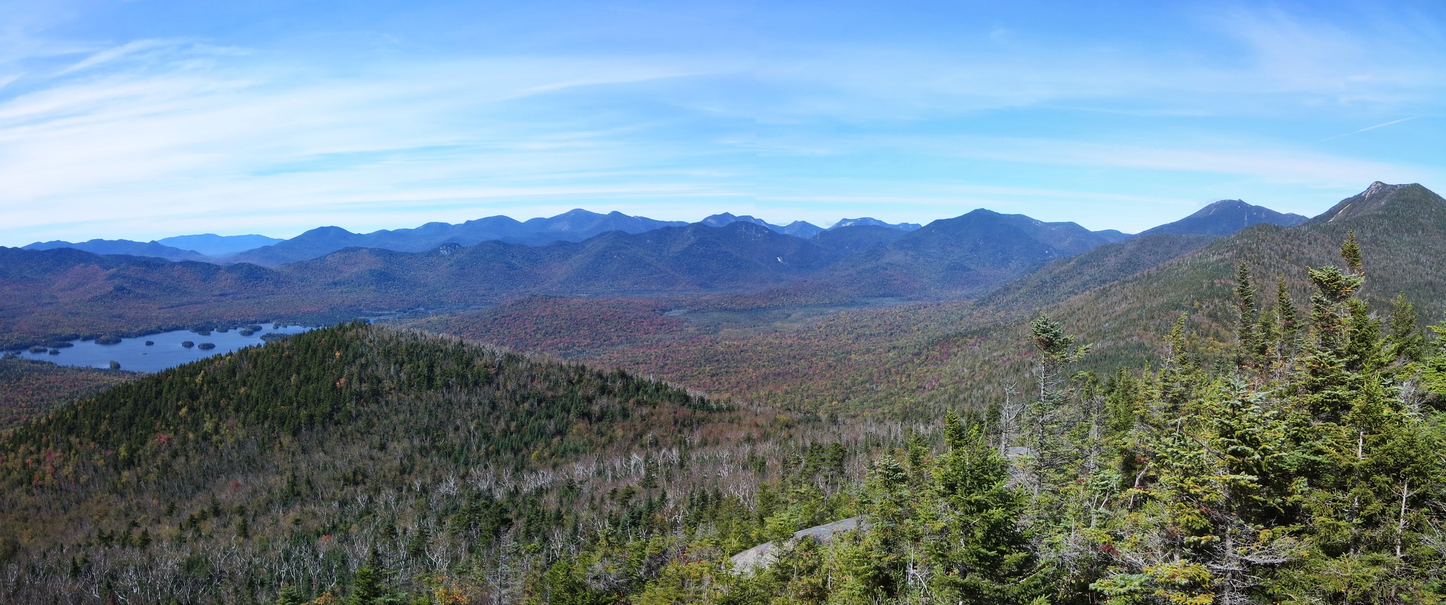
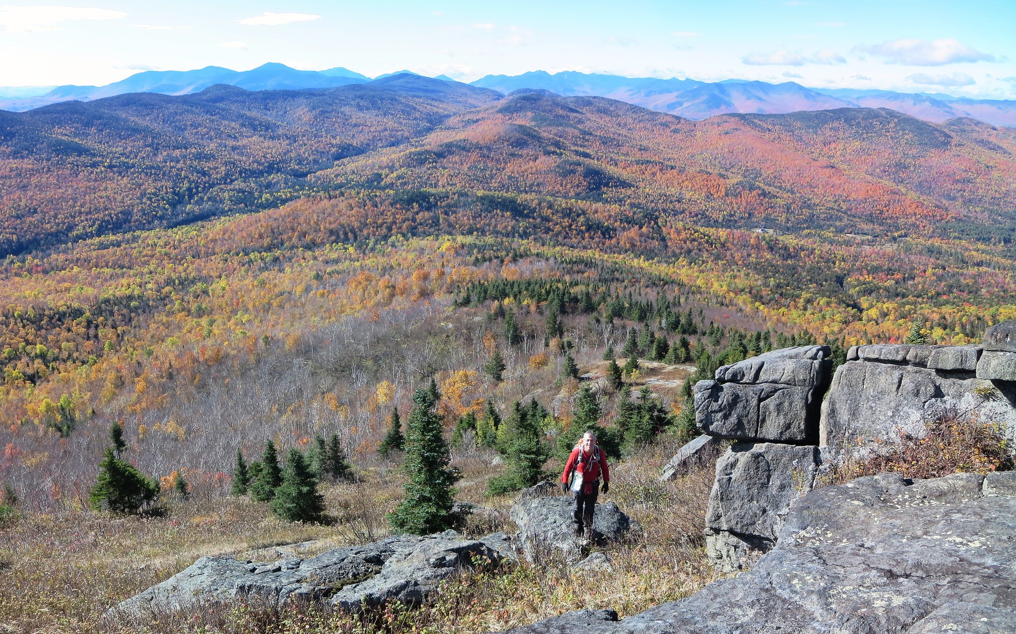
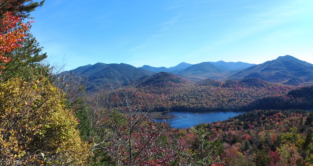
We found, but did not follow, a dicey route to the top of the overhang. We continued to ascend and found a smaller cliff with a narrow grassy shelf leading to a single bush. We stepped out onto the shelf and were rewarded with a clear view of the High Peaks and Henderson Lake. Although it was possible to traverse the cliff to rejoin the woods, we agreed it was too "exposed". We retreated the way we came, entered the woods and continued to climb.
 |
| View from cliff. |
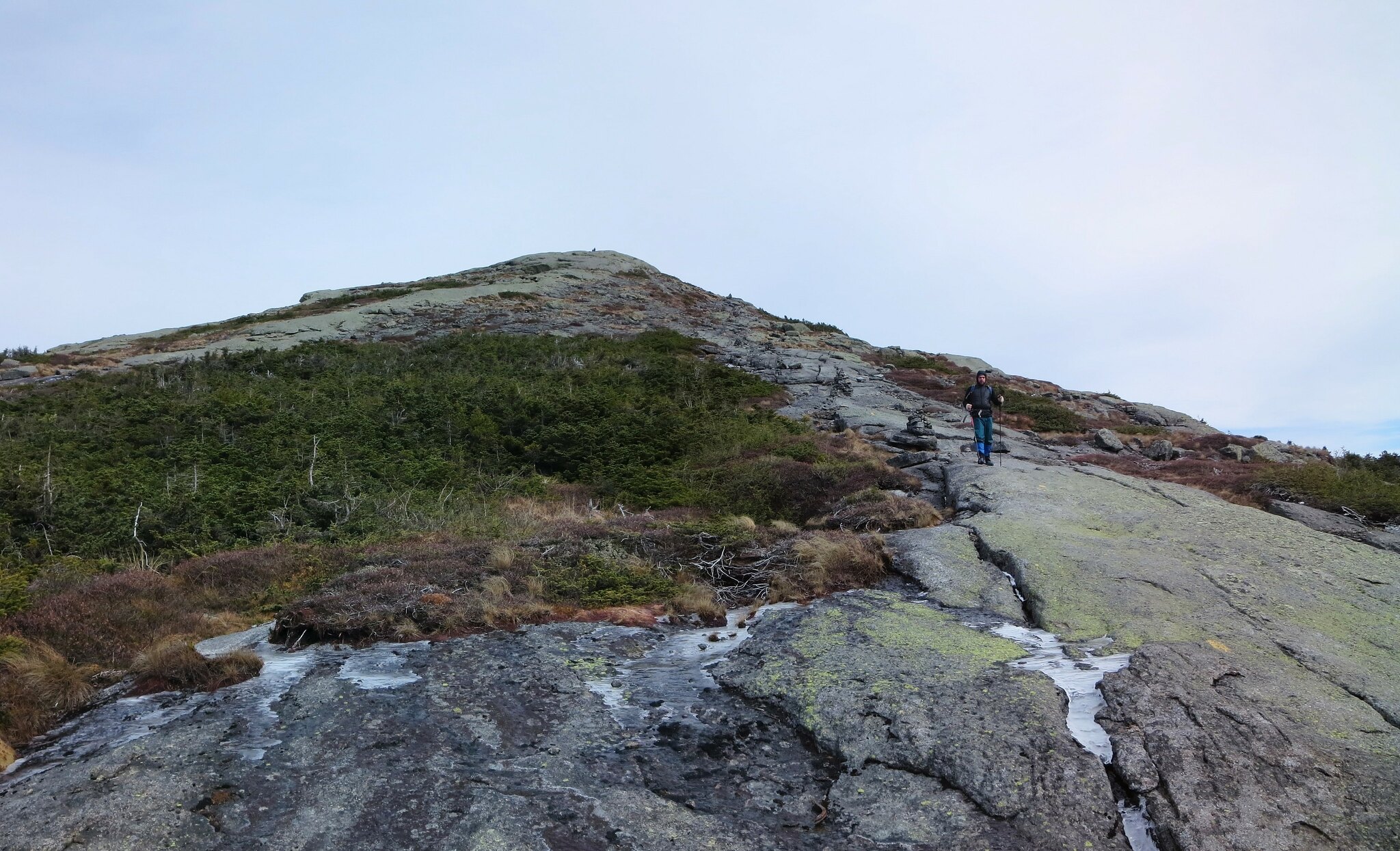
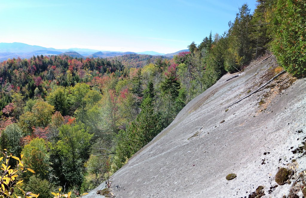
The woods bordering the top of the cliff were dense and obscured all views. We probed the margins but could not find a safe vantage point. We traversed to the right side and found a reasonably safe spot to emerge onto the slab. The view was worth the effort.
 |
| Slipping is not an option. |
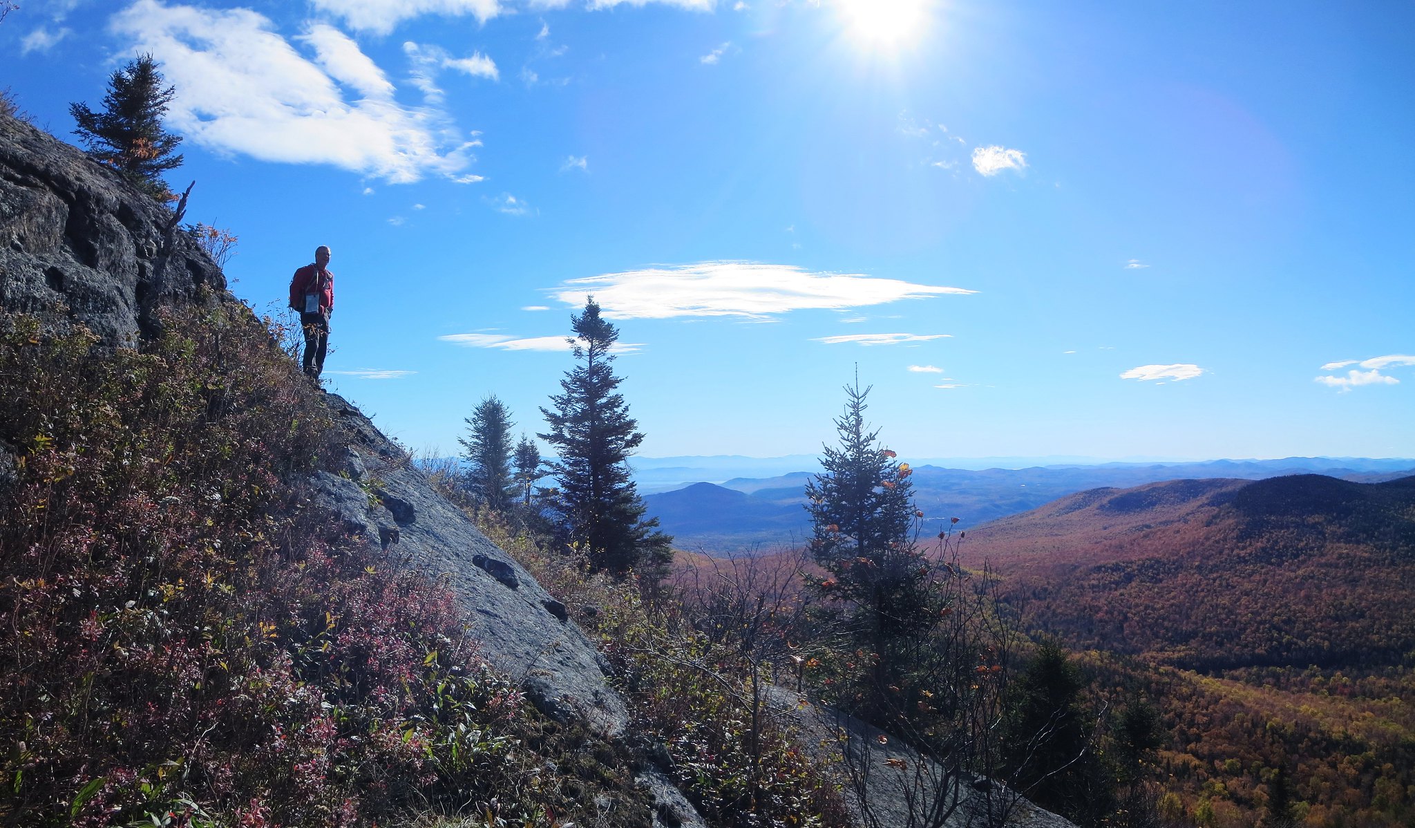
For the next leg, we ascended to ~2600 feet and were fortunate to find relatively open woods. We followed the stripe between two contour lines and marveled at our good luck. The land rose steeply to our right and dropped precipitously to our left. It was going so well that it seemed self-evident that we would return via this route rather than traverse to Bradley Pond.
We descended to an intermittent stream and then everything changed. It's normal for the woods to be denser near a source of water but they simply refused to thin out. Wherever they did it was either short-lived or due to a blowdown field. Our progress slowed to a crawl. It became increasingly difficult to flank the blowdown fields because they seemed to have no perimeter. My gnarlometer registered a new high-water mark.
While clambering over several fallen trees, I reflected on how my perception of difficulty had changed. This was my fourteenth bushwhacking trip in 2015 and what once caused trepidation now instilled stoicism. It is what it is, so just keep moving because it can't last forever (it only feels that way). Our doggedness was rewarded by excellent views of Wallface from blowdown clearings.
 |
| Wallface and McIntyre Range. |
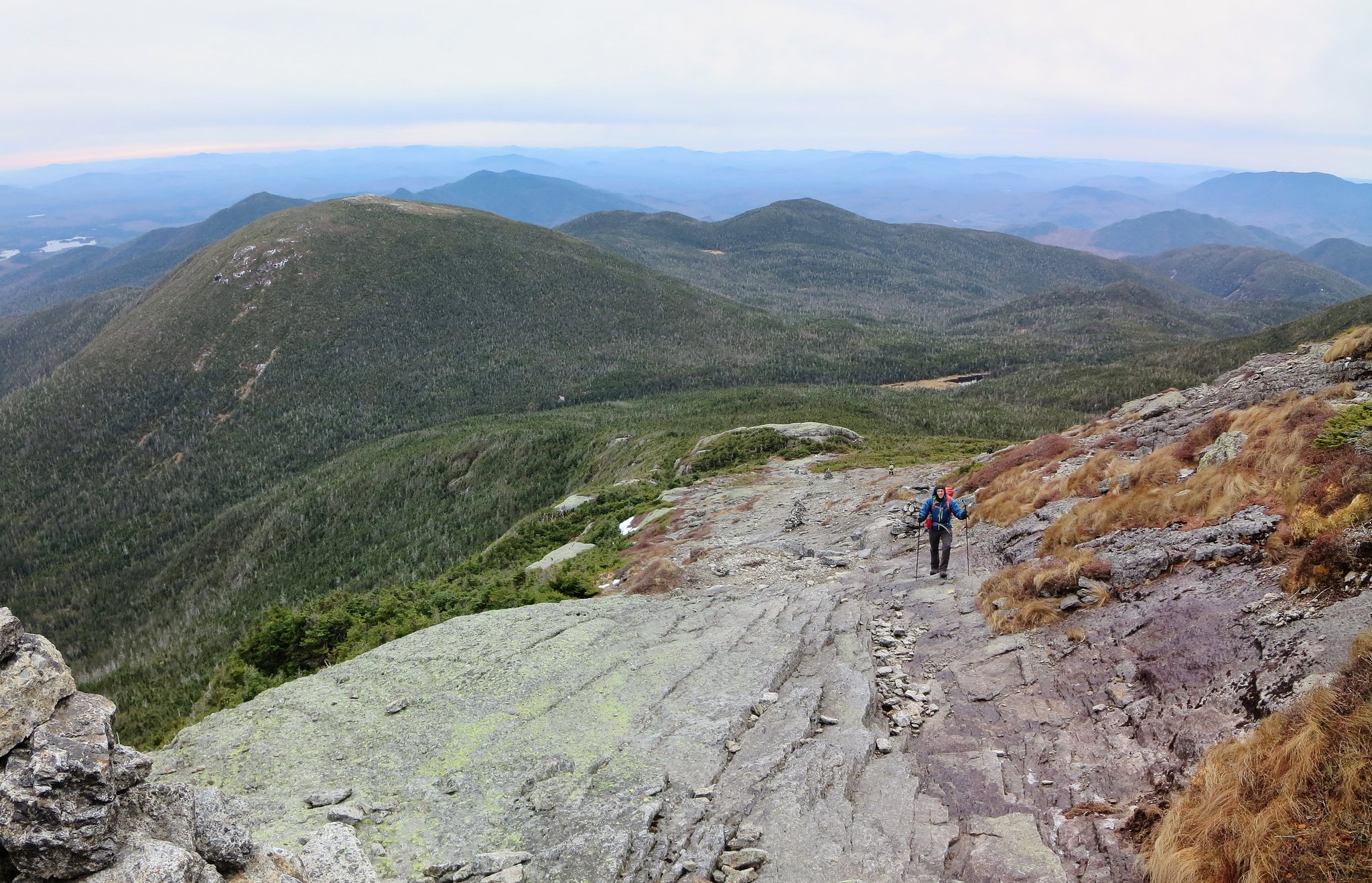
Nearing the summit, the blowdown diminished and the relief was palpable. It was clear we would not be returning the same way. It had taken us 2 hours to cover 0.6 miles and climb 1000 feet. It was a new personal record for 'least miles per hour'.
The summit offered no views. I climbed a fallen tree to get a partial view of the High Peaks. We paused briefly for a snack and then began our descent to the Santanoni lean-to (aka Bradley Pond lean-to). Our descent route was a welcome change from our ascent route. Henderson's western slope was mercifully free of blowdown. Forty-five minutes later, we intersected the marked trail slightly north of the lean-to.
 |
| Yard-sale at Santanoni lean-to. |
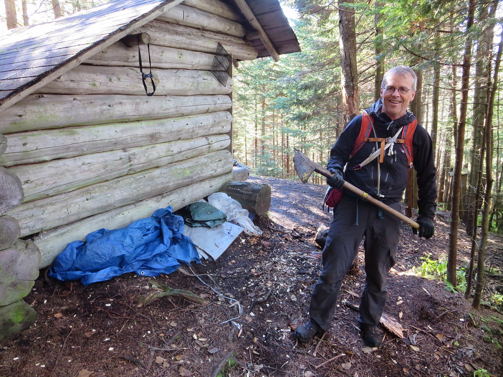
The last time I saw the Santanoni lean-to was in 1982. I have a vague recollection of having a view from the lean-to. According to the High Peaks guidebook, the lean-to was moved uphill. In 2015, there is no view but it seems like everyone is trying to re-establish one. The lean-to is surrounded by dozens of foot-tall stumps, tacit evidence of cutting live trees. This illegal activity was aided by a hand-held "Means of Destruction" hanging from a nail. Good luck finding it now.
The air of 'backcountry slum' was enhanced by a rumpled pile of tarps and discarded items like an adze and a sleeping bag. The fire-pit had the usual assortment of burnt and unburnt garbage. It was the polar opposite of the pristine Henderson lean-to.
Both of us had seen the Bradley Pond trail several times so we shifted into high gear and cleared the 4.4 miles in under 90 minutes. Along the way we found a hat and evidence of recent passage. We emerged at the Santanoni trail-head and caught up to two separate hikers preparing to leave.
Apparently the hat belonged to neither of them. However, its owner was known and we were instructed to deposit it on the "blue car". Both hikers graciously agreed to give us a lift to Upper Works and we accepted the first offer. I congratulated the younger hiker who had just completed his ADK 46 on Couchsachraga.
Back at Upper Works, we changed into clean clothes and made one sight-seeing stop at the McIntyre Iron Furnace before settling in for the 3 hour drive home. The balance of our trip was spent ogling the brilliant fall colors from the comfort of the car. Memories of Henderson's gnarly western side were already fading into the distant past.
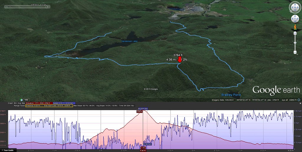 |
| 9 miles and 3300 feet. |
Photos
See all photos.