Saturday, September 19, 2015

Dix Range Loop 2015-09-19

On Saturday I joined three other hikers, Gabriel, Luis, and Sébastien, for a tour of the Dix Range. The trip was organized by Gabriel and, given that he had already hiked Dix, his goal was to hike four of the five peaks of the Dix Range. On the summit of Hough, Luis and Sébastien desired to continue and I joined them for their first ascent of Dix.

Our day began at 5:00 AM in front of Gabriel's home. We piled into his car and headed south. Somewhere past Westport, our host became sleepy so I volunteered to drive. We arrived at Clear Pond shortly after 7:30 PM and noticed cars parked in the lot. I knew this did not bode well for securing a spot at Elk Lake.  A sign confirmed my suspicion; the main lot was full. I chose to drive to the trail-head anyway on the chance a spot had opened up.

As advertised, the Elk Lake parking lot was indeed full. Two cars were parked on the shoulder and risked being ticketed (a sign makes that outcome abundantly clear). I offered to drop off everyone, return to Clear Pond to park the car, and then walk back to rejoin them at Elk Lake. My offer was unanimously accepted. I watched everyone quickly prepare for the hike especially Luis who inhaled his pasta-breakfast with inhuman speed! I left my pack with Gabriel and drove back to Clear Pond.

My 1.8 mile jog/walk back to Elk Lake was made all the more enjoyable by the cool, sunny morning plus being unencumbered by a pack. It took me 20 minutes to rejoin my awaiting hiking partners. We left the trail-head at 8:30 AM and headed north to Slide Brook lean-to.

Along the way I met the first of several people who recognized me. "Are you Taras?" and "Aren't you Trail Boss?" made Luis ask why strangers seemed to know me. I explained my participation in the ADKhighpeaks.com forum and, to a lesser extent, a personal hiking blog, had everything to with it. To all the folks I met on the trail, it was a pleasure to meet you and I hope you had a great hike in the Dix Range.

We passed the cairn marking the start of the unmarked trail to Macomb and headed directly to the nearby lean-to. The last time I had hiked the Dix Range from Elk Lake was in 2011. Since then, the lean-to has been relocated from a clearing, directly on the trail, to a few yards off-trail and in the woods. However, this was not the first thing I noticed. What stood out above all was the concentration of tents in the vicinity of the lean-to.

The place looked like a backcountry slum. I don't understand the attraction of walking two miles into the woods to camp two yards from the trail and two feet from your neighbors. The majority of tents were within spitting distance of the trail. Perhaps I didn't see the designated campsite markers but the majority of tents appeared to be in violation of the 150-foot rule. The owner of the tent parked directly in front of the lean-to must have thought it was the 150-inch rule.

Whereas the woods were full of tents, the lean-to was empty. We paused there for a moment and then made a beeline to Macomb's trail. My companions were young and fit so we made good time ascending the dry, smooth path. We emerged at the base of the slide at 9:45 AM.

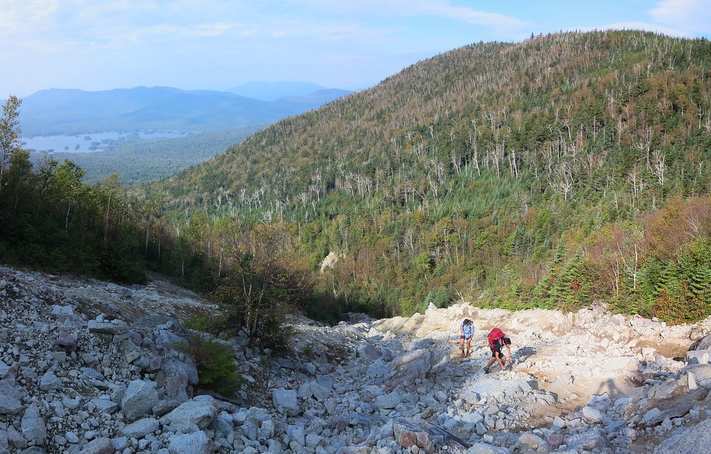
Luis and Sébastien ascend Macomb's slide.
The slide was it's usual self, a mish-mash of sand and loose rubble down low and some clean solid rock up high. There's no shortage of cairns marking what is an extremely obvious route. We split up and took whatever path piqued our interest. I chose the cleaner rock found on climber's left whereas my companions hugged the slide's right edge. We met at the erratic perched at the top of the slide where I volunteered to take photos of a young couple.

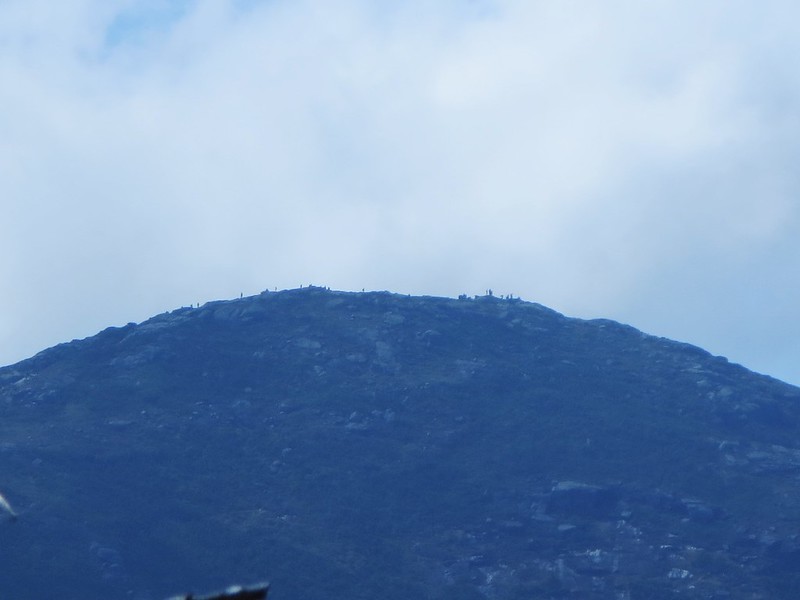
We made short work of the remaining section of trail and arrived on Macomb's summit at 10:30 AM. It was a popular destination on Saturday. It was my eighth time on Macomb and I'd never seen it so busy. The views were good albeit a bit hazy.

I apologize for forgetting her name but a delightful woman offered homemade honey cake and I was first in line. Thank you again, it was delicious! I overheard someone say Macomb's ascent was the steepest of all 46 peaks. I explained Dix from Round Pond held that honor but they pointed to pack with a 46er patch and claimed its owner would disagree. I never got to meet the pack's owner but I invite her/him to inspect this comparative study compiled by ADK 46er Trail Master, Joe Bogardus. It lists the steepest ascents to a summit over a minimum one-mile distance (there may be steeper but shorter sections to be found). Macomb is no slouch and comes in at fifth overall.
Gabriel chose to descend first, knowing we'd catch up to him. I continued to chat with other hikers while my two companions took their fill of views and photos. We spent no more than ten minutes on the summit and then proceeded to rejoin Gabriel. Luis and I proceeded at a spirited pace, passed Gabriel, and didn't stop until we reached the col. I indicated we should wait for the other half of our team to arrive because we were at a junction (southern arm of the Lillian Brook trail).

Ascending South Dix.
I looked forward to ascending the open rock of South Dix's western face. I much prefer it to the viewless "green tunnel" between South Dix and Grace. I paused to chat with an ex-Marine while my partners continued to the summit. The fellow said his training was tough but there's something about hiking that can take the wind out of your sails.

I rejoined the gang waiting for me on South Dix and we proceeded to Grace. Luis set the pace and his feet left a trail of fire! It was a challenge to keep up with him. We paused at the junction (trail to Boquet valley) to await our companions and ensure they did not make a wrong turn.

We had Grace's summit to ourselves for a few minutes before being joined by the VP of the ADK 46ers, her husband, and their 14 month-old daughter. The little one has been to over 30 peaks but, as her mom conceded, none of them count. Nevertheless, she was well on her way to "46er-by-proxy" status (riding in a child-carrier on her father's back).
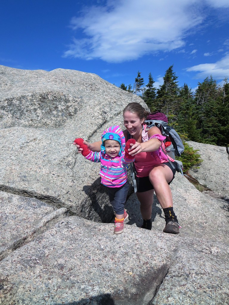
Aspiring 46er!
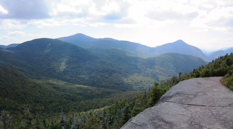
The hikers we had passed earlier started to arrive and the summit developed a party atmosphere. Seeking a quieter, and more scenic, spot for our lunch, we continued past the summit to the top of the Great Slide. There we found a quiet spot to snack and enjoy the spectacular view of Hough and Dix. We spent 45 minutes lounging in the sun and then packed up to return to South Dix.

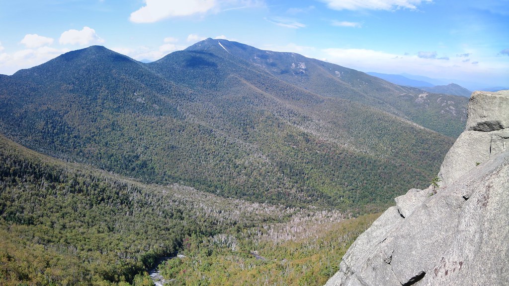
Hough and Dix from the top of the Great Slide.
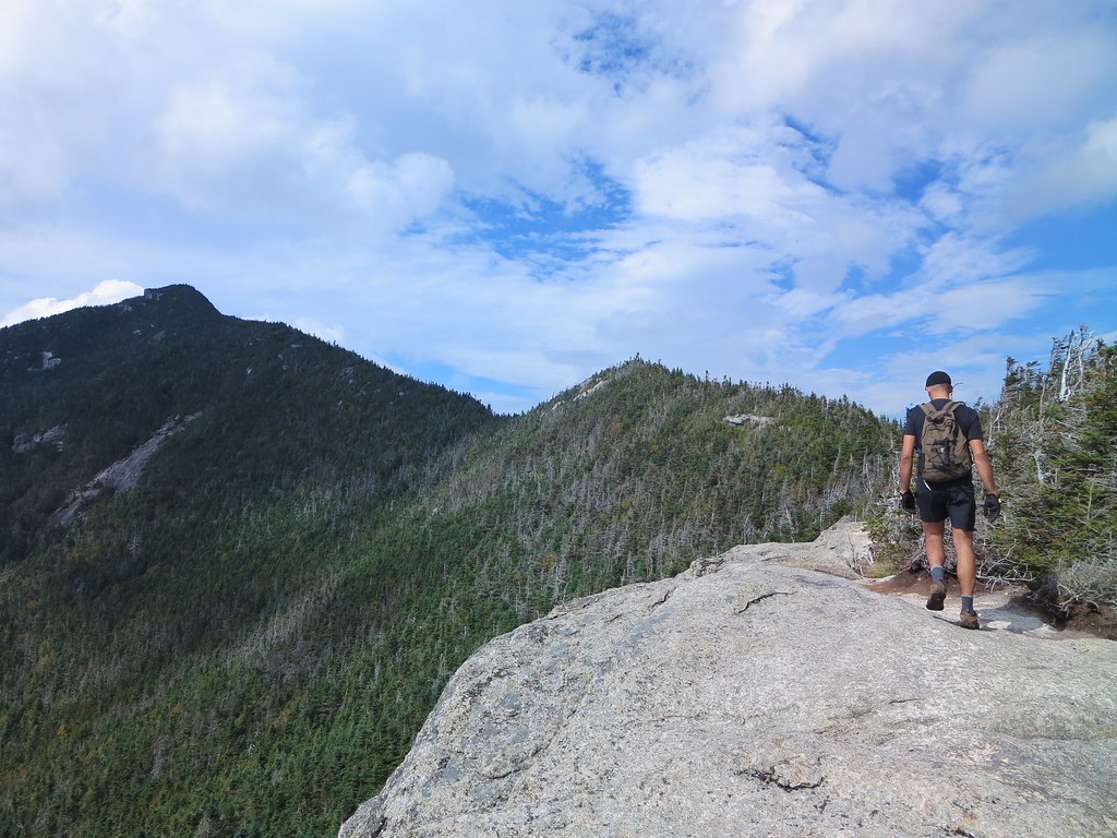
I set a steady pace with Luis and we cleared the green tunnel in 30 minutes. We waited at the junction for our team mates to catch up. I pointed to a ledge on Hough and explained it offered excellent views and we would be there before long. Luis and Sébastien took the lead, eager to set a faster pace.

We quickly traversed Pough and then paused at the base of Hough to allow everyone to catch up. Sébastien took the lead with Luis at his heels and maintained a brisk pace up Hough. I caught up with them at the ledge where Sébastien had taken the bypass route (left past the ledge) and Luis and Gabriel scaled the rock. Other hikers paused here as well to look back at the route they had taken from Macomb and Grace.
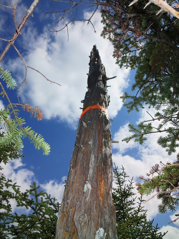
Wind-pruned tree.
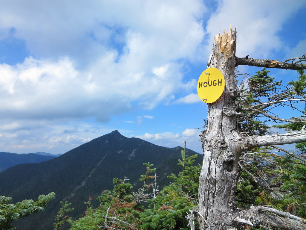
Forty-five minutes after departing South Dix, we stood on the summit of Hough. The brisk wind was very welcome if not a little bracing. After a few photos, we moved out of the wind and discussed our next step. The two aspiring 46ers looked longingly at the Beckhorn. Gabriel declared, as per his original plan, Hough was his final peak of the day. He had been to Dix on a previous trip and felt today's hike was sufficient exercise for him. I explained the next leg to Dix would take add at least two hours to our trip; one hour to Dix plus another hour to descend the Beckhorn trail. Gabriel still needed to return to Clear Pond to retrieve his car so, time-wise, it could balance out nicely.

After considering our options, Gabriel encouraged Sébastien and Luis to continue to Dix and I agreed to join them. We wished Gabriel well and assured him we would do our best to avoid having him wait too long. I took the lead down to the col where Sébastien took over and charged up the slope.

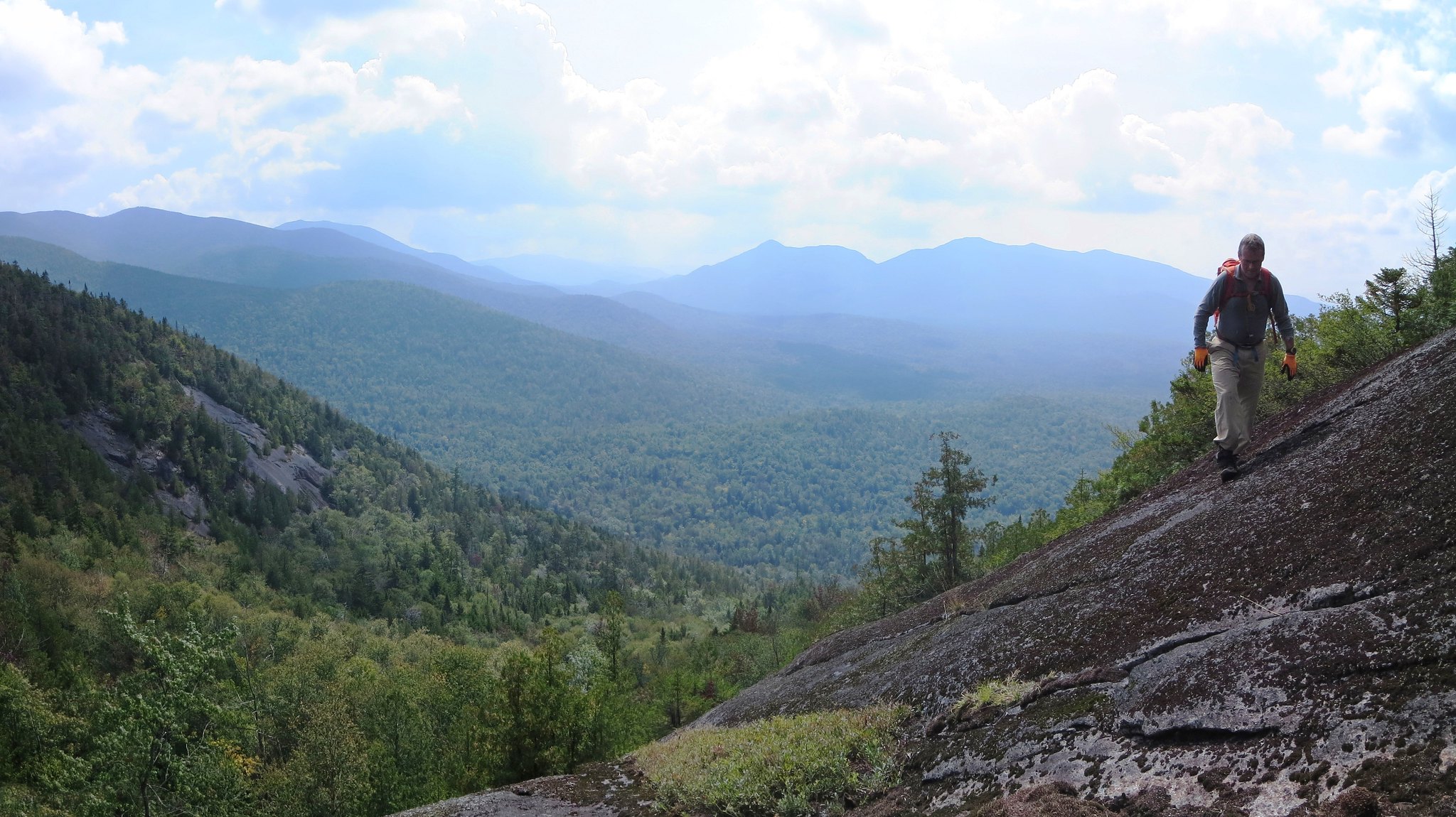
Passing a lookout along the route to Dix.
I had explained that this route to Dix was my favorite. It follows a narrow shoulder to the Beckhorn and features at least three lookouts offering views of one's progress along the ridge. Sébastien's pace didn't leave much time for sightseeing. Luis and I fell back slightly and didn't see him until the base of the trough where he was scouting a bypass route. I pointed to the trough and said it was the usual way up. We scrambled up and, a few moments later, emerged on the windy summit of the Beckhorn.

After briefly pointing out our eventual descent route, down the Beckhorn trail, we pressed on to Dix. Fifty minutes after leaving Hough's summit, we stood astride Dix's summit bolt. I congratulated them for their accomplishment. We had the summit to ourselves and settled in for a fifteen minute break. Dark clouds had rolled in and reminded me of the chance of late-afternoon showers. A wet Beckhorn trail would slow us down so we didn't overstay our welcome.


The A-Team strikes a pose.
We returned to the Beckhorn and began the steep descent along its open rock. We paused at the ledge because it's such a cool feature! The last time I had been on the Beckhorn trail was over 30 years ago so I didn't remember much about it aside from it being steep.
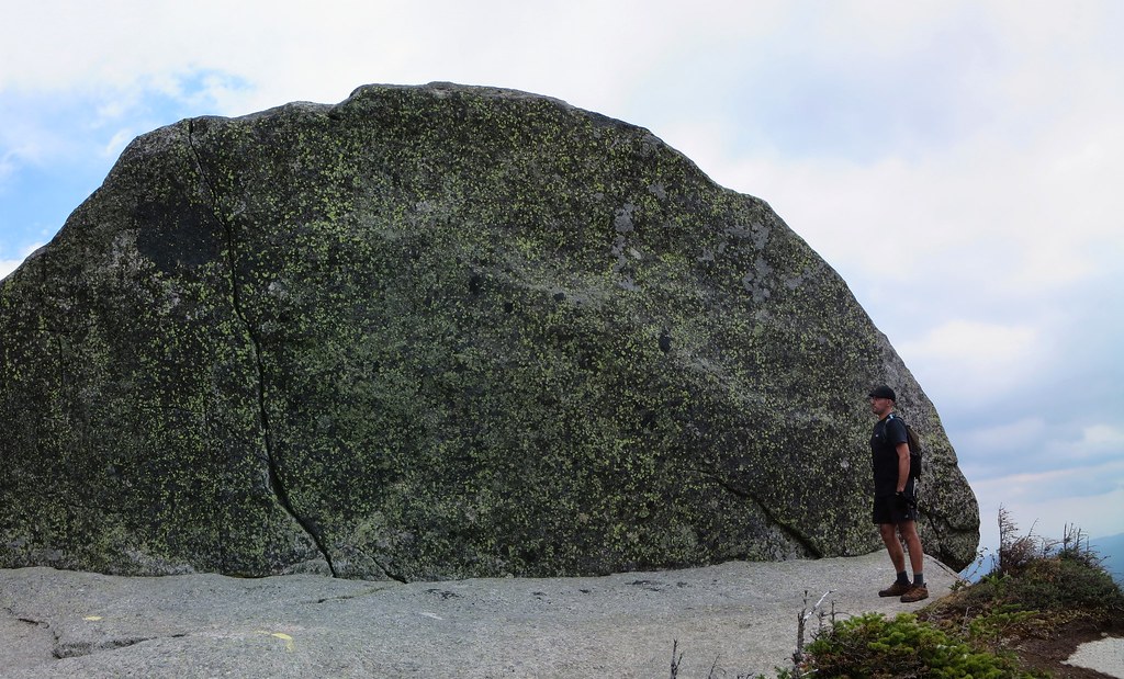

Beckhorn's ledge.
I took the lead scrambling down the trail. I think the north side of Seward is a good deal rougher than the Beckhorn. Nevertheless, there's plenty to keep one's hands and feet busy during the initial descent. Eventually it moderates and becomes a seemingly endlessly loss of elevation (2750 feet).

The dull pain in my knees was occasionally punctuated by a sharper sting along the outside of the right one. I paused twice to massage the area and shake my leg to work it out. I checked my watch and knew I shouldn't expect to see the junction until one hour had passed. I had lost sight of my companions who were somewhere behind me. Undoubtedly they too were coping with grumbling legs.

Steep section of the Beckhorn trail.

Fifty-five minutes after departing the Beckhorn, the junction appeared. A few minutes later Luis arrived and then Sébastien. Everyone agreed the descent had taken a toll on their legs. However, we succeeded in covering it in an hour and could now look forward to four comparatively easy miles. Although not without a bit more elevation gain of course!

Somewhere past Dix Pond, Luis reported he had run out of water. I assured him we weren't far from Lillian Brook where we'd take a short break. I pressed ahead, arrived at the brook first and setup my water filter just in time for Luis's arrival. After we topped up our supplies, I took a few minutes to soak my feet in the cold brook and put on dry socks. Sorry Coca-Cola but this was the real "pause that refreshes"! We consumed whatever snacks we had left and then hurried south to the trail-head. We closed the loop at Slide Brook and now had only two miles of easy trail to cover.

We arrived at Elk Lake at 6:00 PM and met Gabriel resting in his car. He said he had only waited 25 minutes so we felt good that our peak-bagging excursion had not been an excessive inconvenience. After cleaning up, we stuffed the trunk with our gear, which seemed to have expanded since the morning, and then talked all the way back to Montreal. We all had a fantastic day in the mountains and look forward to our next trip.

Photos

See all photos.

Stats

08:30 AM Elk Lake
10:30 AM Macomb
10:40 AM Macomb - Depart
11:15 AM South Dix
11:46 AM Grace
12:30 AM Grace - Depart
01:00 PM South Dix
01:46 PM Hough
01:55 PM Hough - Depart
02:45 PM Dix
03:00 PM Dix - Depart
03:55 PM Beckhorn Trail Junction
04:15 PM Lillian Brook
04:30 PM Lillian Brook - Depart
06:00 PM Elk Lake

Saturday, September 12, 2015

Marcy Dam Trail Work 2015-09-12

On Saturday I volunteered for ADK 46er trail-work. I got a ride to Adirondack Loj with a MOAC group headed for Iroquois and Algonquin. We arrived at 9:20 AM which was late enough to require parking near South Meadows road. After establishing a rendezvous time of 7:00 PM with Badri, the organizer, I wished everyone a great hike and disappeared down the road.

Fifty minutes later, I emerged at Marcy Dam and began looking for tool-wielding 46ers. They had arrived well before me and were busy working on several projects. I learned Joe was a half-mile up the trail, somewhere near the Kagel lean-to. I recognized Mike milling around near the dam and introduced myself. He was waiting for Katey who would assign us our next task.

A few years ago, Marcy Brook washed away a section of the trail leading to Avalanche Pass. The trail was re-routed away from the brook. However, whenever the brook jumps its banks, at a sharp westward bend, water runs directly down the old trail and floods the new one. Katey showed us where to build a retaining wall in order to block the entrance of the old trail.


John, Mike, Bill, and Gary haul a large stone to form the base of the retaining wall.
The job required hauling stones from the nearby brook and stacking them to create a dam. The heaviest stones, weighing in at 200+ pounds, would form the base. We carried each stone in a nylon "diaper" suspended between two sturdy iron bars held by four people. The technique made us look like stretcher-bearers.


The stone heads for the unreinforced stream bank visible in the background.
Three rows, of the largest stones we could carry, formed the base of the retaining wall. The brook and the steep muddy bank made footing treacherous. The danger of twisting ankles or crushing toes was very evident. By task's end, we emerged with nothing worse than tired muscles and wet footwear. The same could not be said for the "diaper". It developed many small tears which eventually became one gaping hole that rendered it useless.


John tips the stone in place to form another row.
After completing the retaining wall, we proceeded to reinforce the earthen bank with stones to prevent the brook from undermining the wall. With the diaper out of commission, we hand-carried thirty-pounders and then lobbed 5-10 pounders across the brook. Given an ample supply of nearby rocks, we made good progress creating a stony shield. By mid-afternoon, our work was done and Joe complimented our handiwork. We estimated that we had moved close to 3 tons of rock to create our masterpiece.

Done! The stream bank is now reinforced to protect the retaining wall.
We gathered our tools and returned to store them at the DEC Interior Station at Marcy Dam. There we saw the results of another project, the construction of new "thunder-boxes". Built of recycled 2-inch thick planks, volunteer 46rs will carry these sturdy toilets to nearby lean-tos.


Autographed, limited-edition "thunder-box".
Upon departing Marcy Dam, the predicted rain arrived. It began as a light shower but we stayed dry walking under the forest canopy. Whereas we were lightly dressed, and outbound, the crowds of inbound backpackers seemed "post apocalyptic". Burdened by enormous packs and clad in full raingear, they appeared to be escaping from some devastated place. Unfortunately, they had it all backwards because the impending torrential downpour would soon make the backcountry a sodden mess.

We arrived at the parking lot shortly after 3:00 PM and said our good-byes in the intensifying rain. Joe handed out beverages and I took two bottles to tide me over the 3-4 hour wait for the arrival of the MOAC group. I joined the growing number of soggy hikers seeking refuge in the HPIC building. I chose a good people-watching vantage point, reached into my pack for a towel and dry shirt, and then settled in for the balance of the afternoon. Shortly thereafter the rain fell hard and fast.

There was an endless queue for the showers and bathrooms. The line up for the female john became so hopeless that several desperate women invaded the men's toilet. After the crowd thinned, I found an empty shower stall to change into dry pants. The last step was to buy a steaming cup of hot cocoa. Dry and warm, I could now comfortably sit and watch the droves of wet hikers seeking shelter from the downpour.

Mike reappeared and kept me company until 5:00 PM. A woman introduced herself as Celine and asked if I had finished a 46er round atop Dix and had handed out drinks to everyone. Indeed I had completed my first winter 46er round on Dix and I offered single-malt to willing celebrants. I met Celine and her father on Dix's summit and we had toasted to the occasion. She said her father was doing well and he had also finished his winter round. I extended my congratulations to him and to her young daughter who, despite the dreary weather, was ebullient.

Shortly after 6:00 PM, Gabriel appeared and indicated the balance of the group was not far behind. Over the course of the next hour, the group reassembled and was in good spirits. They had ascended the Boundary trail, skipped Iroquois and hiked over Algonquin when the rain caught up with them. The descent was slippery but everyone exited without incident. It was now after 7:00 PM, the rain had restarted and it was getting dark. Several hikers had commitments the following day so a group meal was nixed in favor of returning to Montreal ASAP. We said our goodbyes and settled in for the rainy ride home.

Photos

See all photos.

Saturday, September 5, 2015

Tabletop, TR, and Phelps. 2015-09-05

On Saturday, I joined a trip to Tabletop organized by the Montreal Outdoor Adventure Club (MOAC). Dan, the organizer, was kind enough to allow me to "do my own thing" so I added TR and Phelps to the mix. It was a profitable "List Fulfilment" day because it added:
  • One peak to my 7th round of the ADK 46.
  • Two peaks to my September ADK 46 Grid.
  • One peak to my ADK Hundred Highest.
Naturally it was also an opportunity to get some exercise, breathe fresh air, and socialize with MOAC members.

On any other sunny weekend, a 6:00 AM departure from Montreal would mean arriving at ADK Loj around 8:30 AM and possibly finding a parking spot. On a sunny Labor Day weekend, 8:30 AM was most certainly too late to secure a spot and we arrived shortly after 9:00 AM. The numerous cars lining Adirondack Loj road indicated it was fruitless to continue to the Loj. Gary, our driver, immediately parked along South Meadows Road.

While Dan shepherded his flock of twelve, I bid everyone a great hike and headed towards the Loj. Instead of the one-mile road-walk, I opted to duck into the woods and follow the Northwoods and Easyside trails. It's a touch longer but far more pleasant than pounding pavement. Fifteen minutes later, I emerged in the parking lot and observed throngs of hikers milling about. I signed in at 9:45 AM, a fairly late start, and took my place in the conga line to Marcy Dam.

After passing several hikers, I caught up to an elderly gentleman who was shuffling slowly down the trail. I noticed a well-worn ADK 46er patch on his pack and stopped to talk to him and his wife. Without revealing anyone's identity, his 46er number was in the low 2000's and he finished in the mid-80's. They were heading to Marcy Dam for the day. After a brief chat, I wished them well and continued towards Marcy Dam.

Dan and I agreed to meet at the Loj at 4:30 PM. Although I had ample time, I made a point of maintaining a good pace because I didn't know how much time I'd need for TR (Theodore Roosevelt).

The ascent to the Tabletop junction was uneventful except for meeting Christian and his group. Also from MOAC, he led a tiny group (4), in the wee hours of the morning, to watch sunrise from Marcy's summit. He reported they had perfect viewing conditions and everyone thoroughly enjoyed the experience.

I arrived at the Tabletop junction at 11:00 AM and noticed the signage had been improved. The climb to Tabletop took a half-hour and along the way I met several descending hikers that I'd see later in the day. Many people had Tabletop and Phelps in their sights. Seeing one young couple, I quipped they must be seeking 46er status because why else would someone choose Tabletop on such a beautiful day? Indeed, they were aspiring 46ers.

Tabletop's summit sign may soon be in need of replacement because the editing of its name has progressed from "ABLETOP" to "ABLETO". My time on Tabletop was brief; just enough to down a handful of dates and appreciate the partially obscured view of Basin, Haystack and Marcy. An over-zoomed view of Marcy revealed hikers like so many little "hairs" on its bald summit.

Marcy's populated summit.
The descent to the junction was quick. I continued to Indian Falls to take in its iconic view of the McIntyres. Upon my return to the junction, I met the twelve stalwart MOAC hikers preparing for their ascent to Tabletop. Everyone was in good spirits and looking forward to the challenge. I wished them well and turned down the trail to begin my bushwhack to TR.

Iconic view from Indian Falls.
I read there's a herd-path to TR but didn't see evidence of it, or a cairn, during my ascent to the Tabletop junction. I set my compass and plunged into the woods. I started a little too close to the junction so the first step was to descend to the Tabletop-TR col. Hearing voices to my right, I realized I was simply paralleling the Van Hoevenberg trail. I rejoined the trail for speed, descended to a flat section, and then ducked back into the woods .

The bulk of TR's eastern face lay directly ahead of me so it was simply a matter of following the "Law of Up". The woods became messy and made "up" a bit slower than anticipated. Wearing T-shirt and shorts resulted in the expected pokes and scratches. Eventually I found a herd-path and was able to pick up the pace. The path faded in and out, mostly due to blowdown, but I was able to follow it to TR's summit.

Summit of TR.
Except for flagging, and a "TR" carved into a tree, the small clearing was featureless (and viewless). Backtracking along the herd-path proved to be more challenging and I lost and regained it several times before losing it altogether. Navigation was a given; head east and down. I emerged on the trail a mere twenty feet from where I had started. The entire venture took less than a half-hour and cost me one laser-printed map which had worked its way out of my pocket. Two down, one to go.

The climb up Phelps was punctuated by:
  • Meeting others I had seen earlier.
  • Running out of water.
  • Being overheated.
The ascent took forty-five minutes, and a handful of Skittles, but resulted in the best summit views of the day.

Hazy view from Phelps.
Initially I felt a bit run-down but was renewed after pausing on the summit to chat with a father and son. I left Phelps at 2:00 PM and was back at the junction a half-hour later. I had a powerful thirst and made a beeline down the Van Hoevenberg trail to the Phelps Brook crossing. Along the way I recognized the tall fellow ahead of me. I caught up to "BillB" and we shared the details of our day. We parted ways at Phelps Brook where I stopped to filter and guzzle over a liter of water to wash away the Sahara in my mouth.

Now that my blood was liquid again, I rediscovered a spring in my step and began passing the folks I had met descending Phelps. It was like a scene from the Truman Show. There weren't many people in the High Peaks, just a small crowd of familiar faces that moved around a lot!

I rock-hopped Marcy Brook at the base of the dam and eventually caught up to "BillB" again. We couldn't help but notice the stream of backpackers and campers heading to Marcy Dam. Several carried their bear canisters tucked under their arm. I wondered how many times the canisters would change from one tired arm to another before reaching their destination. Perhaps they discovered, upon their arrival at Adirondack Loj, a canister was mandatory and they had no means to attach it to their pack. Others hand-carried plastic supermarket bags filled with who-knows-what, sleeping bags, and gallon jugs of water. Ouch!

We arrived at the trail-head shortly after 3:30 PM. We parted company a second time and I headed to the HPIC's porch to seat my sweaty-self down. I overlooked to check Dan's logbook so I sauntered back to the trail-register. I found his entry and he had not checked out yet. I added a note indicating I was waiting at the HPIC.

I had time to kill so I relaxed and began to people-watch. A father and son team recognized me and we struck up a conversation. I congratulated his son who had just completed his ADK 46 on Marcy (and is also a lurker on the ADKHighPeaks forum). Another forum member also recognized me and we chatted briefly (forgive me but I cannot recall your name). Someone was interviewing hikers on the subject of environmental awareness and I eavesdropped on their responses. "MtnManJohn" appeared and we commiserated on how the heat was a drag on the day's performance.

Shortly after the appointed rendezvous time of 4:30 PM, I returned to the trail-register. I spent time helping others locate their name in the logbook. There were many pages of entries and finding one's own was tedious. I asked when they had set out and marked the time in the top margin. Eventually there were enough times marked to simplify the process of locating one's entry. I wandered back to the HPIC and listened in on a few more survey interviews. Eventually, I chatted with the interviewer about the nature of some of the questions, notably on "foraging".

By 5:30 PM, I became concerned there may have been a grave miscommunication. Perhaps they overlooked to sign out and were waiting at South Meadows for over an hour. I returned to the trail-register and changed my note to "Waited 2 hours. Went back to car." I paused momentarily at the HPIC and heard someone call my name. Gabriel was seated and explained he was the first to arrive and the others were not far behind. Talk about lucky timing! Within a few minutes Dan and the gang streamed across the lot. All's well that end's well.

I convinced Gary, Marisa, and Gabriel to return via the Easyside trail and, before long, we were back at South Meadows. The group reconvened at Cascade Lakes for a refreshing swim. The final stop was Stewart's for tasty calories and great conversation.

Stats

Loj to Loj: 12 miles, ~4700 feet, 5h 50m.

Photos

See all photos.

Thursday, September 3, 2015