Standing at 3980 feet tall, Green is the 48th highest peak in the Adirondacks. It lies 1.5 miles north of the ever-popular Giant Mountain and no trails lead to its wooded summit. A very popular route to Green is from the south and involves about five miles of trail-walking, along the North Trail, followed by a steep, half-mile bushwhack ascent. Of the many ways to ascend Green, the one that appealed to me most was from the east. Departing the North Trail near Owl Head Lookout, one follows Green's ridge to its summit.
Neil suggested we up the ante and approach Green from the
distant east. Our bushwhack route would start from highway 9 and proceed six miles over Iron Mountain, Owl Head Lookout, and along Green's ridge to its summit. Our return route would descend to the North Trail and follow it out to 9N. The proposed itinerary was more challenging than the "trade route". However, satellite imagery showed exposed outcrops and slides along the way so the payback would be scenic views. I was instantly sold on the idea.
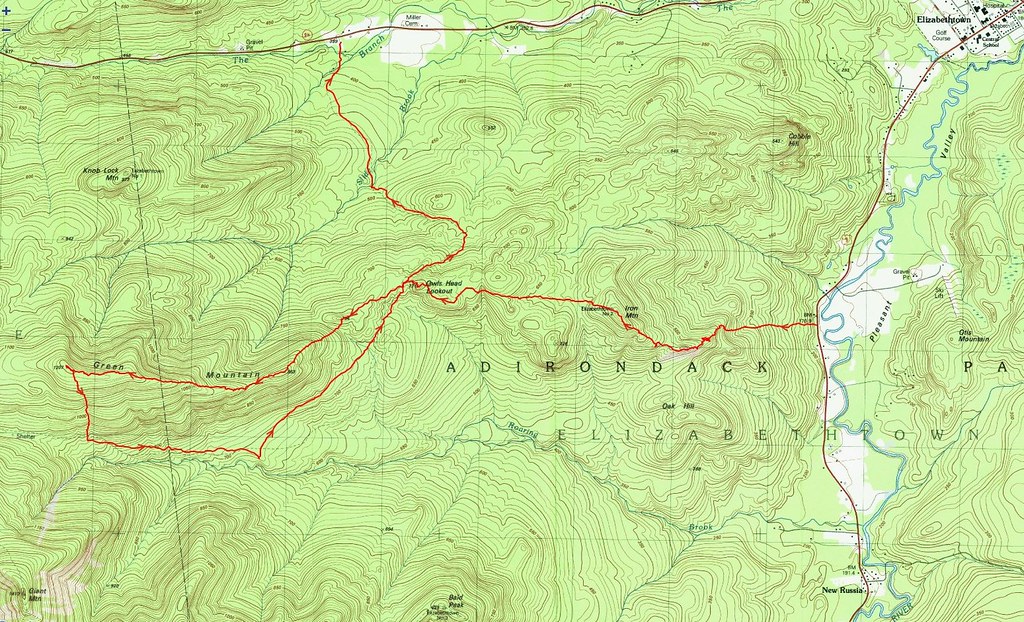 |
| Our route from 9 to Iron, Owl Head, Green, and 9N. |
 |
| Aerial view. |
Expecting a long hike, we left Montreal at 5:00 AM and arrived at Tom Haskins' home two hours later. Many thanks to Tom for agreeing to shuttle us from one trail-head to the other. We parked my car at the Owl Head trail-head, on route 9N, and then Tom drove us to a pull-off on the west side of route 9 about 2 miles south of Elizabethtown. Based on information gleaned from the DEC's
State Land Interactive Mapper (SLIM), we selected this point because it provides legal access to Iron Mountain. A great deal of the land lying east of Iron is private and only one section borders the highway.
At 7:45 AM we bid Tom goodbye and immediately began ascending the steep embankment. After climbing about 150 feet, we were surprised to intersect an old road. We continued our ascent and crossed, re-crossed, and followed the road until it no longer coincided with our desired trajectory. The woods were surprisingly free of underbrush and, with a thick carpet of fallen leaves, made for very easy travel; there was no "bushwhacking" involved.
 |
| Hemlock Varnish Shelf (Ganoderma tsugae) |
After a half-mile of park-like conditions, we breached a broad, grassy cliff and turned slightly southwest to join Iron's ridge. Mere feet below the northern side of the first knob, our progress was halted by a very broad wall of rock. We skirted it to the west and found a way to ascend it safely. In retrospect, an easier approach would be to curl around the southern end of the knob and avoid the wall entirely.
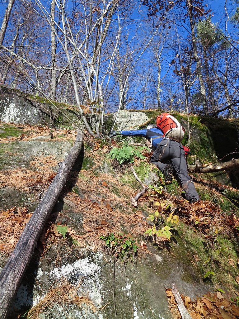 |
| Working hard. |
The open knob stands 1100 feet above route 9 and provides a commanding view of Pleasant Valley and nearby Elizabethtown. The mountains lying directly east were unfamiliar to me but I recognized the distant cloud-capped Green Mountains in Vermont. Later in the day, the clouds would lift and expose the distinctive silhouette of Camel's Hump.
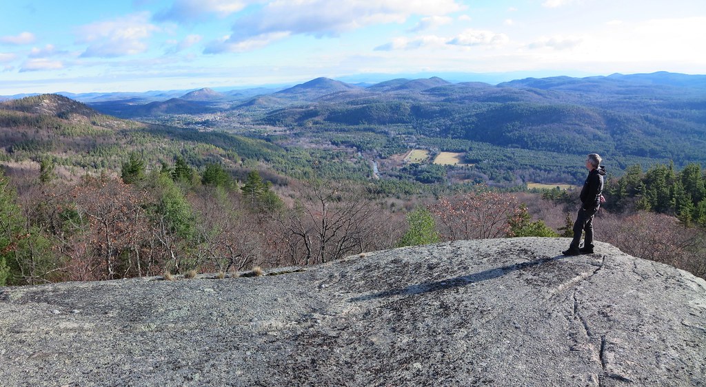 |
| First clear view of Elizabethtown. |
Navigation now consisted of "connect the dots" where the "dots" were visible rock outcrops. The next section of open-rock elicited a "Wow!" I had seen satellite images but they had not prepared me for the large slope of open rock. I blurted "What an amazing slab climb!" as I envisioned ascending it from the valley. an added bonus was discovering three eye-bolts in the rock. They were arranged in a triangle and probably secured a survey station in the past. There was a shallow hole at the center of the triangle but I could not find a "survey bolt". Was it the handiwork of Verplanck Colvin's first survey or something more recent?
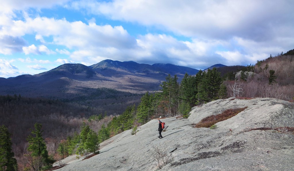 |
| Neil explores the bare slope. |
We re-entered the seemingly manicured woods and continued through airy pine, spruce, and birch. With a wealth of views to be found along its shoulder, Iron's summit was somewhat anti-climactic. Nevertheless, it provided us with our first unobstructed view of Owl Head and Green. Owl Head seemed close by but Green appeared to be uncomfortably far. Being only 10:00 AM, it was too soon to be concerned about running out of daylight.
 |
| Easy walking. |
The next leg involved losing about 350 feet of elevation. The woods remained open but contained more underbrush and downed trees. In other words, it seemed more "normal" (to me). The lack of leafy trees worked to our advantage by allowing us to navigate visually. An unnamed peak, slightly taller than Iron, was our navigation marker. We kept it to our right and headed for a col on its south side. For anyone wishing to explore this area, I recommend heading directly for the unnamed peak. The terrain beyond the col required steep "side-sloping" across a drainage that could've been avoided by staying on high ground.
After climbing out of the drainage, the terrain returned to gentle slopes with broadly spaced trees and a deep carpet of leaves. Through the leafless trees we could see the outline of distant Bald and Rocky Peak Ridge. Its an outstanding place for anyone looking for an easy "bushwhack".
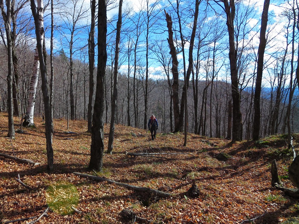 |
| Park-like woods. |
One final very short and steep ascent led to the summit of Owl Head Lookout. The last time I was there was May 25, 2015
volunteering for ADK 46er trail maintenance. A late season snow storm made for miserably cold and wet conditions. Low lying clouds dominated the landscape. On this day, the weather was excellent and we were treated to a splendid view of the peaks that form the Roaring Brook valley. Green was now closer but revealed a significant ascent awaited us.
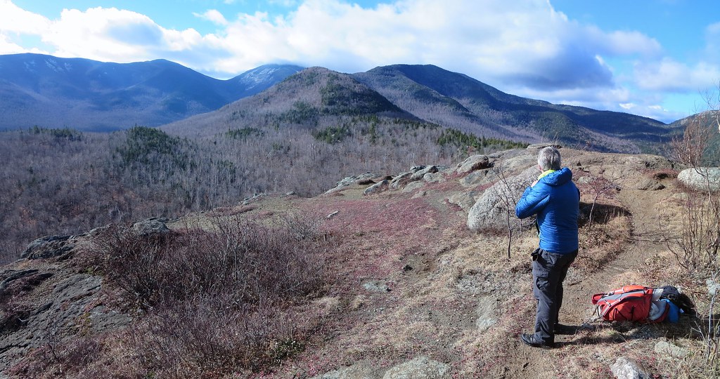 |
| Owl Head Lookout. |
We stopped for a short break. My right boot had been gnawing at my heel and created a nagging pain. I was concerned I had developed a blister but the skin was simply inflamed. I paused to apply a blister bandage reinforced with waterproof tape. Instead of trail-shoes, it was my first hike of the year wearing a pair of leather boots. Although they were broken-in, my feet preferred the fit and flexibility of my well-worn trail-shoes.
After a quick snack, and several photos of our intended destination, we made the short descent to the North Trail. We followed it for a few yards and then cut into the woods. The conditions became decidedly more "Adirondack" and we were greeted with thick firs and downed trees. Fortunately, it was short-lived and soon we were moving along at a good clip.
We had studied our route from Owl Head Lookout but nothing prepared us for the rocky knob we named "Owl Head Two". Lying a half-mile west-southwest of Owl Head, "OH2" stands a few yards taller than OH1. Its south side is steep, exposed rock and, with limited daylight, we chose not to ascend it. However, it appears to be well worth one's time to explore. The col west of OH2 is a rugged place littered with huge boulders.
 |
| The rocky knob we called "Owl Head 2". |
What grabbed our attention was the steep slope on the opposite side of the col. It was the start of a 600 foot climb to the top of the eastern end of Green's ridge. Hidden between the map's contour lines, gray walls of rock peaked through the firs and tacitly said "None shall pass!"
We contemplated skirting them by either heading north, to the col's height-of-land, or south, deeper into the drainage. We chose to get a closer look and discovered we could thread a route between the cliffs. Whereas navigation was easy, scrambling up the steep slope was not.
After clearing the steepest section, we breathed easy and settled into a steady rhythm. The sun was now lower in the sky and our route ran in the cooler shadows. We noticed the first signs of snow accumulation. It looked like rock salt and it seasoned the moss and fallen leaves. Upon reaching the top of the climb, we re-joined the warm, sunlit, snow-free side of the mountain.
The next half-mile was a treat. Rising only 100 feet over its length, it is covered in tall grass, (prickly) underbrush, and sparse trees. Standing 900 feet above High Bank (on the North Trail), it offers unimpeded views of Roaring Brook valley and the ridge running from Bald to RPR and on to Giant. A braided game trail runs its length. It is also the last stretch of open woods along Green's ridge. The last mile to the summit is the typical Adirondack terrain one finds above 3000 feet, namely an abundance of conifers and blowdown.
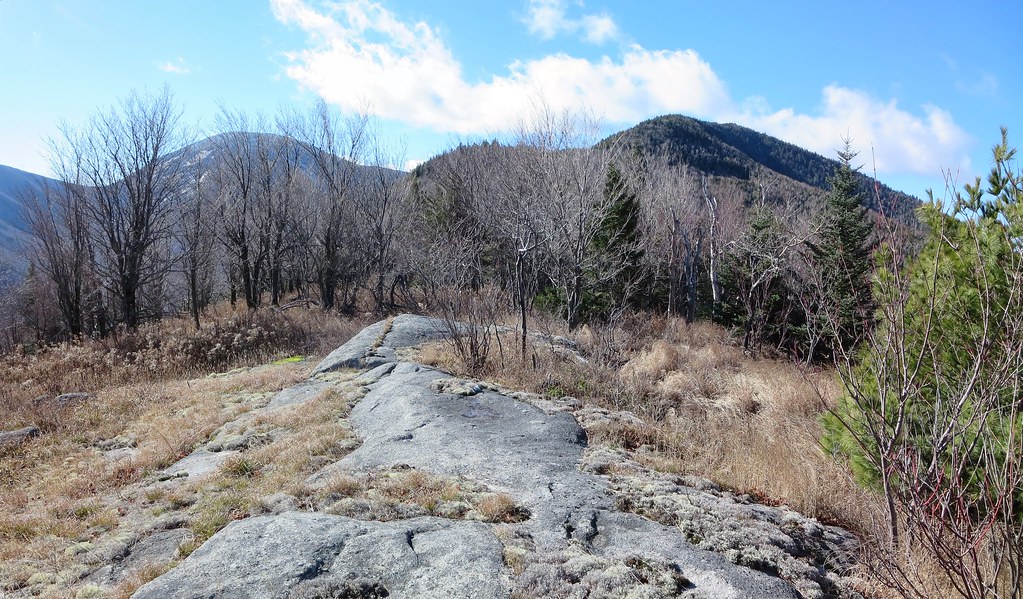 |
| Beautiful open woods along Green's ridge. |
After savouring the last view we'd see for awhile, we pushed into the woods and began the slow grind to the summit. The final mile rises about 800 feet and it took us a little over 1.5 hours to traverse. I had to stop one more time to tend to my right foot. The bandage had slipped off and the heel pain had become impossible to ignore. A fresh layer of tape and a dry sock made a world of difference.
Attempting to remain exclusively on the ridge's centerline became difficult. We dropped a few yards down the north side where we found a steep slope but open woods. I also got a peek of rocky Knob Lock mountain. Neil explained it was well worth a visit and could be incorporated into a trip to Green from route 9 (as he had done in the past).
I didn't expect much from Green's summit. It is completely wooded, quite flat, and, despite relatively open woods, no views. We had followed a game-trail/herd-path but it did not lead to a marked summit. Unlike many other peaks, I found no sign, leftover canister mountings, blaze, flagging, cairn, trodden patch of ground, or other evidence of a "herd-summit". To stand atop a peak that hasn't been marked is both satisfying and perplexing; you felt like the first person to reach it or like someone who simply hadn't found the true summit.
After scouting the area, I settled on a mossy boulder to represent the highest point even though some nearby ground seemed equally tall. I'm not sure why I bothered but it seemed important at the time. The ground was bleached white by a thin blanket of snow and the late-afternoon sun streamed in through the trees. It was the best Green could muster to welcome us to its summit and it was appreciated.
 |
| Green's approximate summit. |
Our descent route seemed like a no-brainer: head south and join the North Trail. Within a few yards our progress was halted by a field of blowdown. We had no appetite for it. We backtracked east, approximately 300 yards, and tried again. It was a good strategy because it permitted us to skirt the blowdown (confirmed later using a satellite image) and find friendlier woods.
A quick check of the map showed a drainage running down Green's south face. It intersected the North Trail about a half-mile east of Giant lean-to. We knew there were cliffs so we bet on the drainage to create a navigable path through them. The gamble paid off. We easily threaded our way through the steepest sections and dropped 1000 feet over 0.6 miles in 45 minutes (~2 mph) which is a respectable clip for bushwhacking.
Upon intersecting the North trail we paused to strip off layers, have a bite, and prepare for the final five mile trail-walk back to my car. There would be a 450 foot ascent beyond High Bank but until then it would be an easy-peasy gradual descent along a smooth trail. We wouldn't exit before sunset but we would cover the five miles in two hours.
At High Bank we met the only other hiker of the day. I believe his name was Bob and he had just returned from the base of the slides on Giant's east face. A resident of Lake Placid and an avid backcountry skier, he had lost a ski while descending the slides a few years ago. He returned to explore the area and, for fun, attempt to locate the lost ski. We spent several minutes chatting with him and he recounted many examples of what experienced local skiers had accomplished in the High Peaks.
It was now close to 4:00 PM and sunset was a mere half-hour away. Bob joined us and we chatted all the way back to the car. The final 450 foot ascent to the Owl Head junction did not go by unnoticed. After a steady climb the grade diminished and I thought the junction to Owl Head Lokout must be just a few yards away. I looked up and saw, illuminated by the day's last dim light, Owl Head about a half-mile away. Well darn! I forgot there was a brief high-point before the trail descended into a drainage and rose to meet the spur-trail to Owl Head. We passed the junction at sunset.
A half-hour past the junction, twilight was lost so we stopped at Slide Brook to don our headlamps. The remaining mile flew by in the darkness. At the trail-head we thanked Bob for his company and said our goodbyes.
Neil and I proceeded with our usual post-hike preparations for the drive home (change into clean clothes, bag and stow dirty gear, retrieve wallets and passports, inspect ground for dropped items, etc). We made one quick stop at Stewarts in Elizabethtown to replace lost calories and fill up with comparatively cheap US gasoline (US$2.45/gallon or, at 35% exchange rate, CDN$0.87/liter vs $1.10/liter in Montreal). Under a clear and starry sky, we drove home while recounting the amazing things we had seen. Visiting Green by way of Iron and Owl Head is a wonderful hike.
Stats
Distance: 12 miles.
Ascent: 4850 feet.
Time: 9h 37m.
Photos
My photos.
Neil's photos.
