After exploring Sawtooth 1, 2, 4, 7, 8, and 10, all from Averyville, I can confidently say the area is no longer the "Terra Incognita lying west of Street and Nye". Its valleys, brooks, abandoned logging roads and camps, are now part of my experiential map of the Sawtooths. I credit Neil for recommending this wild, trailless, and unpeopled corner of the Adirondacks as a diversion from the busy, muddy, and eroded trails of the High Peaks. It also didn't hurt to have a few extra peaks added to my Adirondack Hundred Highest list.
Starting from the Pine Pond trail-head in Averyville, Neil and I followed the road for a mere tenth of a mile before ducking into the woods to head south along an unmarked path. It led us along a property line for about a half-mile and then turned sharply east to connect with the old/original Northville-Placid Trail ("ONPT"). The ONPT is a lovely unmarked trail that runs for about 3 miles before connecting with the NPT at the Chubb River crossing. We met a runner and her dog returning from their morning run along this smooth path.
Shortly before joining the NPT, the ONPT winds its way through a flooded grassy area. Beavers have transformed the woods into a giant rice paddy. Finding the trail, among the grass and water, isn't too difficult but staying dry is a another proposition. Upon reaching the NPT, we paused at the footbridge over the Chubb River and watched the water rush through the narrow flume.
 |
| Chubb River Flume. |
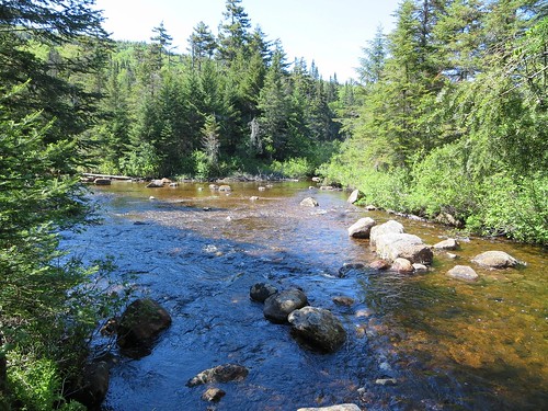
The remaining three miles to Moose Pond rolled by smoothly and we remarked how fortunate we were to be out on such a perfect day. It was cool, dry and sunny and, surprisingly, the bugs weren't out. We paused for a snack at Moose Pond lean-to and ventured onto the shore of Moose Pond to have a look at our objective, Sawtooth 3.
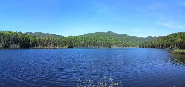 |
| Sawtooth Range. |
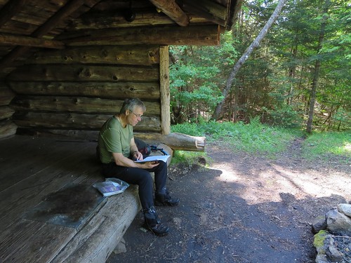 |
| Perusing Moose Pond lean-to's log book. |
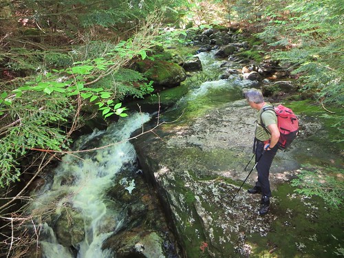
We continued for about another mile along the NPT to our intended exit point. Lost in conversation, we walked past it and had to back-track a few hundred yards. In preparation to wrestle with spruce "razor-wire" and other bushwhacking hazards, we paused to don our gloves, hats, and gaiters. We turned west into the woods towards Moose Creek. It was running high enough to warrant finding a convenient crossing point. After a bit of exploration, we settled on a combination of protruding rocks and a fallen log to make our way across the creek.
 |
| Crossing Moose Creek. |
An initial foray into the woods proved they were exceedingly thick so we retreated to the creek bank and followed it downstream along the path of least resistance. Our route was eventually blocked by a tributary that Neil recognized from one of his earlier trips to Sawtooth 3. Pushing through an unwelcoming tangle of trees and bushes, we followed the tributary upstream and crossed it on a fallen log (more or less). The next section was even less welcoming. Neil recognized it immediately and assured me it was just "three minutes" (of hell).
I imagine many bushwhackers have developed there own slang to describe challenging obstacles. Tom (a.k.a. Randomscooter) had coined the phrase "jail bars" to describe trees growing very close together. When spruce branches lose their plush coat of needles, I call the bare and abrasive result "razor wire". You only need to have it drag across your neck once to understand what I mean. When spruce trees grow like jail bars, their branches mesh together and create interlocked "wire-brushes" (for what they do to skin and clothing). We pushed through the thicket of wire-brushes for the predicted three minutes and emerged in open woods. Hurray for open woods!
The balance of the route involved waypoints, maps, compass bearings, "handrails", and other navigational tools to guide us to the summit. Our chosen route led us through two cols and the first one revealed an unexpected waterfall.
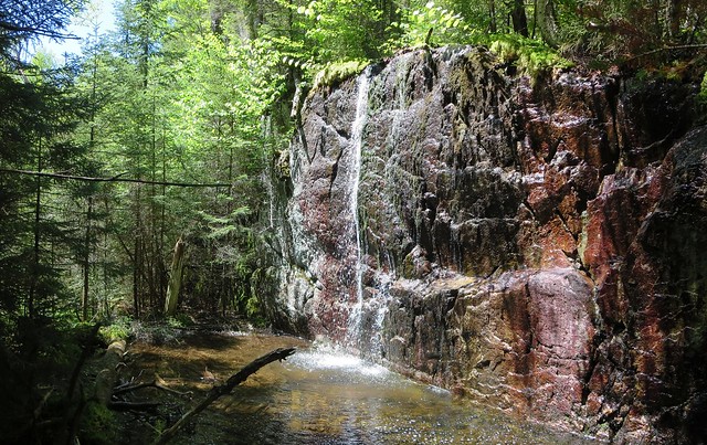 |
| Unexpected waterfall. |
Somewhere along the way I was distracted for a moment and walked into a pointed branch. It struck below my left eye and stung like a sonavagun. At the end of the day, I inspected the injury. I don't know if my eyeglasses deflected the blow but the wound was on my lower eyelid. That's a bit too close for comfort.
We paused at the summit for a snack. The "bug hiatus" we had experienced earlier was over and we had to don headnets to avoid becoming blackfly blood donors. Deer flies had pestered us for many hours (and would continue for several more) but DEET, a brimmed hat, and a thick shirt, helped prevent bites. Neil wasn't so fortunate and occasionally my good hiking friend would do the "shout and slap" as a deer fly drilled into him. He donned a rainshell to thwart the l'il bastards.
We chose to descend via a different route in hope of finding more open terrain. It proved to be somewhat better than our ascent route and we made good time. However, in my zeal to maintain a healthy distance from our ascent track, I led us too far south which required some side-hilling to correct our heading.
We continued along our inbound route with one major course correction in a col. In the morning I had led us along the col's south-facing slope and that proved to be a tough slog. In the afternoon, Neil suggested we stay low, in the lee of the north-facing slope, and found far more open terrain. Such is bushwhacking; a few yards this way or that can make a world of difference.
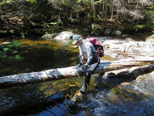
We aimed to re-cross Moose Creek south of our inbound crossing. We found a breached beaver dam but decided the gap was too wide for a dry crossing. We headed upstream and unfortunately found another thicket of wire-brushes. We pushed through them and found ourselves a few yards downstream of the tributary junction! Sheesh! I didn't have the stomach for more wire-brush territory and, in the interest of expediency, suggested we simply walk across the shallowest stretch of the brook. My boots were far from dry and more water wasn't going to make a big difference. Neil concurred and we were on the eastern bank in no time flat. Our squishy socks had several trail miles to dry out.
|
| Where we crossed. Junction of Moose Creek and a tributary. |
The balance of the hike was a repeat of the morning's route. The only difference was the "rice paddy" seemed wetter than in the morning. We emerged at the trail-head a little over ten hours from our departure. A quick change into fresh clothes and we were off to Stewarts for refreshments. It was a very enjoyable trip and I look forward to tackling Sawtooth 5 in the near future.
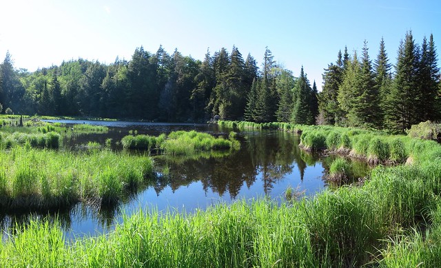
|
| Beaver's rice paddy. |
 |
| 15.7 mile route to Sawtooth 3. |
Taras,
ReplyDeleteYour photos in the post have gone missing.
-Kimball
TrailsNH.com
Yes, they are sourced from OneDrive which has apparently developed a new problem. A photo's URL has always remained stable but now, in this post, all photos have had their URLs change three times in six days!
DeleteThe problem is posted on answers.microsoft.com and hopefully they will find a solution.